|
Local
flooding in the past
woodcut print of East Anglia Floods in the 1600s |
||||||||
|
Goldhanger has not been affected by
large scale flooding for many years. This could be due to the seawall being raised several times in the last
century, the absence of a significant river nearby, and the relatively dry local climate. There have however been many flooding
incidents in the past, both within the village and in the surrounding area.
Some were caused by high tides combined with storm force winds, some were the
result of unusually heavy rainfall causing the rivers, streams and ditches to
burst their banks. Some were a combination of all of these. When individual houses are flooded
it is extremely distressing for the family involved, and these days any form
of flooding can have serious long-term implications for house insurance and
property values. Fifteen incidents from between 1450
and 2021 are identified here in chronological order. Most did not affect the
village itself. The list finishes with Recent developments
and Going forward at the end of the page. go straight to a
flooding incidents of... 1450 1736 1874-5 1894 1897 1928 1936 1953 1958 1970s 1998 2001 2019 2020 2021 |
||||||||
|
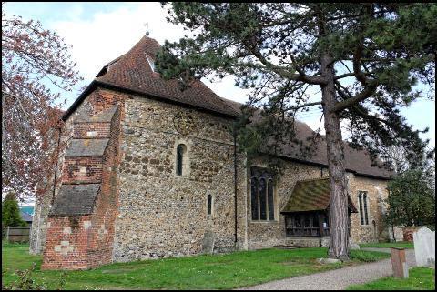
1450
Flooding at Heybridge In 1450 flooding from the Blackwater
caused the St Andrew's Church tower in Heybridge to collapse and the 'ruined'
church was restored into the present form later in the century leaving it
without a bell tower...
|
||||||||
|
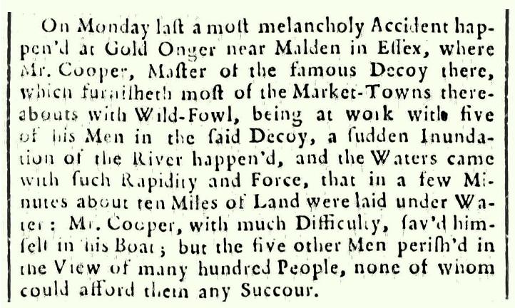
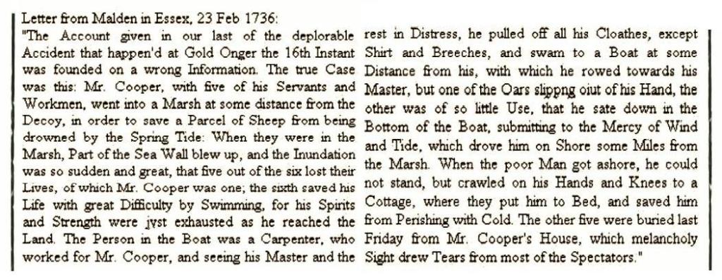
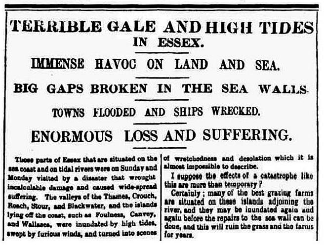
1736 The
Great Tide In 1736 a great tide destroyed parts
of the Goldhanger seawall, swamped the decoy ponds and caused in the death of
five Goldhanger men working on the ponds and nearby. These two articles were
in the Newcastle Courant. Select
the articles to enlarge... |
||||||||
|
|
||||||||
|
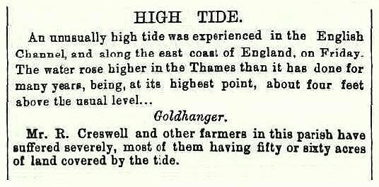
1874-5 High
Tide
the Essex Standard in March 1874 |
the Essex
weekly News in 1875 |
|||||||
|
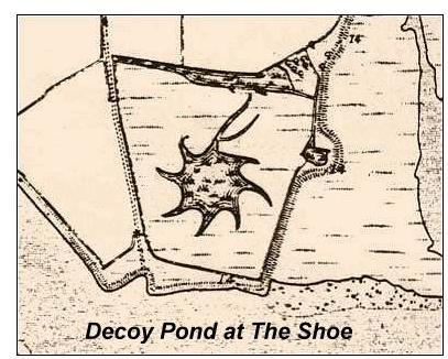
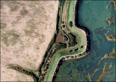
Once the seawall has been breached,
the water rushing in and out with the tide causes a large depression to form
in the soil, which makes a repair difficult. The photo on the left below
(probably from the 1953 floods) shows how difficult it can be. On many
occasions in the past the solution was to build a new wall in a different
location leaving a permanent kink in the seawall and evidence of this can
still be seen today on the 1875 OS map (in the middle below) and today in the
aerial photo (on the right below). This repair at Highams Farm, close to
where there was once a duck decoy pond, was
probably the result of either the 1736 or 1874.breaches... |
||||||||
|
|
|
|||||||
|
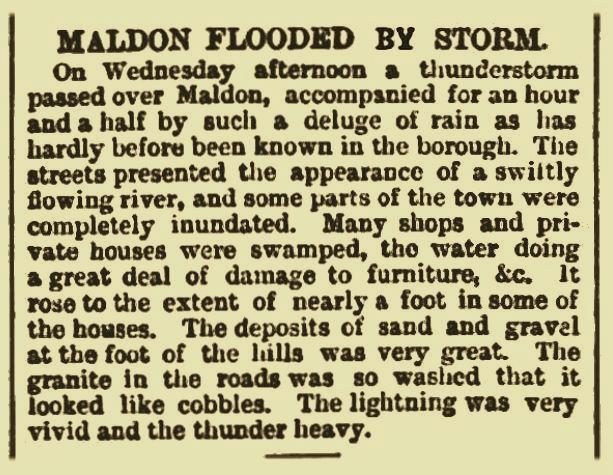
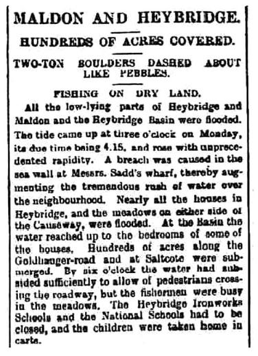
1894 Maldon flooded
by storm An Essex Herald report in this year describing that Maldon was
flooded by huge storm... |
||||||||
|
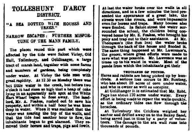
1897 Floods The 1897 Floods became known
as “Black Monday” and caused much
havoc across Essex including Goldhanger. From the Essex Herald of Tuesday, 7th December, 1897. Select these three articles to enlarge... |
||||||||
|
|
|
|||||||
|
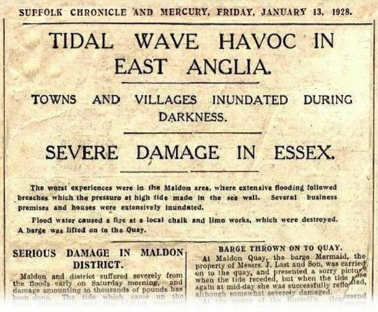
1928 Floods
to read the full article select and enlarge Serious flooding was reported in
Heybridge Basin. From an article in the Essex
Weekly News of January 1928... In the village of
Heybridge Basin water poured over the sea walls and canal banks, and quickly
rose to a dangerous height. Upwards of 30 houses were flooded The lock gates
were forced open by the tide, causing a tremendous rush of water, and the
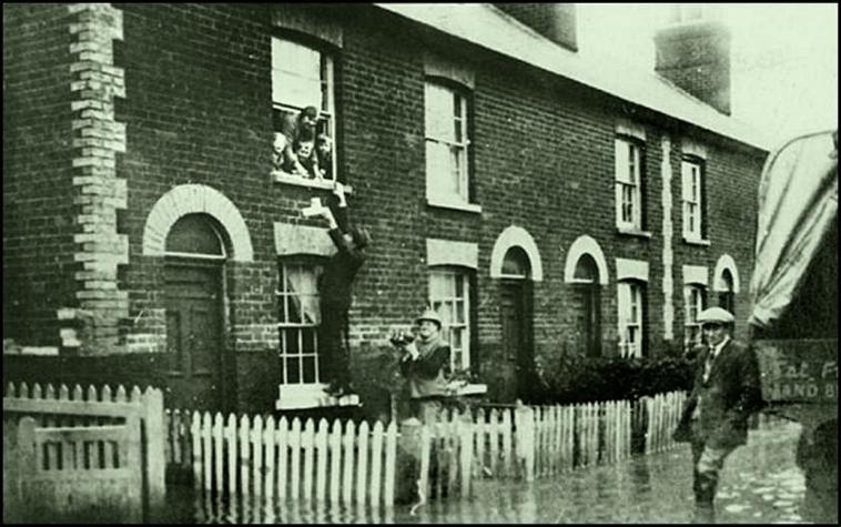
canal banks being lower than the sea wall. The photo shows Rose Cottage, and
shows food being handed up to a woman and her children in Rose Cottage, who
had taken refuge upstairs...
|
||||||||
|
1936 Floods
around Witham and Maldon An Essex Newsman report in February 1936...
In the 1930s Charles Stokes, who ran the petrol filling
station and servicing garage in Church St. Goldhanger, was paid by local
councils to regularly ride his bicycle or motorcycle along the seawall from
Tollesbury to Maldon, checking on the condition of the seawalls and sluices. |
||||||||
|
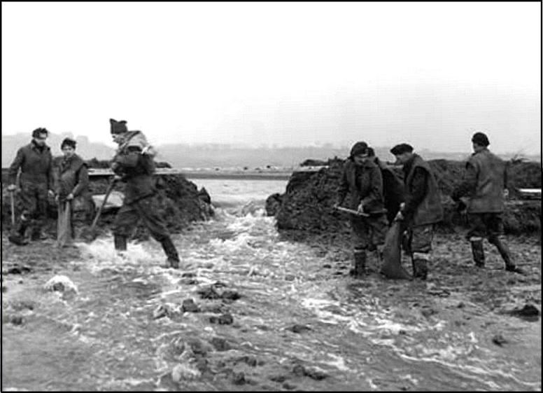
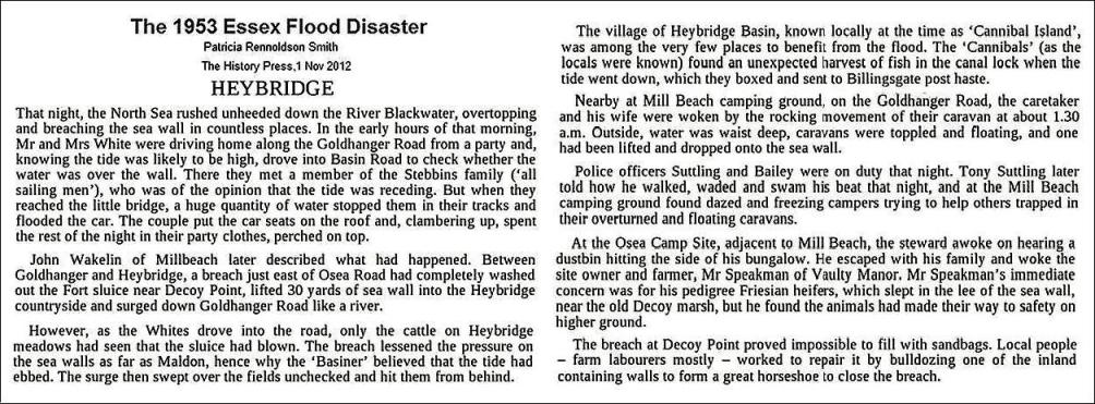
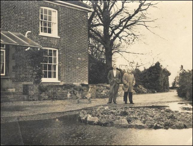
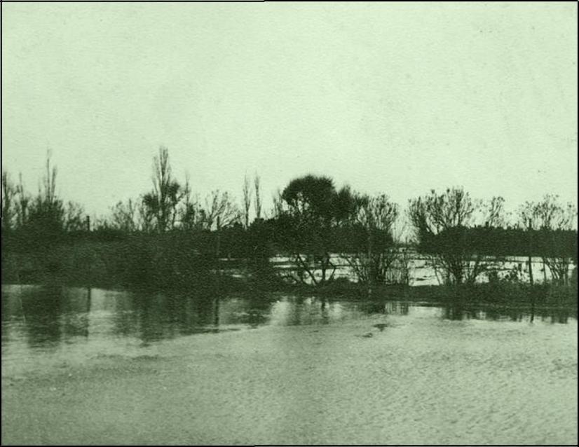
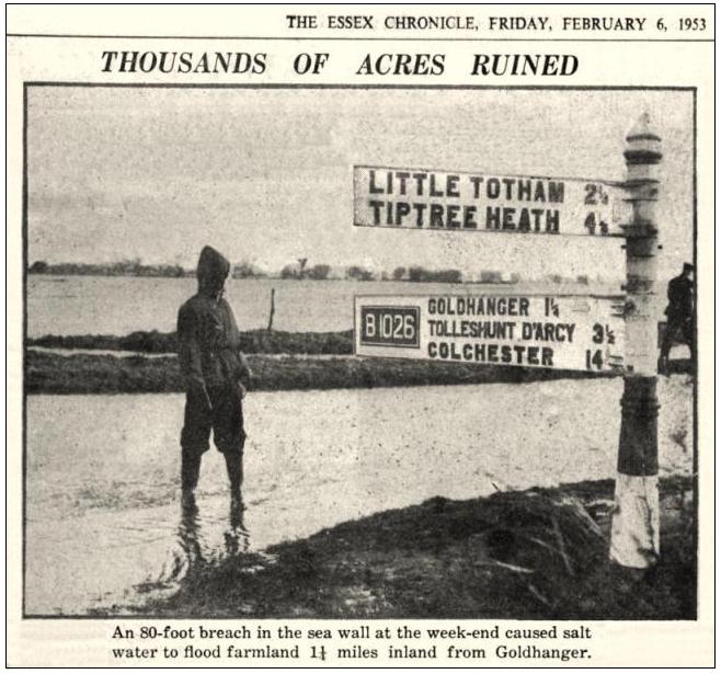
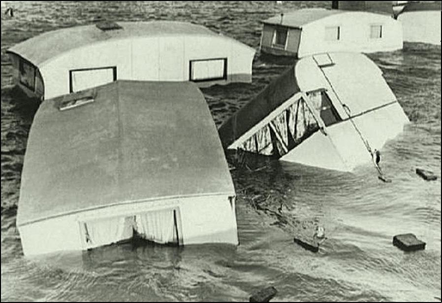
1953 Floods There was no warning of the great tide
on the night of 31 January 1953 and over 300 died in East Anglia. Two
breaches of the seawall occurred near the village and within Goldhanger
Parish: one near The Shoe and one near Decoy Point on Osea Rd. Bounds Farm was severely affected and the
flood water came up fish Street as far as number 25. Flood waters swept along
the inside of the seawall from Goldhanger to Heybridge following the route of
the Goldhanger Road, and many caravans on the three caravan sites were
destroyed. Here is one local news article about the incident...
|
||||||||
|
Bounds Farmhouse |
Bounds Farm fields |
a Wilkin yacht stranded at
Bounds |
||||||
|
Wash Bridge in the news ( this same location
flooded in 2019 shown here
) |
Barrow Marsh Caravan site ( within Goldhanger Parish ) |
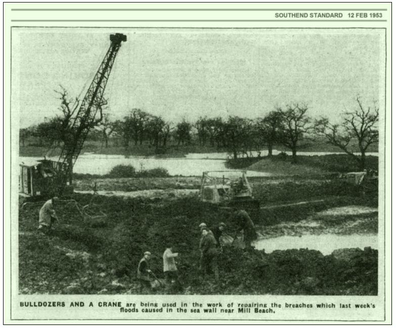
repairing the wall at
Decoy Point |
||||||
|
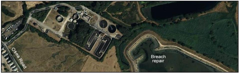
site of the Osea Rd /
Decoy Point breach and repair as it appears in recent times |
||||||||
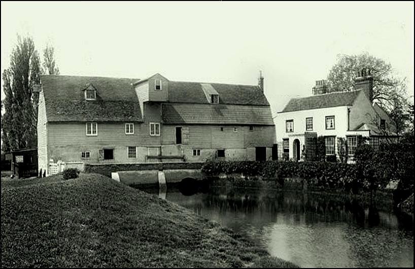
|
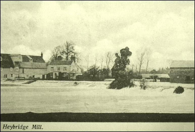
Heybridge and Heybridge Basin were severely affected
by the 1953 flood and the watermill there at Heybridge had to be demolished after
severe flooding. However the Millhouse (on the right in the photo below)
still stands... |
||||||||
|
Heybridge watermill and
millhouse in the early 1900s |
Heybridge Basin was severly affected |
|||||||
|
These
maps show the extent of the 1953 floods. Select
either of these maps to enlarge.... |
||||||||
|
|
||||||||
|
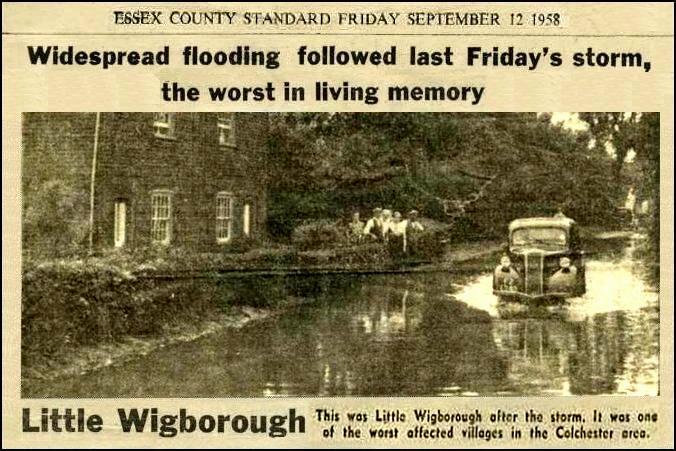
1958
Wigborough From the Essex County Standard of September 1958... |
||||||||
|
1970s Heybridge canal gates opened An exceptionally high tide allowed the
canal gates to be opened at the same time as all the levels were equal...
|
||||||||
|
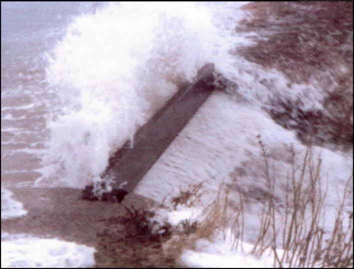
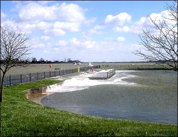
1979 High
Tide This picture shows the estuary
overflowing Bounds Hatch during an exceptionally high tide in 1979. The
seawall close to the village has been raised by a metre since that time...
|
||||||||
|
1998
Flooding along the Goldhanger Road, Heybrdge The Goldhanger Road at Heybridge
has been a problem for many years... |
||||||||
|
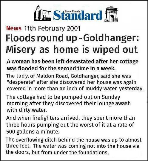
2001
Goldhanger cottage flooded |
||||||||
|
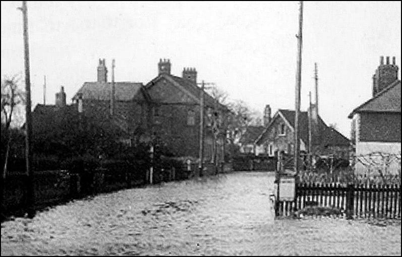
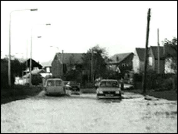
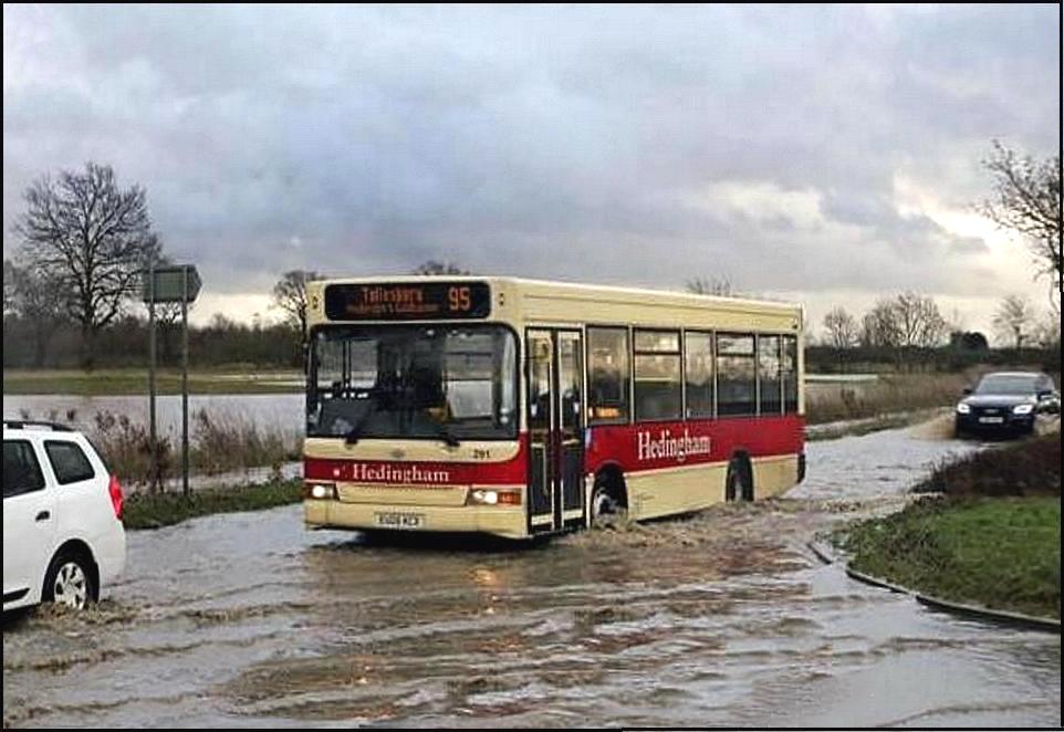
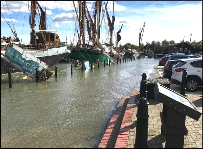
2019
Flooding along the Goldhanger Road The short
stretch of road near Wash Bridge still frequently floods after heavy rainfall
at high tide. Further along the Goldhanger Road in Heybridge, it frequently
still floods after heavy rain... |
||||||||
|
Goldhanger Road at Wash Bridge |
|
|||||||
|
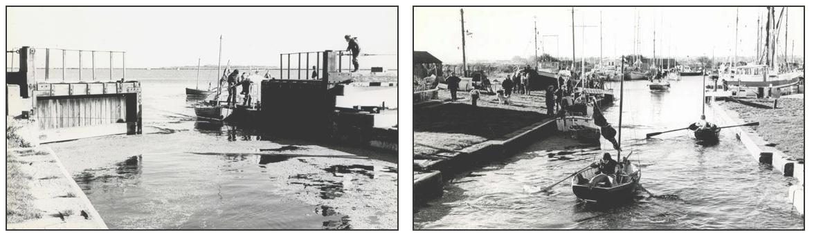
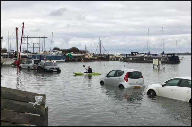
2020
Tollesbury Quay Tollesbury
Quay is frequently flooded during spring high tides and visitors are often
caught out in the summer months... |
||||||||
|
2021 Maldon The Hythe and the Prom in Maldon frequently still
flood at spring high tides. Biulding barriers or walls is probably
impractical here and as the ground in the town rapidly rises away from the
Hythe, it seems more of a novelty rather than a serious risk to most
locals... |
||||||||
|
|
||||||||
|
Recent developments There has
been some limited flooding in the village in recent years caused by excess
surface water during heavy rainfall. This has been said to be due mainly to
lack of maintenance of ditches and drains resulting from 30 years of
exceptionally dry weather. The ‘water table’ in the area during that time has
lowered significantly and also reduced the need to clear the ditches and
drains. An ancient farmer/land-owner principle of “if you want a ditch
cleared then do it yourself” seems to have long since been forgotten,
particularly by the various public authorities forever hoping someone else
will pick up the cost. For many
years there has been not been any flooding in the village from the Estuary
resulting from high tides and strong winds which could have overtopped or
breached the seawalls. This is most likely the result of the walls being
lined with concrete slabs after the 1953 floods and raised more than once in
the last 50 years. Regular inspections and maintenance has also insured the
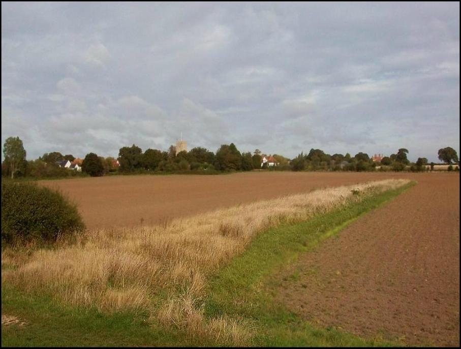
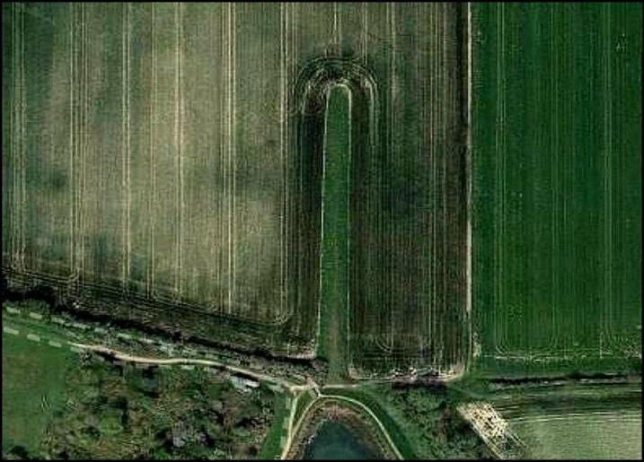
walls have been kept in a good condition. During
the work in the 1980s on the seawall in Goldhanger Creek, a low mound was
build at the head of the creek that protrudes into Church field and it
remains there...
view
from the seawall
aerial view The
purpose of this mound has sometimes been questioned, however there is a
rationale... In the past
it has been explained that it is a ‘fallback’ mound to protect the lower part
of Fish St. in the event that the seawall is again breached to the east of
the village in the same way that it was during the 1953 floods. When a
relatively small breach occurs at high tide, only a limited amount of
seawater can pass through the gap before the tide recedes. Similarly,
if an exceptionally high tide together with strong winds causing waves to
overflow the top of the seawall by a few inches, then again only a limited
amount of water can reach inland before the tide recedes. The small mound in
the Church field would be sufficient to keep back this surge from the lower
end Fish St., Sadly the Government website shown below do not seem to
recognise this feature on their maps of flood predictions, and it is not
known whether insurance companies recognise it for property flood cover in
the area, but it seems unlikely. Going forward There are
much better forecasting and warning systems in place today than in the past.
One is invited to study these recently created (2021) UK government
websites... https://flood-warning-information.service.gov.uk/warnings There is
now also much more information available about the long-term risks of
flooding provided by the government. These webpages which have somewhat
complex interactive maps are well worth a study... https://flood-warning-information.service.gov.uk/long-term-flood-risk For tidal
risk see... https://flood-warning-information.service.gov.uk/long-term-flood-risk/map ...and enter a postcode For
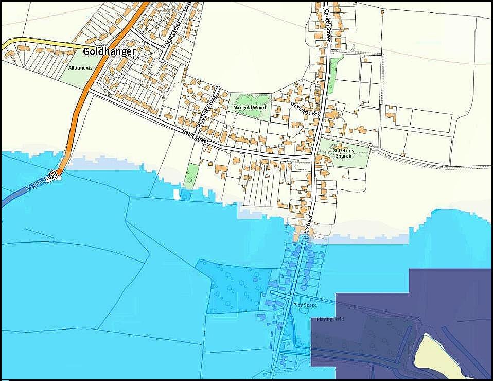
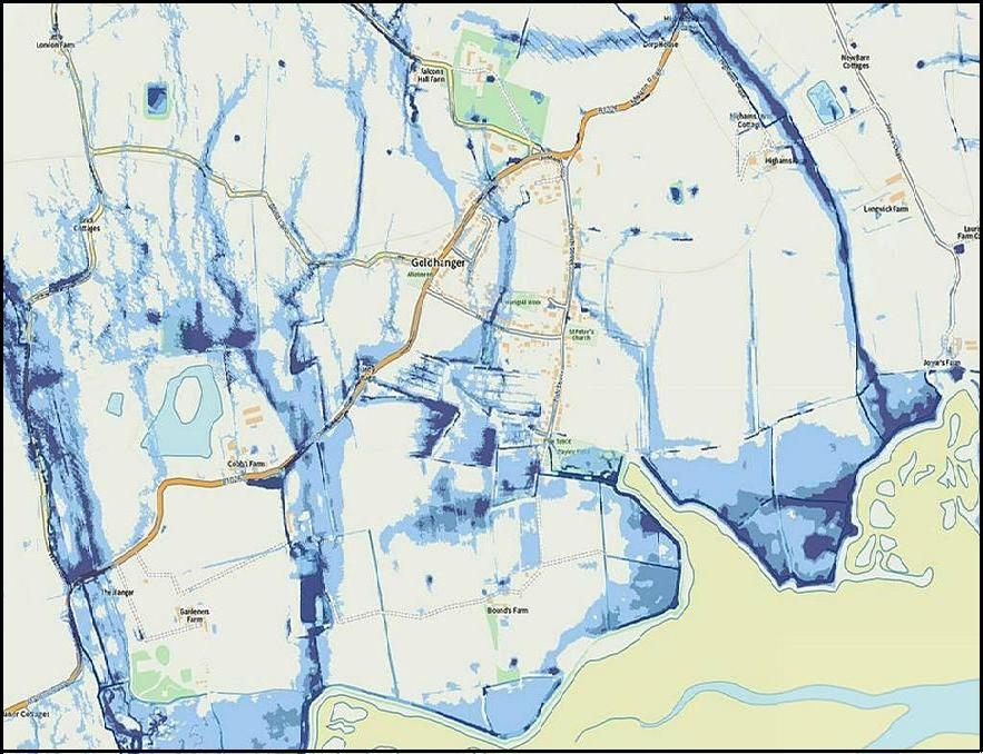
surface water risk see... https://flood-warning-information.service.gov.uk/long-term-flood-risk/map=SurfaceWater ...and enter a postcode Here are two sample maps taken
from these webpages showing most of the village... Light blue areas are identified as having a risk of
flooding between 0.1 and 1% per year Dark blue areas are identified as having a risk of
flooding of greater than 3.3% per year |
||||||||
|
|
|
|||||||
|
tidal risk This computer generated map made in 2021 shows the
lower half of Fish St. potentially flooded in the same way as it was in the
1953. Due to the work carried out on the seawalls since then however this
would seem to be an extremely unlikely occurrence in the near future. |
surface water risk When zooming in on the website version of this map, which
was also computer generated in 2021, it shows incredible detail. It is consistant with known
street flooding in the recent past however, which could have been avoided
with regular drain and ditch maintenance. |
|||||||
|
_____________________________ top estuary seawall climate did you know
about... home DWN 2025 |
||||||||