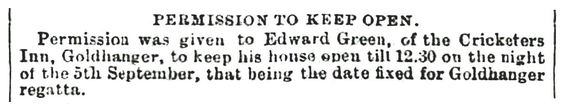
Activities
in the Blackwater Estuary
There has always been a close connection between the
village and the Blackwater Estuary, and the many activities associated with the
water have had a major influence on village life:
|
o Fishing |
|
|
|
|
|
|
|
|
|
o Military activity & Seaplanes |
|
|
|
|
o Regattas (recent
addition) |
|
|
|
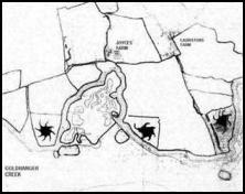
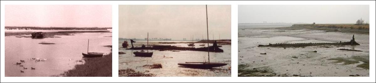
Fishing
Fishing has been a major
commercial activity in the Estuary for centuries. In Goldhanger - estuary Village (page-19) Maura
Benham describes Fish Weirs or Kettles used to catch fish, which may be
the origins of the many pieces of ancient wood still projecting out of the mud
in Goldhanger Creek. Some are also likely to be the remains of jetties used by
fishing smacks in the 18th &19th centuries. See... Ancient
wooden posts in the Creek.
Two Fish Pits were located
adjacent to Goldhanger Creek near Bounds Farm.
They appear on the 1820 Tithe map and are listed in the Tithe Awards as part of
Bounds Farm property, they are also shown on 1900 OS map and a map the
Proceedings Antiquaries Society of 1910. They were most probably used to hold
temporarily oysters, shellfish, eels and large fish catches from further out at
sea, in the days when refrigerators were unavailable and ice was expensive.
Fishing
in more recent times
Fish Street was said to be
the haunt of Maldon based fishermen whose boats were temporarily moored in
Goldhanger Creek waiting for the tide to reach Maldon. In the meantime the
fishermen frequented the various ale houses and other houses of ill repute down
Fish Street.
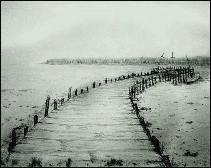
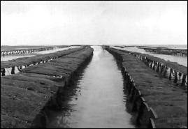
Oyster Beds
Oyster fishing and
cultivation has been an activity in the Estuary for centuries. However, an
abrupt end came to local industry in the early 1980s when a disease caused the
government to curtail production. Native Oyster shells litter the foreshore and
oyster shell are found in the gardens in Fish St. In the last 20 years
commercial oyster beds have been re-established at a location referred to as
Goldhanger Creek but is close to Lauristons Farm and are now sold all around
the world. See... Goldhanger Oyster Beds
A history of
local fishing is given in...
Commercial Fishing at Goldhanger and in the
Blackwater
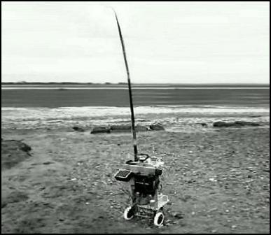
Decoy Ponds
& Duck Shooting
Decoy
Ponds
In the past there were huge
quantities of ducks around the Estuary and the local Duck Decoy Ponds were a
good source of income for the village. The ponds were "star" or
"octopus" shaped with between four and eight "pipes", and
were use in in the 17th & 18th centuries. They were on the land-side of the
seawall with "hatches" through the wall. Decoy ponds was private
property, were well protected by a wide ditch or high fence, and were in remote
situations. They was usually worked by one man, or perhaps a father and son.
A history of the local decoy ponds is at... The
Goldhanger Decoy Ponds
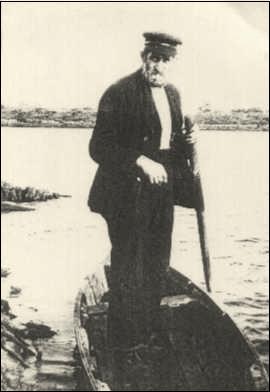
Duck
Shooting
As the number of wild ducks
on the estuary steadily declined duck shooting from a punt became more
effective than using the decoy ponds and in more recent times was both a
commercial activity and a popular pastime. Just before WW-2 a wealthy
Goldhanger resident kept his own punt and gun at The Shoe, keeping the gun and
tackle in a long sturdy box of some three metres length that sat on top of
several posts set into the ground. It was situated on the waterside below the
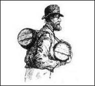
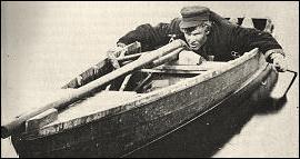
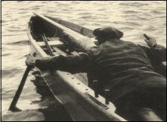
seawall, and was kept padlocked. Below on the left is a typical duck punt with
gun and on the right is Samuel Johnson of Fish St. in his punt in Goldhanger
Creek, who made a living in the winter from this activity.
|
|
|
|
|
The following extract is taken from www.chelmercanaltrust.co.uk
and the life
story of Darby Stebbens of Heybridge Basin:
...One
famous man who I helped was the artist Peter Scott. I took him on a duck shoot
down the river with his guns and dog. I rowed and he sat in the back but he
didn't have a lot of luck! I had a punt gun myself and once got twenty five
widgeon with one shot just off Osea in the morning mist. You went out in the
winter just before dawn, or at dusk, lying flat in the bottom of the punt and
paddling gently with paddles no larger than your hand - you had to keep as low as
you could. I sold the birds around the Basin houses at three shillings a
brace..
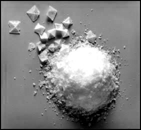
Salt Extraction
Exceptionally low rainfall
in the Blackwater Estuary results in the salt being retained in the extensive
mashes and mud flats, which has traditionally made the location ideal for salt
extraction. The Redhills in the area
have been extensively excavated in the past and been show not only to have been
used for salt production but were also early potteries as the salt produced
locally was used to salt-glazed the pottery. In 2007 the Maldon Crystal Salt
Co. returned to the locality with a new processing plant at Longwick Farm, just
half a mile from Goldhanger.
The full history is given in... Salt extraction in the Blackwater
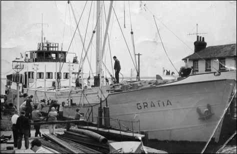
Commercial Shipping
Barge
Transportation
It is said that before the
railways came through Essex in the 1850s in winter the journey to London was
quicker by sea than by road could, which took 3-days.
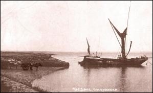
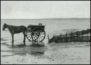
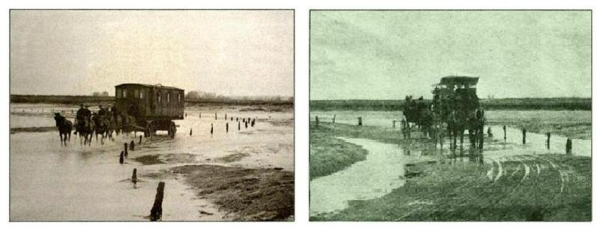
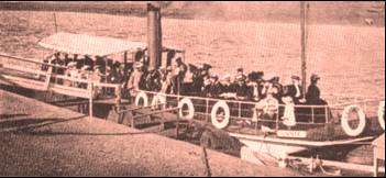
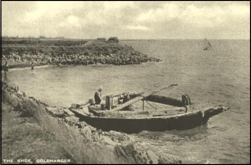
This early postcard
photograph shows pony carts loading and waiting to load a barge at The Shoe in
Goldhanger Creek. The barge belonged to Robert Page the farmer at Highams Farm in the late 1800s. The mooring posts
were accidentally knock over in 2009 but up until then were still occasionally
being used for maintenance work on the Maldon barges. These barges took farm
produce up to London and returned with 'London mixture' - horse manure, and seaweed for fertilizer, lime, coal and other cargoes.
One important local cargo was Kentish rag stone, which was used to build up the
sea walls and helped in the reclamation of marshland. Barges stacked with hay
were called Stackies. These flat
bottomed barges could navigate and moor in the shallowest of creeks and rivers
adjacent to farms and mills. The barges were sailed by just two people, so it
was a very economic form of transport for bulky and heavy. In 1860 there were
5000 sailing barges on the East coast, by 1910 there were 2,000 barges trading
in the UK, but with the decline of the hay trade, there was a dramatic fall in
their numbers. In 1939 there were 750 and in 1949 a mere 125.
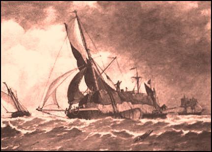
Stackie at sea - taken from
Maura Benham’s book
Today the sad remains of the
barge Snowdrop
lies in Goldhanger Creek, having been abandoned in the 1950s after it was
moored in The Creek for maintenance work and broke its back on a shingle mound.
These pictures show the barge during its working life and how it has
deteriorated since it was left. . .
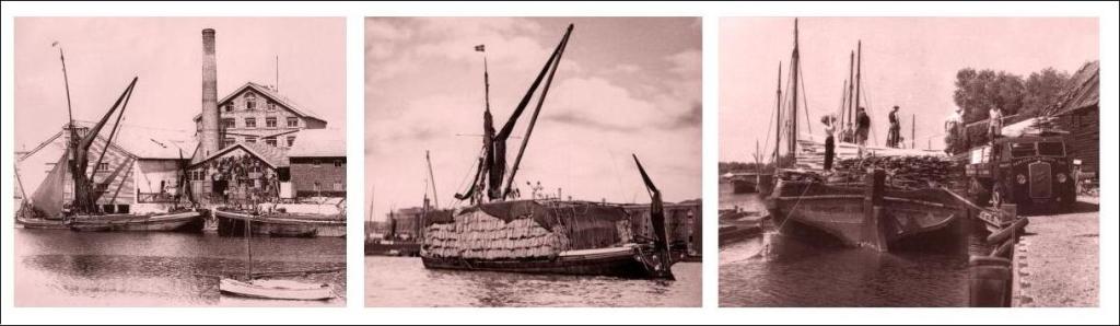
at
Greens flour mill,
Fullbridge in
London Docks mast-less
in the pool at Heybridge Basin.
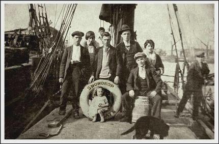
The Kelly Family on Snowdrop in 1928
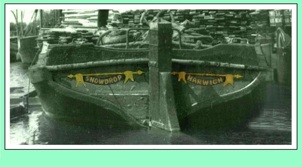
Snowdrop's name on the Stern
in the 1950s in the 1970s in 2010
There is a recent video from
a drone of The wreck of the barge Snowdrop available here..
www.youtube.com/watch?v=TFuxT5P8eVs
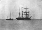
20th Century Shipping
For most of the 20th
century large volumes of commercial shipping passing up and down the Estuary
heading for Maldon quay and Heybridge Basin. At high tide ships could be seen
regularly passing up and down the Estuary. At low tide they would moor up in
the estuary adjacent to Osea Island in regularly dredged deep water areas
waiting for a sufficient depth of water and a pilot.
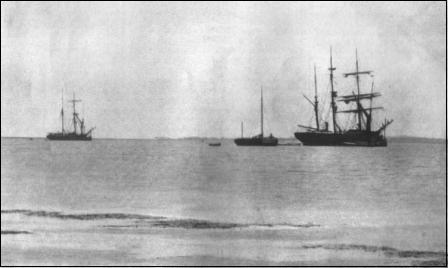
Shipping at anchor off Osea
Island
Commercial vessel in
Heybridge Basin lock.
This trade ended in the
1970's
when bigger ships with
containers took over
On two occasions on the 20th
century, in the 1920s and the 1970s, the Estuary was used to lay up surplus
commercial shipping and they were clearly visible from the village. . .
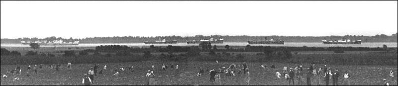
Ships
laid up in the background - strawberry pickers in the foreground
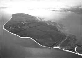
Osea Island
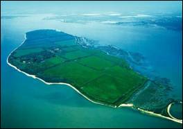
Osea Island has never been within
Goldhanger Parish, but as the island is less than a mile (and a short pleasant
dingy sail) away, and there have been many past associations between the island
and the village, so it is very appropriate including a short history of the
island here. . .
Name of the Island
Over the centuries the
island has had many names and variations of spellings, some associated with the
islands Roman, Danish/Viking and Saxon past, and have included:
Uvesia, Vuesia, Ōsgybes
īeg, Ovesey, Totham-Oveseye,
Totham-Magne-cum-Ovesem, Awsey, Oosy, St. Osyth, and Osey.
It is not a coincidence that
it has been called St Osyth island, a name used by Daniel Defoe. The village of
St Osyth, just 10 miles away by sea, was previously called Chich. A seventh
century Saxon nun called Osyth was murdered there for religious reasons by
Danes in a Viking raid. It is said that when the Danes were finally defeated
and left, both the village of “Chich” and the island, both then occupied by
Saxons, were re-named after the beatified nun.
Owners
of the Island
A total of 23 owners have
been identified over the past 1000 yrs. Seventeen are identified in the
biography of Mr Charrington's: The Great
Acceptance written by Guy Thorne in 1913, which includes a very interesting
chapter about Mr Charringtons involvement with the island.
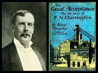
Here is an extract from that
chapter of the book (which is freely available on-line) describing the history
of the island and its the past owners, which in turn is taken from a booklet
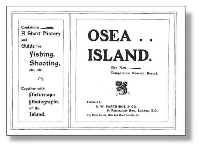
produced by Mr Charrington in 1907 entitled: Osea island - the new temperance seaside resort...
In
the first place, to the history of Osea. This has been compiled by his friend
Mr. Rupert Scott for an excellent little publication issued by Messrs.
Partridge, which is in itself a complete guide to the island.
Mr.
Scott tells us that before the Norman Conquest the name of this jewel of the
Blackwater was Uvesia, and later Ovesey or Osey and Osyth's island. During the
reign of Edward the Confessor (1042-1066) it was owned by one Turbert, who was
Lord of the district.
At
the time of the Norman Conquest it was in the possession of one Hamo Dapifer,
nephew to William the Conqueror. He held it as a manor, and four hides of land,
and there resided on it one bordar or resident. According to the Doomsday
survey book (1086), there had always previously been on the island three serfs,
one fisherman, and pasture for sixty sheep, and at the time of the survey
belonged to the Bouchier family, afterwards created Earls of Essex; and was
included in the Capital Manor, or Parish of Great Totham.
During
the reign of Henry II (1154-1189), it was held by Henry Malache, from the king,
as one knight's fee. This is found in a MS. Of the time of Henry VIII, viz.:
'Totham Magne cum Ovesem, alias Ovesey. It is not known how this Henry Malache
was related to the Bouchier family.
In
the reign of Edward II (1315), the Island of Osea was owned by Gilbart de
Clare, Earl of Gloucester, and then came into the possession of Bartholomew de
Bouchier and his wife, who retained it from 1410-1411 under Henry VI. Its next
owner was Sir Hugh Stafford, who married Elizabeth, daughter of Bartholomew,
Lord Bouchier, who died in 1420, and was held 'by him as the Manor of Oveseye
from King Henry V, as the Honor of Bologne, by the service of half a knight's
fee.'
The
island next came into the hands of one Ludovic Robbesart, and Elizabeth his
wife, in 1431, during the reign of Henry V, and upon their death for the
following two years was held by Anne, widow of the Earl of March. The next
possessor of Ovesey Island was Henry Bouchier, created first Earl of Essex, and
he held the manor of Totham-Oveseye from King Edward VI, and died in 1483.
He
was followed by Anne Bouchier, Marchioness of Northampton, who brought the
island to her husband under the title of 'Manor or Isle of Ovesey, with free
fishery, free warren, and wrec of the sea.' She died in 1570, during Queen
Elizabeth's reign. Her husband forfeited his estates for espousing the cause of
Lady Jane Grey, but this Manor of Ovesey was returned to him by a letter patent
from the Queen dated August 8, 1558, for his maintenance.
On
the death of Anne Bouchier, Marchioness of Northampton, this manor descended to
the heir-at-law, one Walter Devereux, who was the first Earl of Essex of that name;
but in order to carry on his warfare in Ireland he mortgaged and sold his
estates in Essex, including 'Ovesey Island,' which was purchased by a Mr.
Thomas Wiseman, of Great Waltham, Mr. Wiseman held it of Queen Elizabeth by a
Knight's service. He died July 15, 1584, without issue. It then came into the
possession of his two sisters, Elizabeth, wife of Richard Jennings, and Dorothy
Wiseman.
Osea
Island was purchased by a Mr. Charles Coe, of Maldon, but it is not known from
whom, and it was still owned by him at the time of his death in 1786, and
afterwards was conveyed to the Pigott family, who were evidently related to
him, because on the south wall of St. Peter's Church at Maldon there is a mural
monument to 'John Coe Pigott,' and dated March, 1802.
The
next owner of the island known was Mrs. Pigott, who married Henry Coape, and
was succeeded by his son, Henry Coe
Coape, who, through troubles, had to make it over to his brother [in the
1700s].
Henry
Coe Coape is identified as one of our past Goldhanger
Authors and lived at Vaulty Manor which was, and still is, within the
Goldhanger Parish boundary.
Seven other owners have been
identified since The Great Acceptance
was published in 1913. . .
1880s Henry Coe Coape son Henry Coape-Arnold. Both were Lords of
the Manor of Goldhanger.
1903 Frederick
Charrington, heir to the London brewery company (more below)
1910-26 The island was
occupied by the Royal Navy (more below), but was still owned by Frederick
Charrington
1936
Wealthy philanthropist Major Alfred Allnatt (sold to him by the trustees of the
Charrington estate) He is best known for donating Ruben's Adoration of the Magi to Kings College Cambridge.
1960 Michael
& David Cole, founders of Metals
Research and the Cambridge
Instruments companies. The Metals
Research Company was the first to grow silicon crystals, which is one of
the foundations of todays digital equipment. Cambridge Instruments produced very high quality electronic
instruments and were the first to market electron microscopes. Michael Cole's
entry in the Oxford Dictionary of National Biographies quotes him as: an inventor Michael Cole was a genius.
1968 Cambridge
University
1986 The
Cole family re-purchased the island from the University
2000 the Island was purchased by London music
producer Nigel Frieda
(and remains in his possession up until 2024)
A summary of activities
on the island
4K
BC Neolithic occupations on the island
100 AD Romans built the causeway, saltworks
and pottery
800 Holmbyggja -
Viking settlement & burial ground
991 Vikings warriors
were probably based on the island in preparation for the Battle of Maldon
1086 The Domesday Book entry for the
island:
Steward: Richard from Hamo, 4 hides, 1
smallholder, always 3 slaves, 1 fishery, pasture, 60 sheep, value 60s.
1700s James Wentworth Day wrote in the Daily Mail in 1977 that 24
revenue men were murdered in Death Creek
(see Smuggling)
1722 Daniel Defoe wrote about the
island in: Tour through the Eastern
Counties of England.
1880-90 Dr Salter took Prince
Nicholas, later Tsar of Russia shooting on the island, then lunch at The Chequers Inn.
1890s Oysters cultivated commercially in the
salt marshes on the northern shore (still visible today).
1903 Frederick Charrington
created and developed his Cure for
Inebriety on the island.
1903 Mr. Charrington purchased
the steam ship SS Annie to provide transport to and from
Maldon
Mr.
Charrington also used carriages to transport customers and staff across the
Causeway...
1903on Many newspaper and magazine articles were written
at home and abroad about the island developments,
including
articles in... The Times,
The Manchester Guardian, Punch, The Spectator, Country Life,
Christian World, NZ Ashburton Guardian, NZ Oamaru
Mail, AU Launeston Examiner, USA Indianapolis Journal
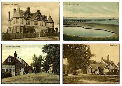
1903 Postcards showing life the island
at that time were distributed (to date seventeen have been identified)...
1904-06 Charrington
developed a menagerie on the island
that included: seals, kangaroos, parrots, and AU swans.
1906-9 London
County Council operated summer open air schools on Osea for children with
learning difficulties.
1906-9 The
Boys brigade held summer camps on the island. There are many photos of their
1906/07 activities at...
www.3rdenfieldbb.co.uk/year-by-year
1907 a
booklet was published entitled: Osea island - the new temperance
seaside resort
select to view the booklet...
1907-9
Many advertisements appeared in the Times and the Manchester Guardian.
1907-12 Alchohol
was smuggled onto the island by local fishermen, Chequers
Inn customers and island workers.
1913 Seaplane
trials based on the island (see Seaplane Trials below)
1917-26 HMS Osea
(see World War-1 below)
1919-23 Foreign
Office secret missions to the Baltic using CBMs based on the island.
1924 Former
Goldhanger curate Douglas Vale, employed by Charrington as island's hotel
manager,
died of alcoholism. A newspaper report can be seen here...
1927 Essex
county council declined to purchase the island from R Charrington for use as a
sanatorium.
1927-30 May &
Butcher of Heybridge purchased the WW1 huts and moved many to Heybridge where
they remain.
1934 The recently formed Rural
Community Council of Essex (RCCE) started a 'reconditioning camp' on the Island
to help the unemployed improve their fitness and readiness for work.
1936 Major Allnatt, wealthy
philanthropist, formed the Society for the Promotion of Old English Pastimes
and each year held a week-long 'Conventical' parties for the wealthy on Island.
Tractor slaloms, mud walloping, searching for ping-pong balls buried in the mud
at low tide. He also used the island for shooting and greyhound-breeding.
1939-45 Dummy
submarines placed around island during World War-2,
The army manned Pill-boxes
on the island and occupied Rivermere
A German V2 rocket exploded
near the island
1960s While
living on the island Lord Gawain Douglas wrote poetry about the island,
published in his book: Fortuna.
1977 The BBC Television made a news
article about the sale of the island (see historic videos
below)
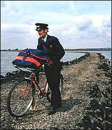
1970s+ Goldhanger
postman Kenny Chaplin made
daily deliveries to Osea, crossing the causeway on his bicycle.
1979 the Children's Film
Foundation feature film “Black Island” was shot on the island – Youtube
summary
1981 The BBC made a half hour TV
programme about the island. (see BBC TV programme below)
2005-10 The Causeway Retreat addiction treatment
centre operated on the Island (see historic videos below)
2006
Semi-biographical novel Once
upon an Island by former resident Joe Canning is
all about Osea and Goldhanger.
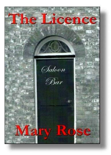
2007
The Chequers landlady's wrote her
memoirs of her time at the Chequers. The Licence has a chapter about
the inn and her family links
to the Island. Extracts from the book
can be seen here...
Films and TV
programmes made on the Island
The location and isolation
made it idea for film productions and there have been many over the years, here
are some...

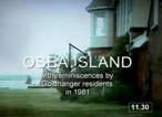
A BBC TV programme
about the island
In 1981 the BBC made a half
hour television programme about the island entitled Causeway's End. Several Goldhanger residents who had connections
with the island were interviewed in The Chequers.
The programme explained how they residents traditionally supported the island's
activities and that island residents frequently used the Chequers Inn as their
mainland base. The film was made by BBC producer Andrew Gosling, who at the
time lived on the island. Goldhanger people described Charringtons retreat for inebriates, and it has scenes from HMS
Osea, plus more recent scenes of the island, including horses at work, barges
sailing by, and vehicles on the causeway. Sadly the BBC no longer has a copy of
the programme, but an abridged version is on YouTube...

|
watch the programme
at... www.youtube.com/watch?v=IrfAh36oskw
|
|
|
watch selected early images
at... www.youtube.com/watch?v=XLU8GQqVkJ8 |
|
Osea Island for sale in 1977 a
BBC television clip from that time |
|
|
The Causeway Retreat in2009 the ‘addiction treatment centre’ located on the island from 2005 to 2010 |

a high definition video entitled “Introducing Osea Island” showing recent
scenes is at... https://vimeo.com/285079175
and here are more websites
about the island that include many up-to-date photos...
www.oseaisland.co.uk www.oseaisland.co.uk/history
milocostudios.com/studios/osea-island milocostudios.com/studios/osea-island/intro
www.tripadvisor.co.uk/...Osea island...
The history of Osea Island is one of our Local History
Talks
The pleasure Ship SS
Maldon Annie
In the early 1900s F N
Charrington purchased Osea Island and set up a treatment centre for alcoholics
in the main residence called Rivermere. He also purchased the steam ship SS Annie to travel between Maldon and
the island. The boat was later re-named the SS
Maldon Annie and was used for many years as a Maldon based pleasure steamer
and was a familiar sight in the Estuary.
Steam Ship Maldon Annie
Maldon Annie took part in the evacuation
of Dunkirk, but sadly did not return to Maldon.
Military Activities
Perhaps the most significant
military event to have taken place in the estuary was the Viking invasion and
the Battle of Maldon in the year of 991.
Ninety Viking longships sailed up the estuary carrying 4000 Viking warriors.
The actual location of the battle remains in doubt, but Northey Island is
generally accepted as the main battle site. However, the western end of Osea
Island and the stretch of water across to Decoy Point may have also been a
battle site. Wherever the battle was located, the armada of Viking longships
would have passed up the estuary visible from the shore at Goldhanger.
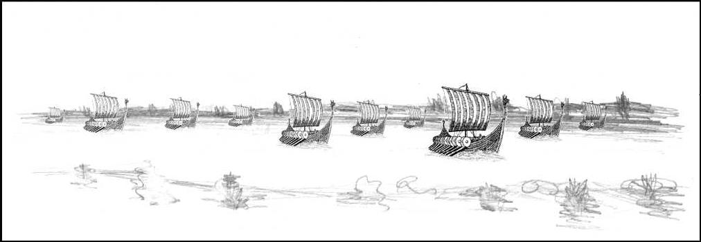
artists impression of armada
of Viking longships in the estuary
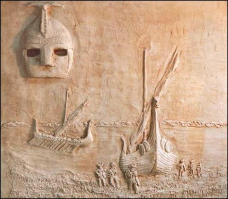
pargetted artists impression
of the invasion
on the inner wall of a
property in the village
Mara Benham wrote about Byrthnoth in...
Byrthnoth’s
Last Journey: from Maldon to Ely
Much else has been published
and written about the Battle of Maldon on the internet.
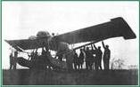
Seaplane Trials
In 1913 Osea Island was
enveloped in tight security while the Royal Navy conducted a series of tests on
a revolutionary new two-man Seaplane called Seagull which was intended
to be the main line of defence against enemy submarines and Zeppelins. The
British Deperdussin Aeroplane Company demonstrated the seaplane in the
Blackwater Estuary around Osea Island.
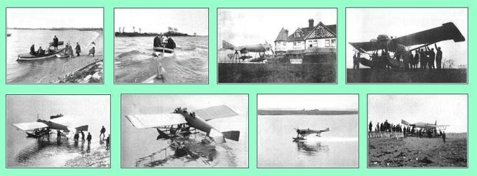
There is more about these trials and the subsequent events at... Osea Island Seaplane Trials
World War One on Osea
Island
During World War 1 forty Coastal Motor Boats (CMBs)
were stationed on Osea Island. At one point there were 1000 sailors stationed
there. It was called HMS Osea
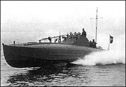
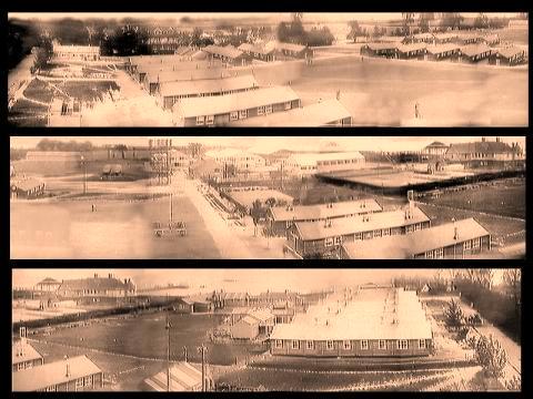
a 180 degree panoramic view
of the HMS Osea during WW-1 shows many of the buildings
There is more about HMS Osea at... The
Great War - HMS Osea
The history of Osea Island and the Great War are two of our... Local History Talks
World War Two
There were many rumours that
Osea Island was used by the Royal Navy during World War 2, and much talk there
being a Clandestine miniature submarine base. However several years ago the
Royal Navy Museum offered this explanation:
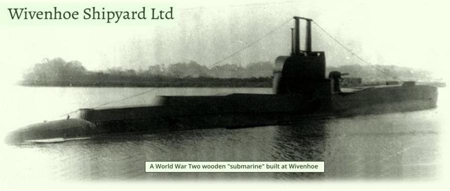
It is know that during WW-2 a company at Wivenhoe constructed decoy
wooden submarines for use in confusing the enemy. These were towed to various
locations around the Essex coast and left for the enemy to find and bomb. Some
were probably located at Osea Island and Heybridge for a while.
There is more about this at... www.wivenhoehistory.org.uk/.../wivenhoe-shipyard-ltd
|
|
|
A
close-up view select
to enlarge |
|
|
one of
the decoys at Wivenhoe select
to enlarge |
|
|
A 1940s postcard of Millbeach
that show what looks like the decoy submarines in the distance |
|
|
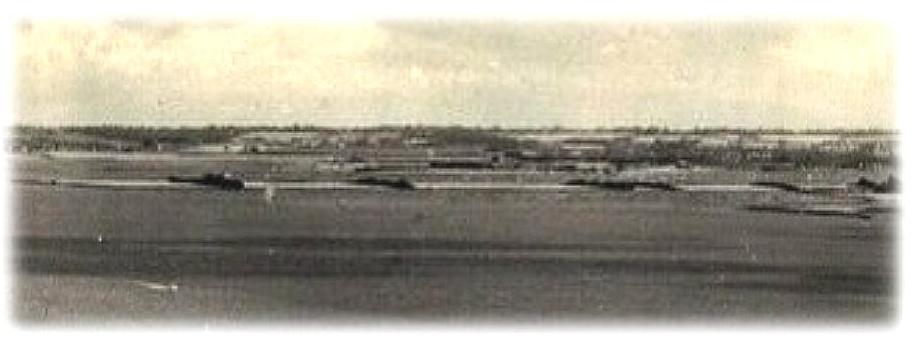
- the wooden decoy submarines were covered by the UK
Secrets Act until the 1970s -
The Blackwater estuary was
also used by both the army and the navy as part of the build up to the D-Day
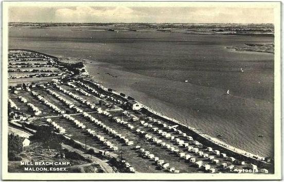
landings at Normandy. Landing craft were seen at many locations including:
Osea, Stone, Heybridge Basin and Mill Beach.
These
paragraphs are taken from...
CHELMER
CANAL TRUST NEWSLETTER ISSUE 24, November 2003
From Darby Stebbens' life
story. . .
The 28th Company Royal Army
Service Corps was stationed in the Basin during World War Two. They had three
or four motorised wooden barges to carry their machinery, together with a 'Tid
Tug', a bit like the old steam tug Brent which you can still see at the Hythe
in Maldon. There were also a dozen or more Thames lighters tied up all along
the sea wall as far as Mill Beach ready for D-Day. They must have been in one
heck of hurry to get away because on the day they left they just threw all
their mooring chains overboard and left them on the shore. What they used to
tie up with when they arrived I'll never know.
There was a lot of military
activity around the Basin with soldiers and sailors billeted at The Towers in
Heybridge and in the Manor House on Osea Island. Certain boats in the Basin
were commandeered for military services: the yacht Francis II, for example, was
turned into a river patrol boat and was moored off Osea.
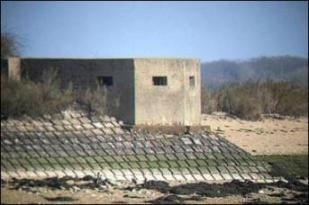
the Osea Island Pill Box still survives
One night Lord Haw Haw told
us on the radio that German planes were going to bomb the submarine base at
Heybridge Basin. The attack happened several nights later: six people were
killed and several houses received direct hits. There were frequent air raids
as German planes flew up the river thinking it was the Thames. At night our
family went and slept on our boat, Gracie, moored on the saltings, so that we
would not have the house fall down on us if we were bombed. One night a land
mine landed right next to the house on Northey Island making quite a thump, but
there wasn't much damage because it went into the soft mud. When I was at Mill
beach one day I saw a Hurricane crash near the Doctor's buoy off Osea.
A German V2 rocket landed in
the estuary near Bounds Farm and its remains lay there for many years. There is
a photograph in the Virtual Museum.
After both world wars May
and Butcher Ltd in Heybridge Basin were involved in scrapping many surplus navy
ships, including the 5600 ton light cruiser HMS Dido. Many ships like this
would have been seen making their last journey up the Estuary to Heybridge
Basin.
See... Memories of World War Two within the
village
Leisure Activities
Swimming and bathing
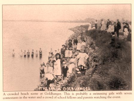
Early postcard photos show that swimming and bathing has been popular in the Estuary and Creek for many years and has probably take place for centuries.
 ......
The picture on the left
shows a children's swimming gala, while the picture on the right shows an
ancient wreck with a crude diving board attached, there are also two bathing
huts in the background, close to The Shoe.
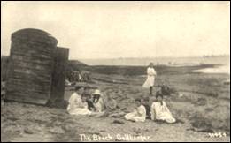
A beach hut in the creek
Sailing for pleasure
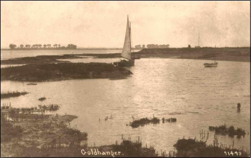
Goldhanger Sailing Club was formed in 1959, however these two photos from much earlier days indicate that sailing has been an pleasure activity in the Creek and Estuary for at least a hundred years...
 .
.
The picture on the left of a sailing dinghy in the
Creek also shows the Coastguard Hut and Flagstaff on the seawall which probably
dates the picture as no later than the 1930s. The picture on the right is from
the 1970s.
The club house is built on the site of the former
Goldhanger salt works.
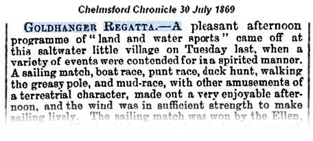
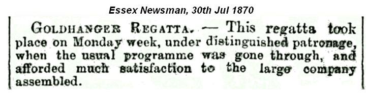
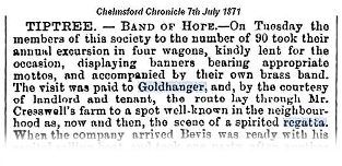
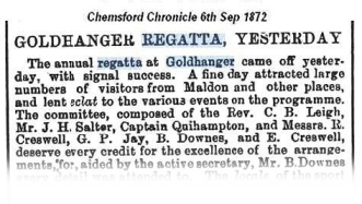
Goldhanger
Regattas
Goldhanger Regattas took
place over a period of at least nine years from 1868 to 1876 and were held in
the Creek and the Estuary near “The Shoe” or “The Horse Shoe” as it is referred
to in the newspaper cuttings below. There were many sailing, rowing and
swimming races, plus a mud race, duck hunt, walking the greasy pole, "land
sports" etc. Several coastguard vessels took part in the races and the
Maldon Volunteer Band played at a number of these annual events.
Several newspaper reports of
the events are available with quotes such as: "This delightful aquatic
event - the company being large and fashionable - many in the carriages came
from Maldon and Witham".
Amongst those on the regatta
committee were: The rector the Revd. C B Leigh, the
well known local GP Dr Henry Salter. Mr & Mrs
Creswell the then owners of Highams Farm who
land the event took place on were also heavily involved.
select any of these extracts to view the full newspaper articles...
|
|
|
|
|
|
|
|
|
|
|
|


The reports reveal that
local coastguards with their coastguard
cutters played a significant role in these events. The Admiralty cutter “The
Rhine”, the coastguard cutter “Widgeon” and the Stansgate coastguard cutter
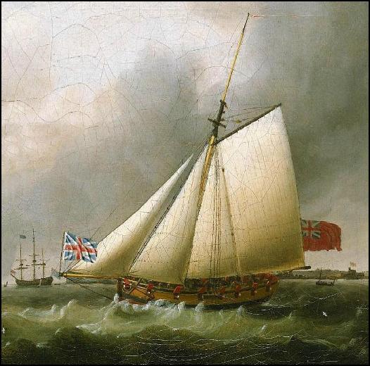
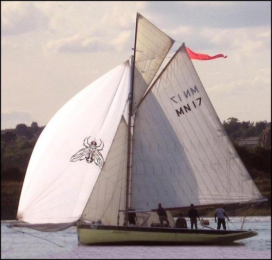
“Fly” are all mentioned. There were several variants of the coastguard cutter
“Fly” in the 1700s and 1800s, here are two contrasting images of those vessels
that may well be similar to the Stansgate based “Fly” at the time and
participated in the events...
|
|
|
|
this excise cutter called Fly was based at Bradwell in the 1790s and early 1800s, and was renowned
for catching smugglers in the Blackwater, Colne and Crouch estuaries. |
this vessel called Fly was built in 1842, was
used to patrol the oyster grounds, and was a fishing boat based at Maldon
from the 1930s. It was re-built in the 1980s. |
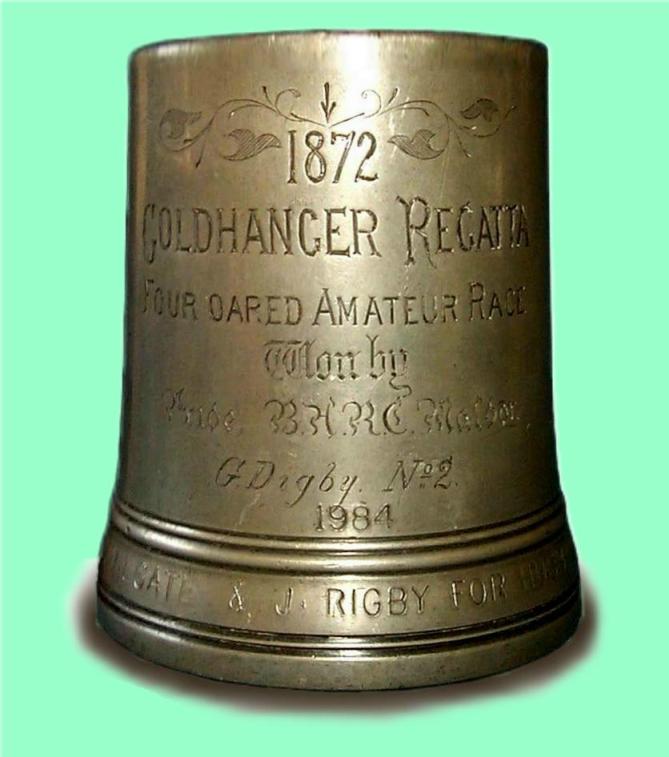
Today a trophy from those
events is in the hands of the West Mersea Town Regatta and is awarded to the
winner of the pair-oared rowing race, which is part of the Cobmarsh Marathon.
The upper part of the tankard is engraves with:
1872 Goldhanger Regatta - Four Oared Amateur Race
Seawall
Construction and maintenance
Seawalls had, and still
have, many benefits: they protect the village and farmland from tidal surges,
they created more useable farmland, they create deeper water at high tide
enabling better navigation and coastal access for small boats and the wall
itself provides access to the coast for wheeled transport and pedestrians. Not
least, a benefit not realised for many centuries, has been that the drying out
of much of the marshes eliminated the mosquitoes that carried the malaria
virus, the disease formally called The
Ague. There is no doubt that most of the walls around the Blackwater
Estuary were constructed a very long time ago, however there is much doubt
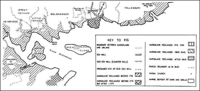
about the dates of the original walls around Goldhanger. Here is a map of land
reclaimed by building seawalls with approximate dates...
Extensive excavations of the
Red Hills were carried at Bounds Farm In the early 1900s, and the report (Proc.
Soc. Ant., XXIII, 69-76.) puts forward the theory that the seawall there was in
Roman times and before some of the Redhills were formed...
“...It was the opinion of the excavators that while
the Red Hill itself had been built on the open marsh, the mould could only have
formed after the sea-wall had been constructed. Hence they would assign a
pre-Roman date to the Hill itself, and conjecture the seawall to have been
built possibly in Roman times. The Roman occupation of a Red Hill, of which
this is the only recorded instance, may possibly have been due to a
recrudescence of the industry”.
The construction of the
seawalls must have had a major influence on the decline of the local sea salt
industry.
See... Salt extraction in the Blackwater
This paragraph has been
taken from: Goldhanger -an Estuary Village by Maura Benham:
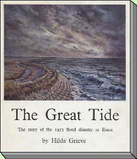
“Hilda Grieve in her
splendid account of the sea-walls of Essex in The Great Tide (1959) finds
evidence of Essex marshland being embanked by the end of the 12th century.
Great storms are recorded in the 12th, 13th and 14th centuries, causing concern
lest the low lying land should be flooded”.
|
The Great Tide The Story of the 1953 Flood Disaster in
Essex by
Hilda Grieve Published
in 1959 by Essex County Council 883
pages long with many illustrations (Hilda
was probably an ECC staff member) |
|
In 1303 a commission was
directed to protect 'the sea-coast of Essex', but the coast line north and east
of Maldon was not specified until 1439 when the commission included the stretch
from Hockley to Tollesbury and to Wigborough. These commissions had to carry
out surveys to find out why dis-repair and decay had occurred, and to levy from
those benefiting from the walls the money needed to repair and maintain them.
The charges included a levy on those using the banks for grazing. The walls had
to be built and maintained by skilled workmen, and the wages paid in 1346-47 to
men building a wall in a marsh during the summer were as much as the marsh
shepherds was paid for a year's work.
E. S. Gramolt in his
unpublished 1960 thesis Coastal Marshlands
of East Essex between the 17th and mid-19th centuries (held in ERO)
described in some detail about the construction of the sea-walls. The practice
was to build the wall in two arms carried across the saltings to the lowest
point over which the wall was to pass. The proposed line of the wall was
prepared by removing vegetation and digging a trench. The soft mud was removed
and the hollows filled with brushwood and good clay, marsh clay being always
the chief material of the wall. Sometimes brushwood made the permanent facing
of the wall, as faggots secured vertically on its face; sometimes chalk and
piles were used; and later Kentish ragstone was brought by barge and used for
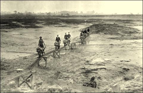
the purpose. The construction technique can be seen in early postcard photos...
The walls around the Blackwater
originally had just a two feet wide top, but after the great tide of 1736 the
walls were heightened and widened to three feet. In the 1790s the Goldhanger
seawalls were 7 feet high. The “borrow-pits” or dykes formed by digging out the
clay to make the wall, also known as delphs or delfs, were at first dug out
very close to the seawall, but were repositioned later to some twenty feet from
them.
Up until WW-2 seawall
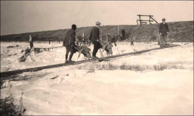
maintenance was the responsibility of the adjacent landowners. We know Highams
Farm used horses and wagons on a narrow gauge rail track to move soil from
ditches dug on the farm onto the seawall during the quiet winter farming
period. The iron rail tracks were dismantled and moved to a new location on or
near the wall where most repairs were needed. The very deep ditches around
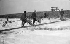
Highams Farm which were the result of this activity can still seen.
 ......
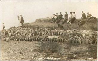
'Seawalling' being carried
out by workers from Bounds Farm in the 1920s
In the 1930s Charles Stokes,
who ran the petrol filling station and servicing garage in Church St.
Goldhanger, was paid by local councils to regularly ride his bicycle or
motorcycle along the seawall from Tollesbury to Maldon, checking on the
condition of the seawalls and sluices.
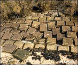
During the 1953 floods the seawall was breached on Highams Farm
close to the Hatches and at Decoy Point on Gardeners Farm, and an area
stretching from the lower end of Fish Street to Millbeach caravan sites was
flooded for many days, including most of Bounds Farm land. The concrete lining
slabs visible today were laid after these floods when the government took over
responsibility for the maintenance of the seawalls. A length of seawall closest
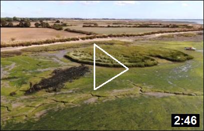
to the village was raised by a further metre in the early 1980s.
At that time a low mound was
build at the head of the Creek that protrudes into Church field and it remains
there...
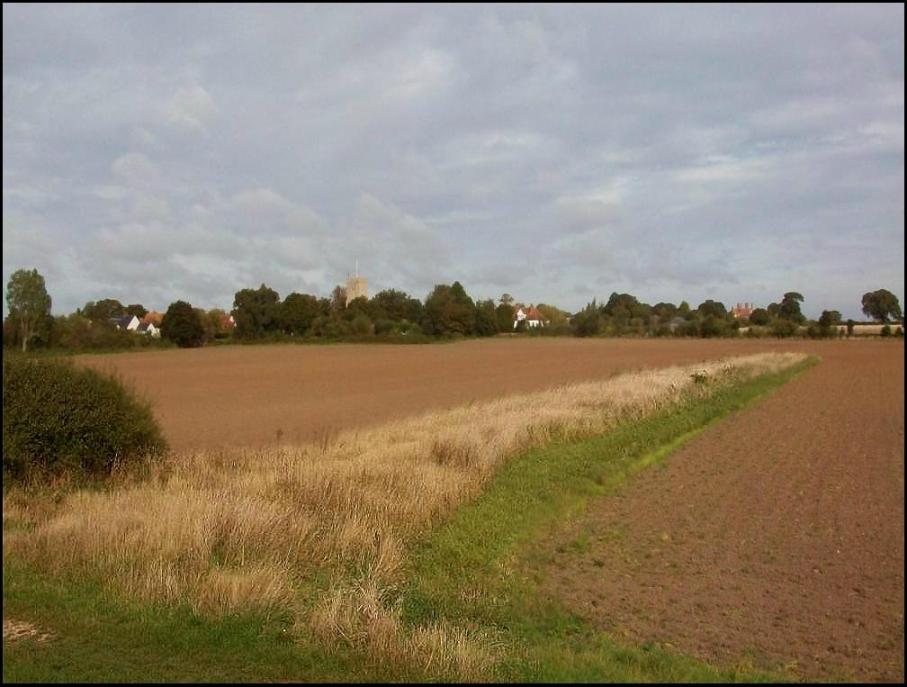
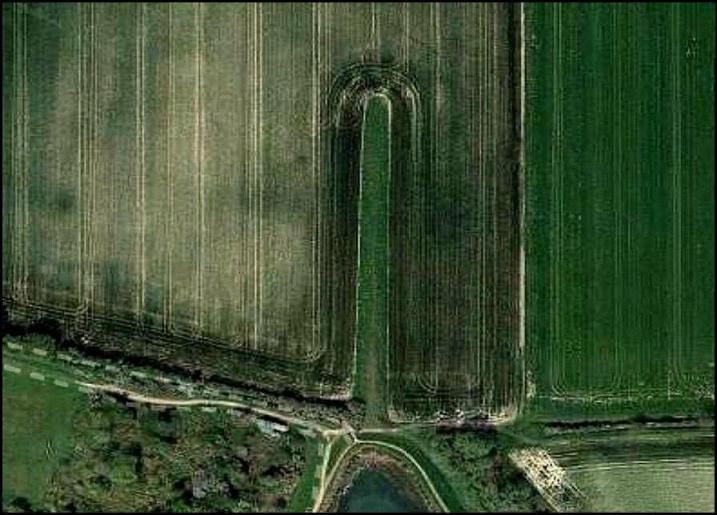
view from the seawall
aerial view
The purpose of this mound, which is much lower the
main wall has sometimes been questioned. This is a rationale...
In the past it has been
explained that it is a ‘fallback’ mound to protect the lower part of Fish St.
in the event that the seawall is again breached to the east of the village in a
similar way to it was during the 1953 floods. When a relatively small breach
occurs at high tide, only a limited amount of seawater can pass through the gap
before the tide recedes. Similarly, if an exceptionally high tide together with
strong winds blowing up the Estuary cause waves to overflow the top of the
seawall by just a few inches, then again only a limited amount of water would
reach inland before the tide recedes. The small mound in the Church field would
be sufficient to keep back these surges from lower Fish St.
Today the Environment Agency
is responsible for seawall maintenance, but in the recent past have been
reluctant and slow to repair the walls to the east of the village, ironically
one of the locations where the wall was breached in 1953. This photo shows the
deteriorating state of the wall a few years ago, but fortunately repaired in
November 2014 after much lobbying by Tollesbury and Goldhanger Parish
Councils...
Deteriorating seawall near
Highams Hatches
The photo was taken in 2013
_______________________________________
top Smuggling
& Coastguards Local flooding in the past home