|
For centuries life in the
village has been dominated by farming and fishing, and there were farmhouses
right in the middle of the village and farms surrounding the village included
within the Parish. Today farming is heavily influenced by national and
international conditions and the European climate, largely resulting from the
ease of transportation of farm produce, but two centuries the local farms
were supplying local needs with a diverse range of produce. As transportation
improved the local farms specialised in produce suited to the drier local climate and terrain, such as peas and soft
fruits, etc. The earliest records of farming
come from the Domesday Book entry for Goldhanger
and that indicated that farming was predominately sheep and pig livestock
production, with the amount of land under cultivation being extremely small
at 50 acres in total. In Goldhanger - an estuary
Village, Maura Benham noted (page-25) that between the 11th and 16th
centuries sheep production and cheese making from ewes reared on the salt
marshes was the major local farming activity. The reclamation of salt marshes
by farmers building seawalls to create more
productive farming land continued over many centuries. A reliable supply of fresh
water on a farm was essential to rear livestock, and all the local farms had
their own well for human consumption and a pond close by for the animals.
Today it is unclear whether the farms were originally built close to a
natural pond (see... Glacial ponds), or
whether the ponds were artificially created by damming a stream. In the 16th
and 17th centuries all the farms adjacent to the estuary had duck decoy ponds on their land to benefit from
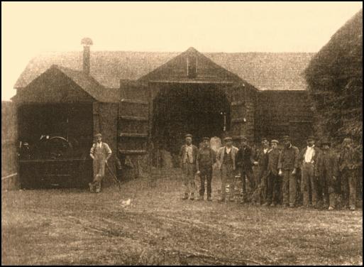
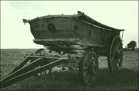
harvesting the large numbers of wildfowl on the marshes in winter months. Up to the 20th century farming
was very labour intensive with large numbers of men and horses used to
cultivate land, providing the main source of employment for villagers. As
farm machinery developed, the demand for labour receded, the smaller farms
were taken over by larger ones and the farmhouses became private residences.
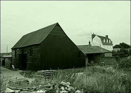
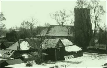
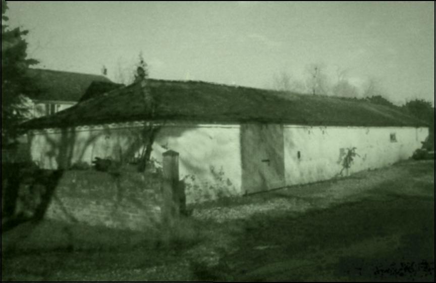
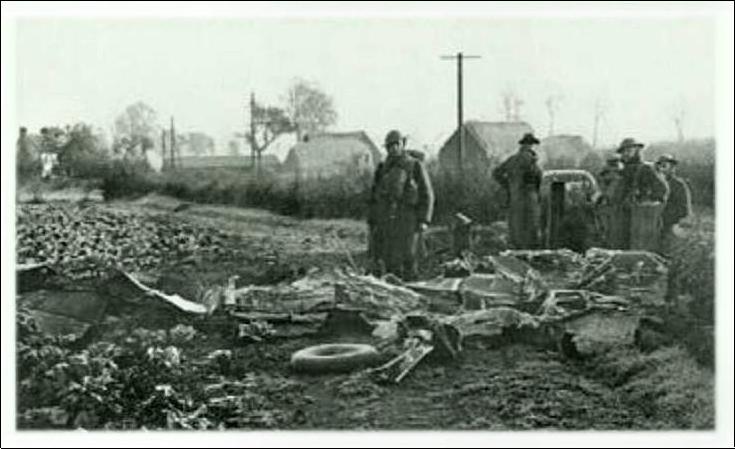
The farm buildings adjacent to these farmhouses became redundant and many of
the barns were lost including the village Tithe Barn. Although photos of farms only
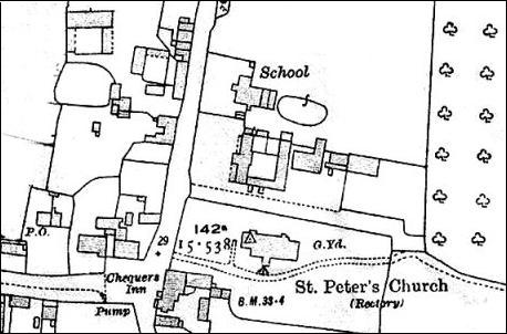
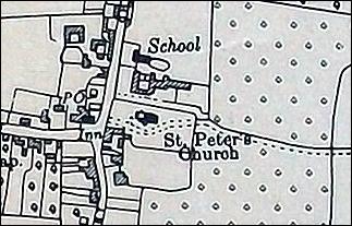
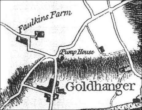
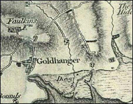
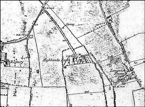
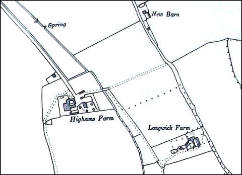
go back to the early 1900s, much earlier maps exist
that details of the farms and associated buildings and ponds. Extracts have
been made from these early maps and are show below. Most of the farmhouses
and some of the barns are listed buildings. Links to those entries are
provided below. Many of the farms have had different
names over the centuries, being named after the farmer or landowner of
the day. The interactive map below uses the modern names... |
|||||||||||||||||||||||||||||||||||||||||||||||||||||||||||||||||||||||||||||||||||||||||||||||||||||||||||||||||||||||||||||||||||||||||||||||||||||||||||||||||||||||||||||||||||||||||||||||||||||||||||||||||||||||||||||||||||||||||||||||||||||||||||||||||||||||||||||||||||||||||||||||||||||||||||||||||||||||||||||||||||||||||||||||||||||||||||||||||||||||||||||||||||||||||||||||||||||||||||||||||||||||||||||||||||||||||||||||||||||||||||||||||||||||||
|
select a farm from the map, or
scroll down through the farms below ( in alphabetic order ) |
|||||||||||||||||||||||||||||||||||||||||||||||||||||||||||||||||||||||||||||||||||||||||||||||||||||||||||||||||||||||||||||||||||||||||||||||||||||||||||||||||||||||||||||||||||||||||||||||||||||||||||||||||||||||||||||||||||||||||||||||||||||||||||||||||||||||||||||||||||||||||||||||||||||||||||||||||||||||||||||||||||||||||||||||||||||||||||||||||||||||||||||||||||||||||||||||||||||||||||||||||||||||||||||||||||||||||||||||||||||||||||||||||||||||||
|
|
|||||||||||||||||||||||||||||||||||||||||||||||||||||||||||||||||||||||||||||||||||||||||||||||||||||||||||||||||||||||||||||||||||||||||||||||||||||||||||||||||||||||||||||||||||||||||||||||||||||||||||||||||||||||||||||||||||||||||||||||||||||||||||||||||||||||||||||||||||||||||||||||||||||||||||||||||||||||||||||||||||||||||||||||||||||||||||||||||||||||||||||||||||||||||||||||||||||||||||||||||||||||||||||||||||||||||||||||||||||||||||||||||||||||||
|
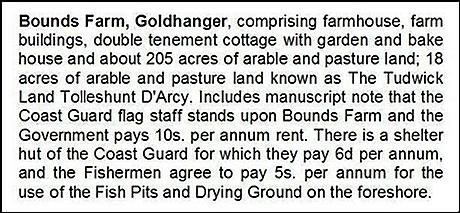
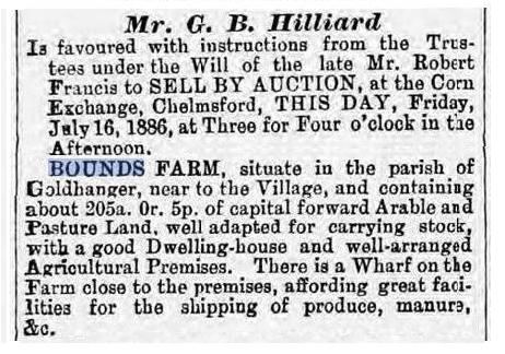
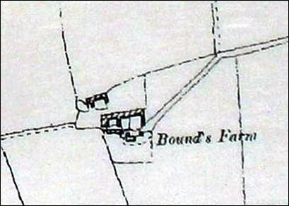
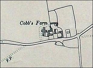
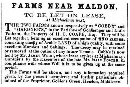
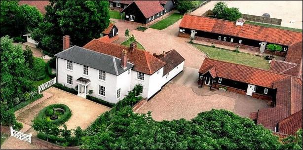
Bounds
Farm English
Heritage extract
In
the 1700s Bounds Farmer Mr Lee built a new seawall around the farm. In Goldhanger - an estuary Village, Maura Benham
describes this on pages 49 and 50. The
field at the east of Bounds is the site of a saltworks in the 1700s. See... Salt extraction on the Blackwater The
Bounds Farm entries in the Tithe Awards for 1820 and 1838 refer to: 18
named fields and marshes, owned by Samuel Gurney and farmed by Robert
Francis. The
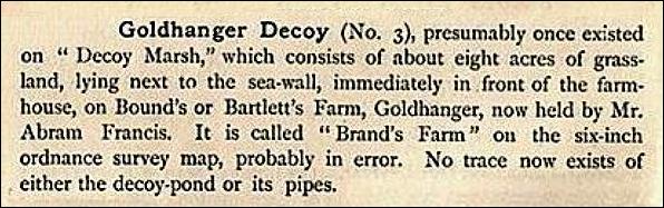
farm was called Brands Farm on the
1880 OS map and in Fitchʼs
1898 book.
from... Birds of Essex, by Miller
Christy in 1890 The
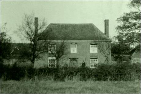
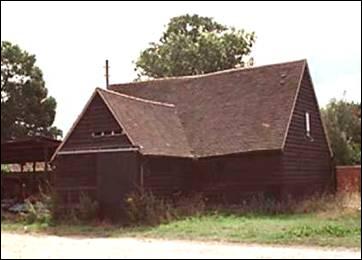
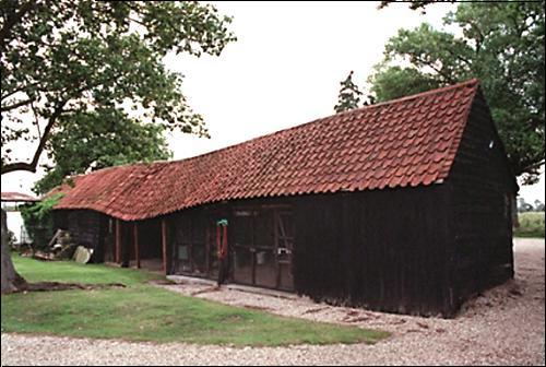
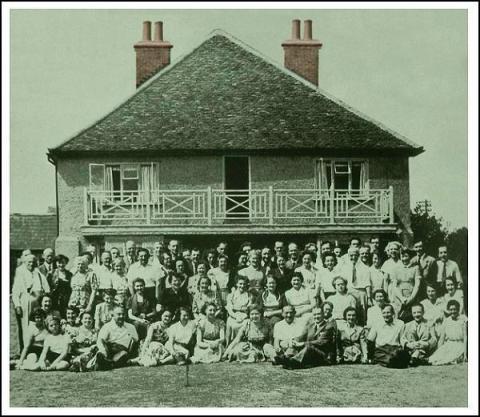
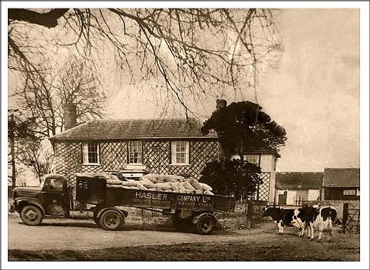
farmhouse was called Boundless in Stanley Wilkinʼs letters of the 1930s. Bounds Farm has been owned by Wilkin&Sons of Tiptree
since the 1920s and the company has grown fruit there ever since. There are
images of the farm from the past as part of biographical details of both Stanley Wilkin and John
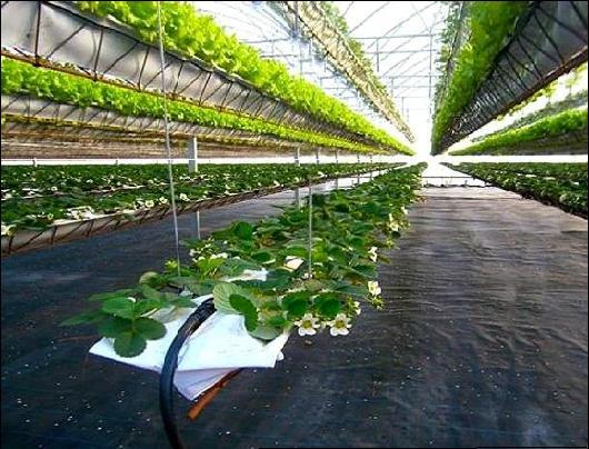
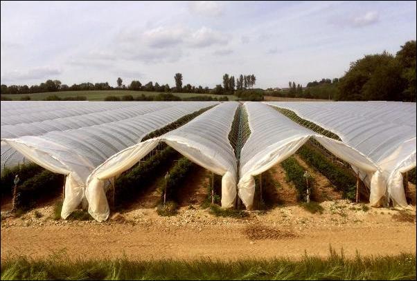
Wilkin. In recent years the farm has been the company’s main site for
strawberries grown under under polythene.
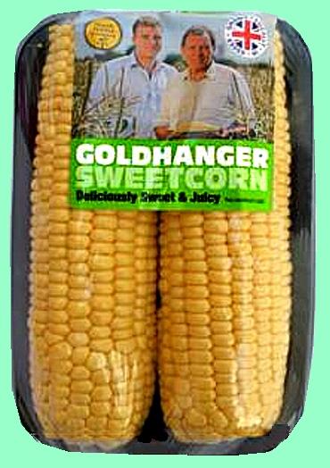
Because strawberries grown in this way need far less
land, in recent years some parts of the estate have been used by the local
co-operative North
Maldon Growers to grow sweetcorn,
pumpkins and ‘Crown Prince’ squashes, making best use of the ‘maritime
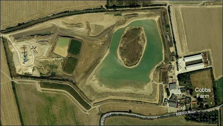
climate’ close to the Blackwater Estuary. Bounds Farm also has a large reservoir for irrigating their crops which is also stocked with fish, see... fishing reservoirs Cobbs
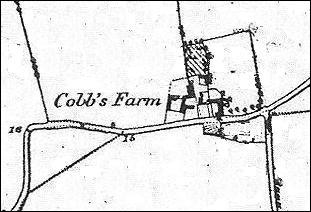
Farm English
Heritage extract
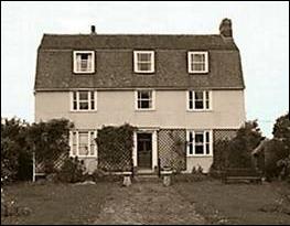
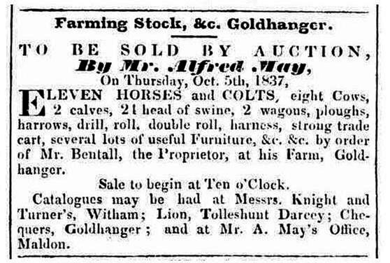
The farm is said to be named after William Cobb in 1222 Referred to as Cobbes in ERO D/DVz/359 in 1569 Referred to as Cobbs Croft in ERO D/DR T28/2 in 1643 In the late 1700s Cobbs was the home of William
Bentall inventor of the Goldhanger plough. To make the parts he developed a
small foundary in a field opposite the farmhouse. More about... William Bentall. In the 1800s Cobbs Farm was owned by the Coe family,
who were wealthy Maldon merchants, and in 1841 it was inherited by local
author Henry Coe Coape. More about... The
Coe-Coape and Coape-Arnold families. On the 1820 Tithe Awards, Henry Coape is listed as
owner and James Wood as farmer. Deeds of 1860 in ERO (D/DU 627/4) refer to Cobbs and
Sewells Farm: 101 acres, lands: 21 acres and marshes: 38 acres near
GOLDHANGER Wash. In the 1920 & 30s Cobbs was farmed by Ernest
Lancelot Pledger, who was Chairman of the Parish Council and also the Village
Hall committee. In recent years some of Cobbs Farm land has been
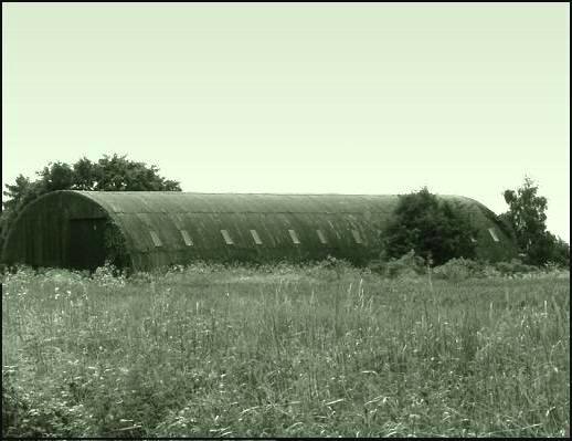
used for sand and gravel extraction...
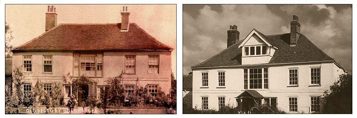
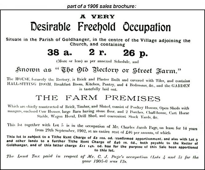
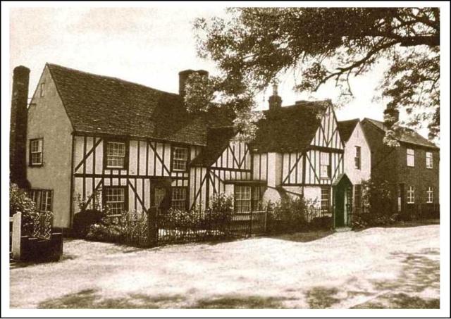
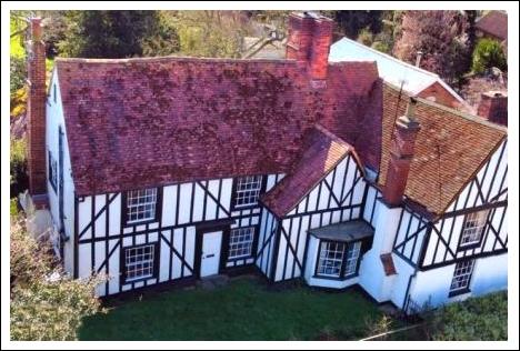
Church Farm / Old Rectory
Farm English
Heritage extract
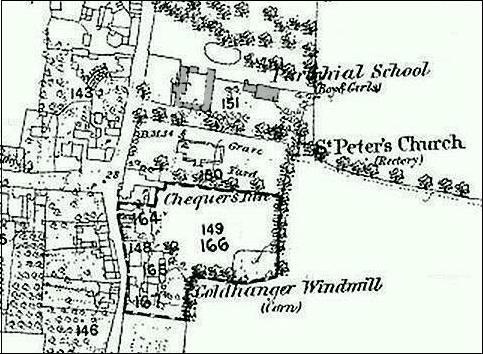
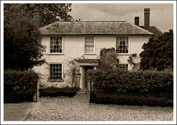
Church Farm has been known by many names over its long history... It was the Rectory from the 1500s to the 1800s and in 1650 was home to author the Revd Edward Howes. On
the 1820 and 1838 Tithe Awards it was named as The Glebe, and Parsonage
House. The house was used a Dame School / Parochial school in the early 1800s. More about... Village School It was The Glebe in Crockfords Clerical Directory of 1868 Called Street Farm in a 1906 sales brochure, however Hall Farm has also been known by this name. Called Rectory Farm in a newspaper article in 1922 Called
Old Rectory Fruit Farm in a newspaper article in 1934. At this was at a time
when the farmer was the innovative and locally well known Charles
Page (more images shown there). Since the 1960s the house has been a private
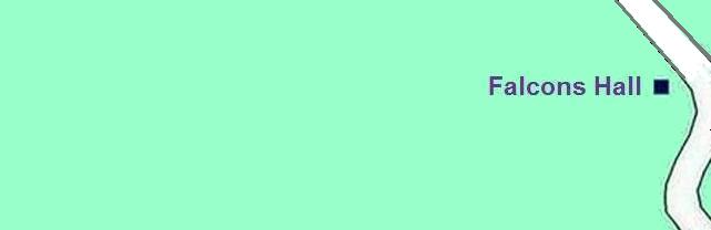
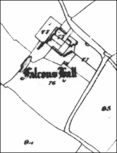
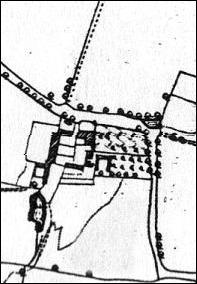
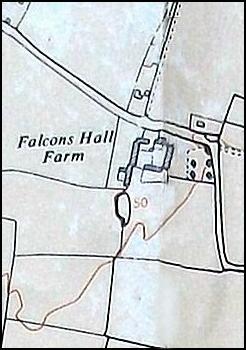
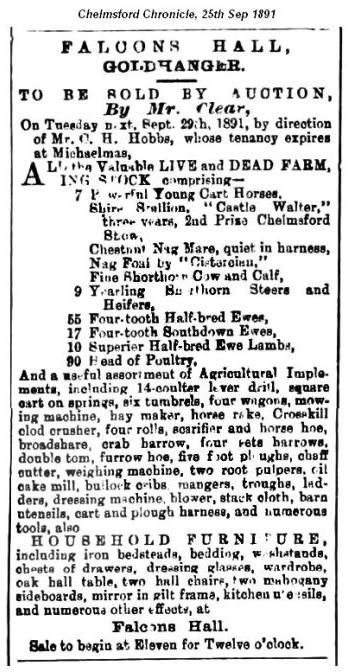
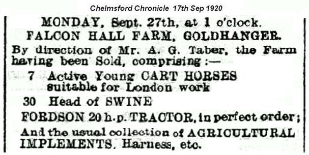
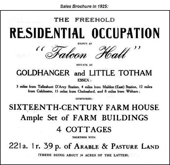
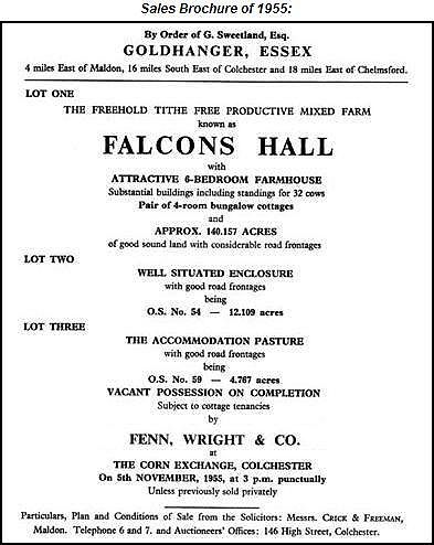
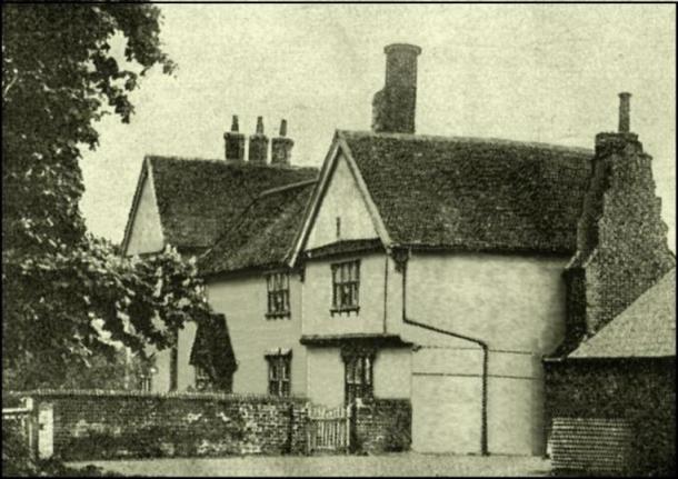
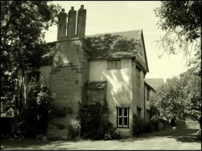
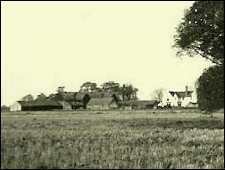
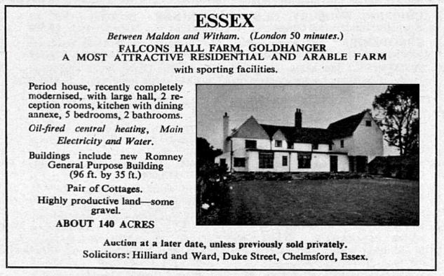
residence known as The Old Rectory. Falcons
Hall English
Heritage extract
The farm was named after the original owner John Ffalons or Ffawcon in 1346. Ffakons is dated 1445 in ʼThe place-names of
Essexʼ and then named as Ffacones in 1484. Sir
Thomas Huett, a London merchant, created a trust in his Will of 1632, leaving
a charge on his lands at Falcons Hall and Bakers (Green). The Charge and the
Trust remained in place until at least 1904.
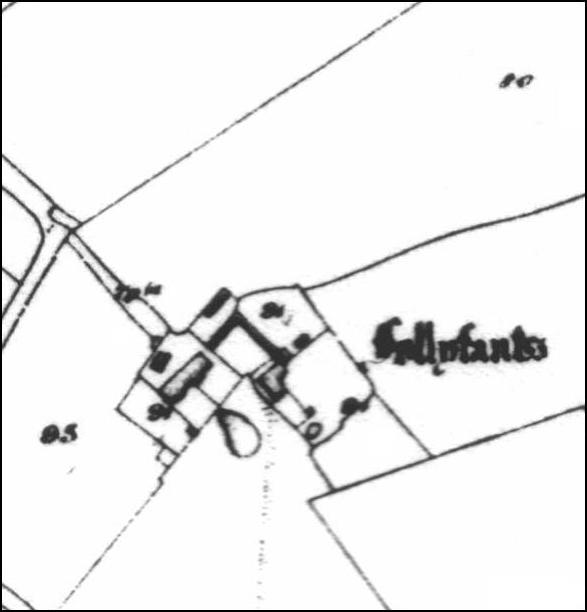
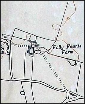
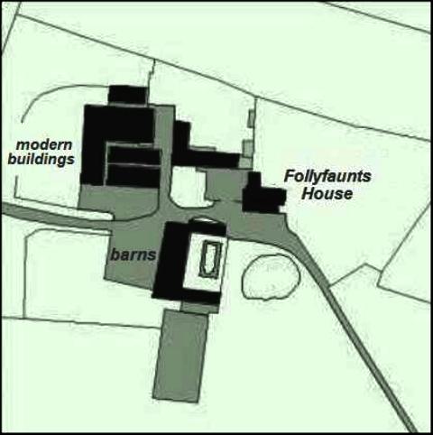
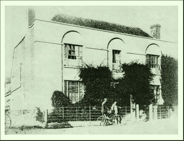
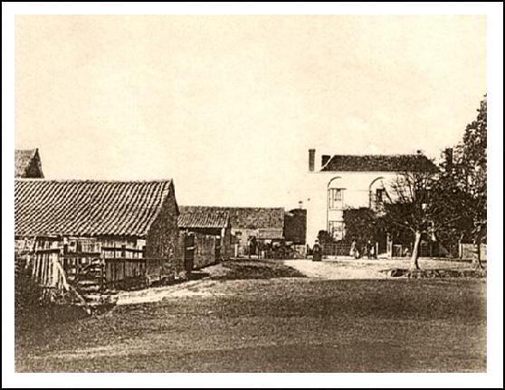
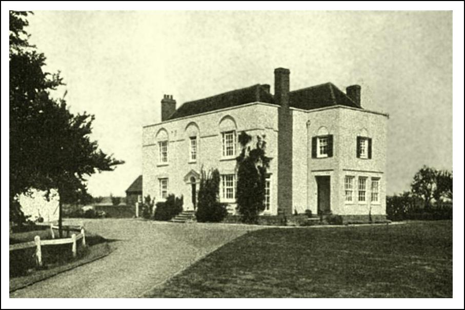
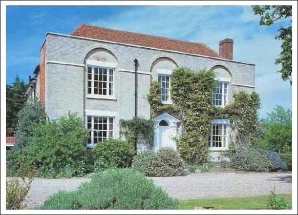
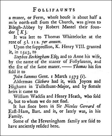
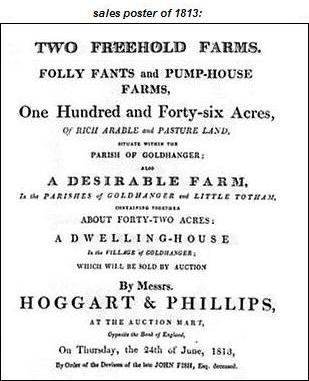
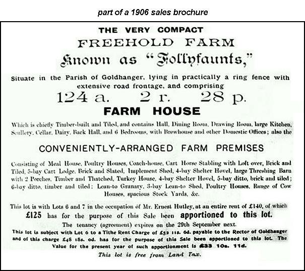
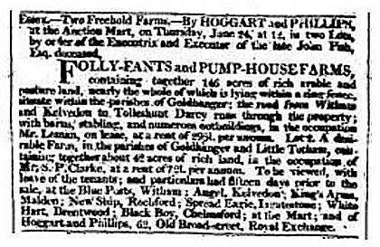
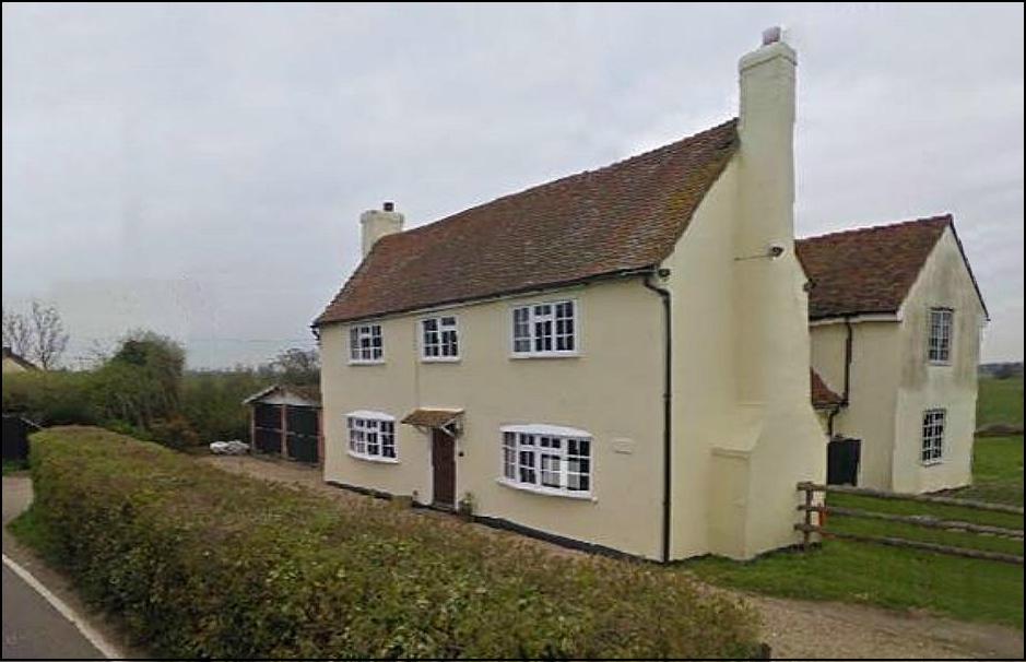
Follyfaunts English
Heritage extract
Before the Reformation Follyfaunts belonged to Beeliegh Abbey
but Henry VIII sold it to Stephen Beckingham in 1543. In the 1820 Tithe Awards the Revd Edward Leigh is
listed as owner and Thomas Francis as farmer. It was part of the Coe-Coape & Coape-Arnold family estate in the 1800s. The Leigh family bought Follyfaunts in 1832 and the Revd. Charles Brian Leigh used it as a Rectory until the
family built a New Rectory at the top of Church
Road. From 1930s Follyfants belonged to the McMullen family who had renovated the house. Mrs
Maude McMullen was president of the " Goldhanger
Players " Drama Society in the 1940s and 50s. The chair in the Village Hall is dedicated to her. In
1939 Follyfants was the home of author and Ming China collector... Major Lindsay Fitzgerald Hay and
there was a 3-page article about Follyfaunts and the major in... Homes and Garden magazine in 1939. In
the 1960s electric robotic elephants was developed and marketed at
Follyfaunts by Lord Hillingdon. There
are more details here about... Eletrophants... In 1962 Mr & Mrs Jenkinson purchased Follyfants
House. They ran their business of Verine Products
from the outbuildings for around forty years and during the summer months
opened the gardens to raise funds for the Red Cross. At the turn of the
Millennium they commissioned professional historian Peter Bushell to research
and record The history of the Follyfants house. His research
identified twenty-one previous owners and farmers of the manor over seven
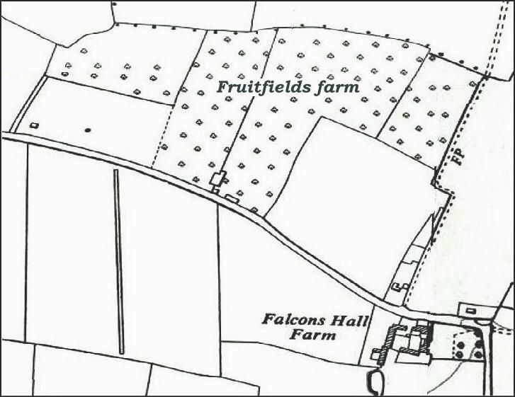
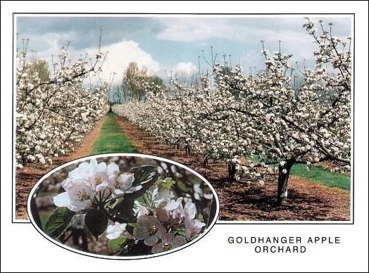
centuries. Fruitfields Farm Fruitfields
has been an apple and pear orchard for about 100 years.
Up
until the 1970s there were several prosperous orchards around the village.
Climate had always been a major factor in their success, and on average
compared with most of the UK the parish has low rainfall, more sunshine,
higher summer temperatures and fewer hard frosts. Sadly however, when we
joined the EU in the 1970s they didn’t recognise this and decided it was not
efficient to grow soft fruits in the UK and paid farmers to grub out the
trees and produce arable crops. All the other orchards nearby disappeared,
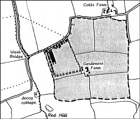
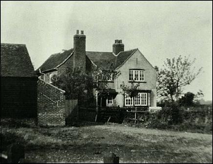
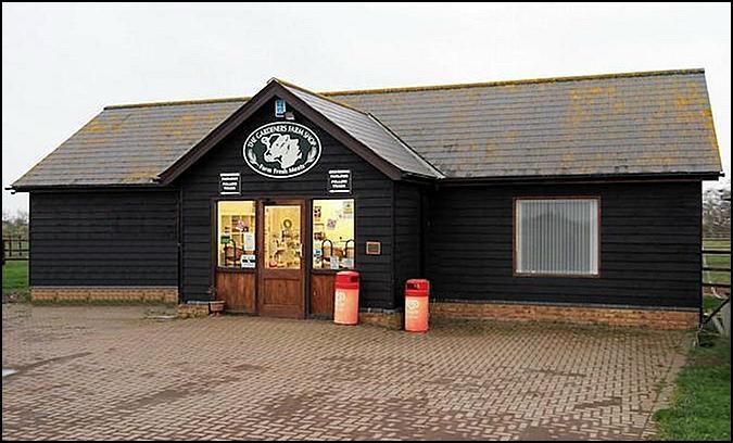
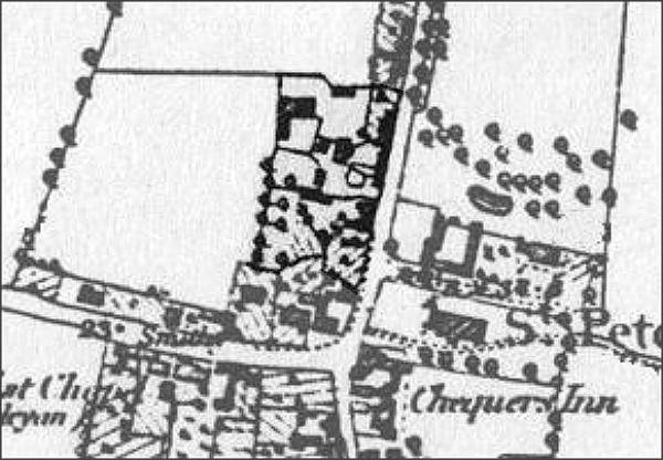
but Fruitfields has continued to produce apples, albeit on a small scale. Gardeners Farm
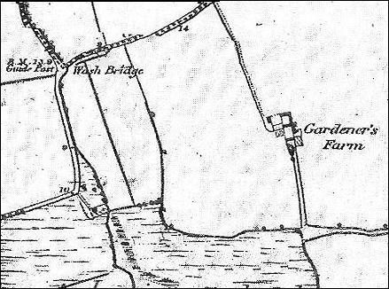
The Farm is identified as Vaulty Wick Marsh, on a Will of 1561 It was called Fawlty Farm on a 173 map and the 1777 map ( the same name was later used by Vaulty Manor ) In the 1700s the farm included a very profitable Decoy Pond. Gardner's Farm on 1820 Tithe map & Awards and on
the 1838 Tithe map & Awards On the 1820 &1838 Tithe Awards, Henry Coape is
listed as owner and Isaac Foster as farmer. The farm was part of the Coe-Coape & Coape-Arnold family estate in the 1800s. It was called Gardner's on 1841 census and Gardeners
Farm on 1880 OS map. Gardeners Farm was the site of a Royal Flying Corps Flight Station in the Great War. In
recent years the Flight Station site has become a farm and butchers shop...
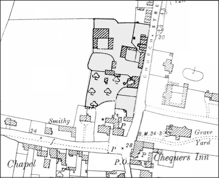
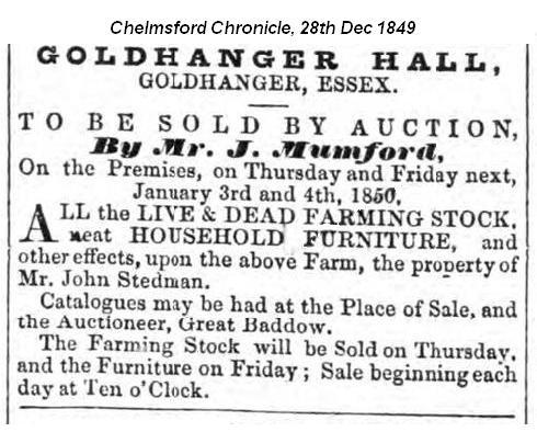
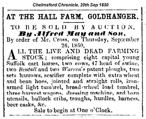
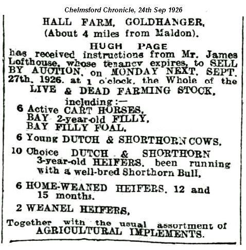
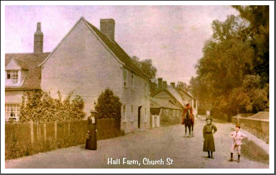
Hall
Farm English
Heritage extract
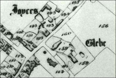
The farm was called Joyces on the 1820 Tithe map and
on the censuses of 1841 & 1851 On the 1820 Tithe Awards the owner is listed as Henry Coape and the farmer as William Wade. It was also called Goldhanger Hall and The Hall, in newspaper adverts in the 1800s It was called Street Farm in Kelly's Directory of 1892 & 1899 (Church Farm / Old Rectory was also called this) It was Hall Farm, advert in 1926 Hall Farm barn was sold in
the 1970s, dismantled and move to Tiptree heath, where it remains as a
private house. Past owner/farmers have
included: Mid 1800s - John Steadman, or Stedman, who was a
Churchwarden in 1848. By 1850 he was in the debtors goal at Springfield. 1900-20s - The Dobson family, the son became a
well known local catholic priest, Canon Francis Dobson The Dobson family also farmed Gardeners
Farm during WW-1 1920s-50s - The Simpson Sisters maintained a dairy
herd at the Farm and sold dairy products at the gate. 1950s-90s - Barry and Jean Rose converted the farm
to arable with poultry sheds behind the farmhouse. Hall Farm has been a
private residence since the the Millennium when St Peters Close was built on
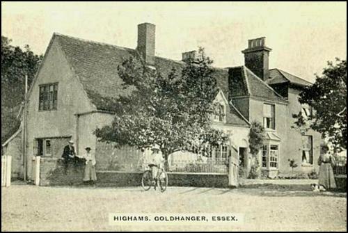
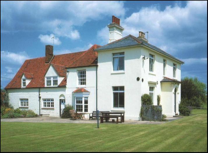
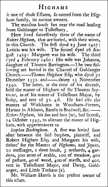
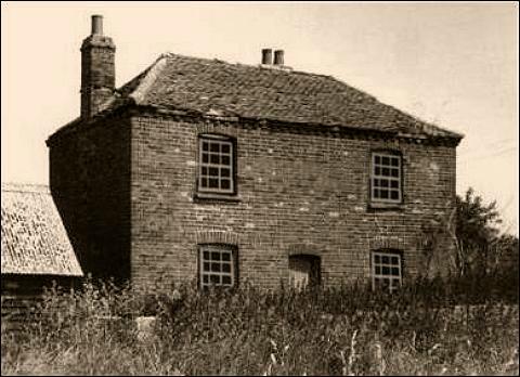
the farmyard. Highams
Farm English
Heritage extract
Farm was once within Goldhanger Parish, but today is
within Tolleshunt Major Parish. Before the Reformation Highams belonged to Beeliegh Abbey
but Henry VIII sold it to Stephen Beckingham in 1543 along with several of
the other local farms. As
stated in Phillip Morantʼs
book above, in the 1400s Highams was the family seat for members of the Higham Family It
was called Highums Farm in 1631 (or mis-spelt in ERO D/DVz/359 ) In 1641 Sir Christopher Clitherow, Lord Mayor of
London in 1635, set up a trust fund for the poor in his Will with income from
Highams Farm. See... Sir Christopher
Clitherowʼs Trust In
the 1700s the farm included a profitable Decoy
Pond close to The Shoe. It was named or mis-spelt Highlands Farm on the 1838 Tithe map, the 1880 & 1906 OS
maps. Robert
Cresswell was the farmer in the mid-late 1800s. He hosted several regattas at
The Shoe. The
Page family farmed Highams from the 1870s until they bought Church
Farm, probably in 1906. In
Kelly's Directory of 1899 Robert Page is listed as farmer at Highams. See...
Charles Page
(some images of Highams Farm shown).
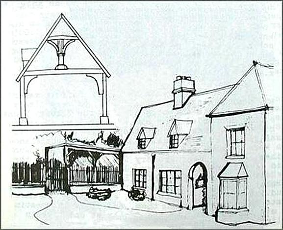
In
1975 a member of the Higham family wrote a 78-page booklet on the family
history. Four pages of the booklet refer to Highams Farm and the members of
the family who lived there and there is a sketch that shows that the house
has a Crown Post beams in its roof confirming the building as a 1400s
structure... Extracts
from the booklet referring to Goldhanger are available here on this
website Highams Farm also has a reservoir nearby for irrigating crops which is also stocked with fish, see... fishing reservoirs
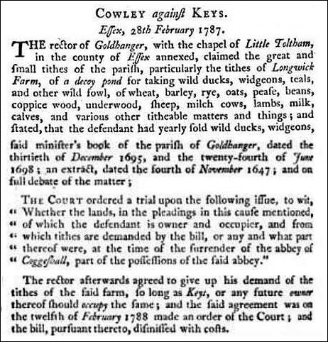
Before the Reformation Longwick belonged to Beeliegh Abbey
but Henry VIII sold it to Stephen Beckingham in 1543 along with several of
the other local farms. Named Long Wyke in Henry VIII letters of 1543. Deed
of Livery, 1569, (ERO D/DVz 359) includes... Manor of Fallyfantes, Longwick
Farm, Grange of Langwyke, Joyces
Farm, Highums Farm, in previous possession of Monastery of Beeleigh, and
purchased from Henry VIII as
part of the... local Reformation effect From
ERO D/P 240/1/3 1598-1769: ʼ60
acres called Langewich occupied by John Parrʼ. Deed of Livery 1569, with Extent (ERO D/DVz 359)
including grange of Langwyke, in previous possession of Monastery of
Coggeshall in Goldhanger. Deeds of 1613 (ERO D/DVz 359) includes... Manor of Fallyfantes, Longhouse Farm, Longwick Farm,
Joyces Farm, Highums Farm. Deeds of 1708-1739 refer to ʼa farm called
Longwick and decoyʼ (ERO D/DEl T86). Called Long Wick Farm in the 1820 Tithe Awards, the owner
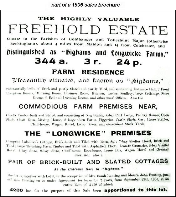
is listed as Henry Lambirth and the farmer as John Hutley. Longwicke Farm was leased to Robert Page along with Highams Farm in 1878 (ERO A8512). Called Longwicke Farm on 1906 sales brochure. By
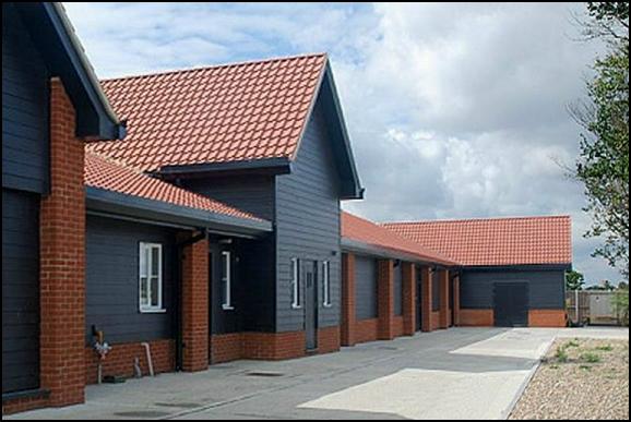
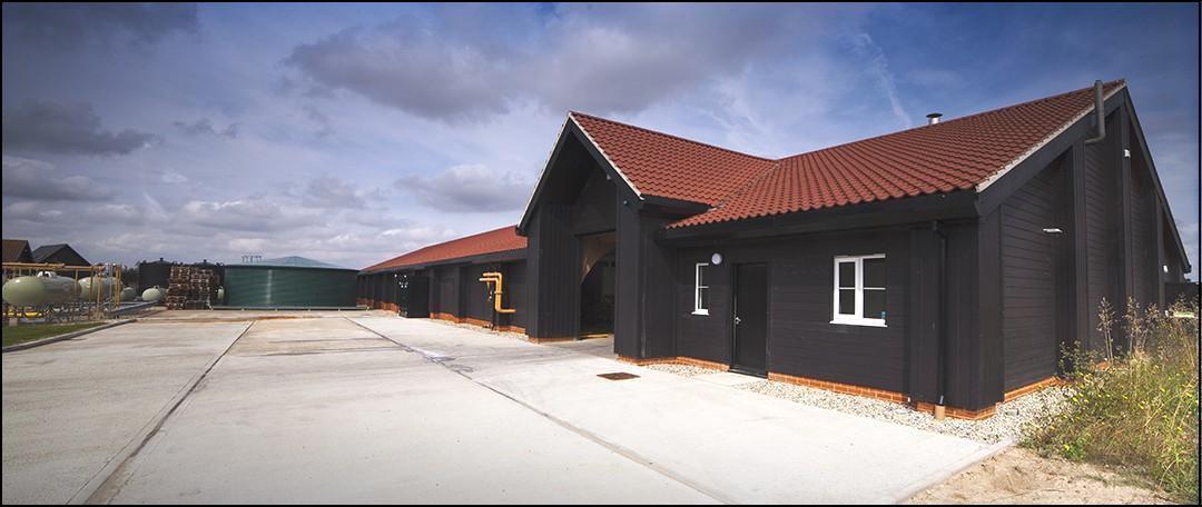
the late 1900s the farm had been unused and derelict for 40 years, and was
purchased by Maldon Crystal Salt Company,
who built a new sea salt processing facility in the
old farmyard which opened in 2006...
As
the business has continued to grow new processing facilities have been added
at Longwwick...
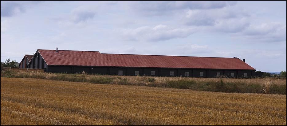
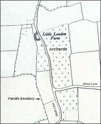
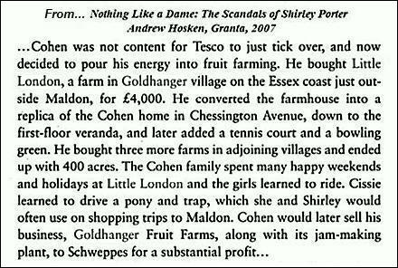
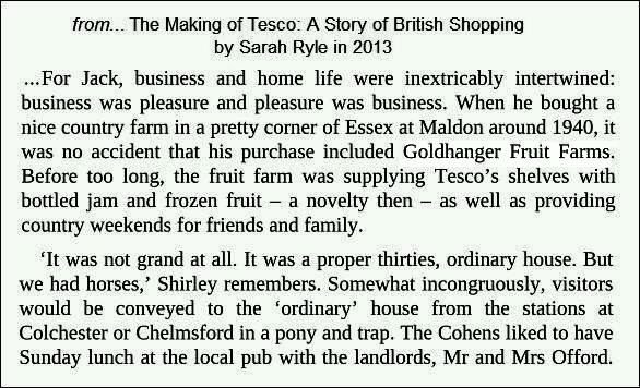
Little
London Farm
In
the 1940s Jack Cohen founder TESCO
purchased Little London Farm as a second home...
While staying at Little London Farm Cohen created and very successfully developed Goldhanger Fruit Farms which was
actually a fruit and vegetable canning factory in the centre of nearby
Tolleshunt Major.
In Pile it High, Sell it Cheap, the
authorised biography of Sir John (Jack) Cohen, written by Maurice Corina,
Cohenʼs association with Little London Farm and
Goldhanger Fruit Farms is described in several pages of chapter-7 which is
entitled ʼGoldhangerʼ. The biography
tells us that the person who introduced Cohen to Little London Farm was a local man by the name of ʼMajor
Frostʼ. Perhaps this could have been Crawshay Frost
of Fish St Goldhanger, who liked to be known as Major Frost. The factory changed owners several times
over the years and is now Beckingham
Business Park. See more about...Sir John (Jack) Cohen
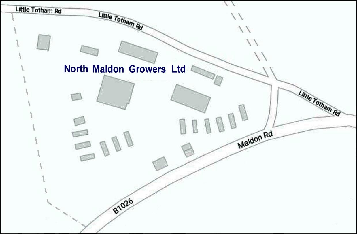
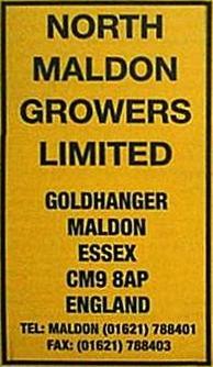
Lt. London Farm has a reservoir for irrigating crops which is also stocked with fish, see... fishing reservoirs North Maldon Growers Ltd.
North Maldon Growers Ltd is a
co-operative farming business of several local farming families which was
formed in the 1960s and makes maximum use of local fertile soils and the
maritime climate. Originally in the 1960s they specialised in dwarf beans,
and carrots, today they produce sweetcorn, pumpkins, ‘Crown Prince’ winter
squash, courgettes, purple sprouting broccoli, kale, etc. Their produce is
sold locally in fruit & veg shops and nationally via supermarket chains.
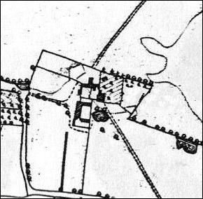
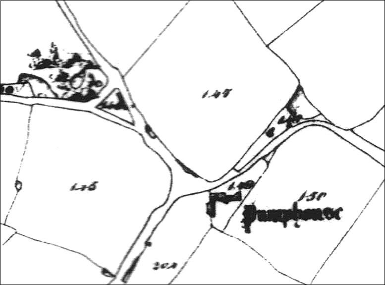
Pumphouse Farm
Pumphouse Farm Deeds of 1750 - 1760 (ERO D/DBt T3) refer to the Will of Robert Harrington, a Goldhanger yeoman. The 1810 Deeds of the Manor of Follifaunts refer to
a ʼmessuage called Pumphouseʼ. The Pumphouse entries in the Tithe Awards for 1820
the owner is Revd Edward Leigh and refers to: Four Acres field, Lower Three Acres, Comer field, the Pightle and a Homestead occupied by Revd. E M Leigh. In the 1841 census the occupier was William Bonner,
farm bailiff. In the Kellyʼs 1899 Directory George Cracknell is named as farmer at Falcon Hall, Pumphouse & Carters Farms. The farmhouse was converted to a coach house for
the New Rectory built by the Leigh
family in 1851. It became a separate property in the 1980s. The ʼPump Houseʼ presumably had
associations with pumping water. Despite being the high land in the village,
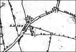
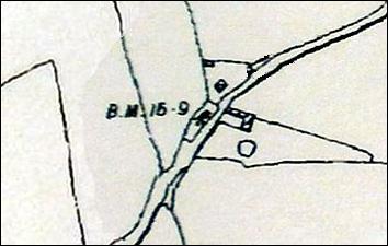
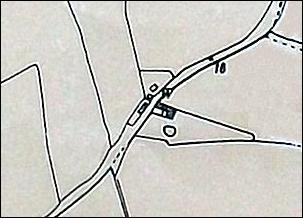
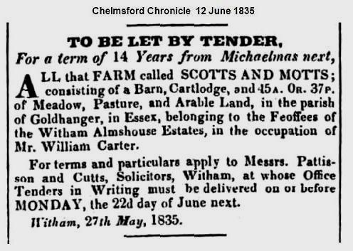
the area has always been very wet, with ponds and springs nearby. Scotts and Motts / Charity
Farm English
Heritage extract
Several early references have been found linking
Scotts & Motts at Goldhanger to the Newland Street Almshouses in Witham,
and are recorded in... Charities for the Sick
& Poor - Newland St Almshouses Deeds of 1571-1653 (ERO D/DHt T325/1): Bargain and Sale Christian Tendringe of Boreham,
yeoman,/Duke of Buckingham, Lord High Admiral, of parkland at New Hall, ...
sold to John and Thomas Corter by feffees Boreham etc. of poor in Witham,
1626... Cottage and land called Scotts (10a.) and Motts (30a.) in Goldhanger.
Includes licence of alienation from Robert Mildmay to William Ward, 1637 Sessions Rolls of 1599 (ERO Q/SR 148/125): We, Peter Tuke and Christopher Chibborne, esquires,
Justices, upon the complaint of John Scott of Goldhanger, yeoman, went to the
house of the said John in Goldhanger called "Scottis" and there
found John Denye and Richard Person Forcibly keeping the same, contrary to
the Stature of 8 Henry VI... and committed
them to gaol until they should paya fins. Deeds of 1742 (ERO D/P
30/25/72): St. Nicolas, Witham,
Bridge Street Almshouse Charity, Unknown donor.
Lease for 21 years at ₤18 per annum to John Holt Goldhanger yeoman.
Cottage and 4 crofts of land (10 acres) called Scotts, and lands (30 acres)
in occupation of Daniel Constable. (There are 12 others similar Deeds in ERO between
1626 - 1808) A reference to: ʼScotts and Motts, alias Westwoods, in Goldhangreʼ by Phillip Morant in 1768 Called Scotts and Motts in ʼThe people's
history of Essexʼ in 1861 On the 1820 Tithe Awards: Owner: Trustees of Witham poor - Occupier in the
Homestead: William Wade (building not named) On the 1838 Tithe Awards: Homestead Scottes & Mottes - Owner: Trustees
of Witham poor - Occupier: William Wade an extract from... SEAX
/ English Heritage listing (SMR 46262) dated 2007 Charity cottage,
Goldhanger. The cottage stands on site of farmhouse along the Maldon Road,
west of the village once known as Scotts and Motts, a former poorhouse used
since at least 1626. Early deeds dating back to 1626 reveal that a messuage
with 4 crofts called Scotts, lands called Motts (ERO D/DHt 354/1) was being
used as a feoffment on trust (ERO
D/P 30/25/65) for the poor of Witham (ERO D/P 30/25/81) by the Bridge Street
Almshouse Charity, whose donor is unknown. The house and land seems to have
been used up to at least 1803 and possibly later as in 1848 there is a
mention of a farm at Goldhanger used for the endowment of 10 widows. There
appears to have been a house on the same site until now but it is unclear
whether this is the original house used by the charity. The house has been called
Charity Farm on recent electoral rolls. Scott & Motts has all but
disappeared. The Limes
English
Heritage extract
The Limes in Head Street
was once a farm and in living memory was a pig farm that that sold the meat
in their own butchers shop next door on the eastern side. The slaughter house
was in an outbuilding in the garden. In 1987 when the Wesleyan Chapel on the
west side of the Limes close the owner tried to convert the chapel to the
butchers shop but planning permission was refused. This building has only
been known as The Limes since the early 1900s. The house opposite used to
have this name until the Revd. Gardner re-named it as The Parsonage. The
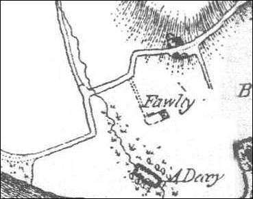
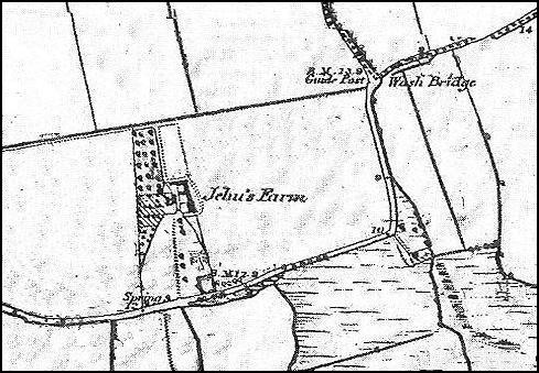
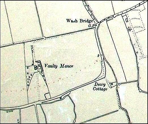
previous names of The Limes were Marriners, Crabtree House and Levers. Vaulty
Manor English
Heritage extract
Before
the Reformation the manor belonged to Beeliegh
Abbey, but Henry VIII sold it to Charles Brandon, Duke
of Suffolk in 1538. The name of the Manor has has been spelt many ways
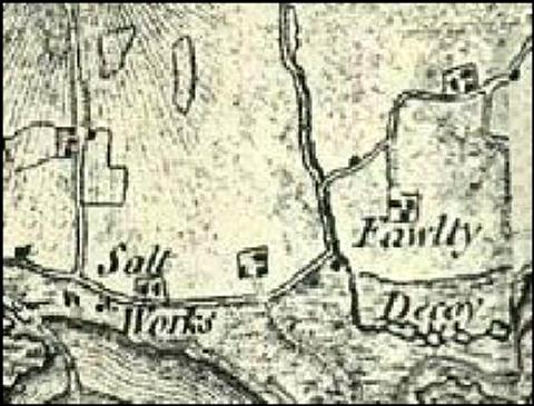
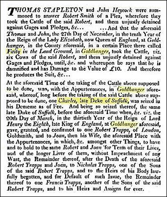
over the centuries... Fawlty in ʼThe Reformation in Essex to The Death Of Maryʼ in 1538 Fauty in 1565 (ERO D/DBe T14) Faltey in Henry VIIIʼs Roll 28, Monasterium Bileigh Faity, in this legal dispute 1573...
Faltie alias Pawtie, ERO on deed and Marriage settlement of 1643 (ERO D/DR T28/2) Vantie alias Faltie ERO on deeds in 1677 (ERO D/DR T28/3) Falty, alias/with: Ravens Croft, Ravens Marshes, Pipers & Pipers Marsh on deeds of 1709 (ERO D/DR T28/6) Fawlty in ʼExcursions in the County of Essexʼ in
1818 and in... ʼThe
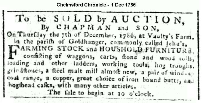
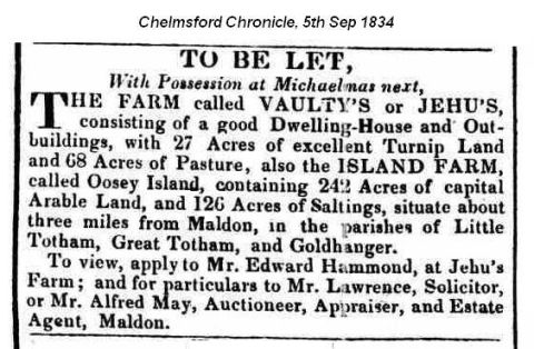
History and Topography of the County of Essexʼ in 1831 (both extracts are shown in... Ancient Goldhanger Documents) Called
Jehews Farm in the 1820 Tithe
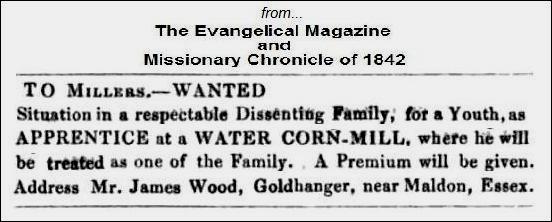
Awards, Henry Coape is listed as owner and James Wood as the farmer, and
in 1842 James Wood advertised for an apprentice at the water corn-mill at Goldhanger...
Called Jehurs Farm, in 1841 census and on the 1880 OS map. The farm was part of the Coe-Coape & Coape-Arnold family estate in the 1800s. The name Faulty
was also used in the 1700s for Gardeners Farm In recent years Vaulty Manor has been a wedding
venue...
|
|||||||||||||||||||||||||||||||||||||||||||||||||||||||||||||||||||||||||||||||||||||||||||||||||||||||||||||||||||||||||||||||||||||||||||||||||||||||||||||||||||||||||||||||||||||||||||||||||||||||||||||||||||||||||||||||||||||||||||||||||||||||||||||||||||||||||||||||||||||||||||||||||||||||||||||||||||||||||||||||||||||||||||||||||||||||||||||||||||||||||||||||||||||||||||||||||||||||||||||||||||||||||||||||||||||||||||||||||||||||||||||||||||||||||