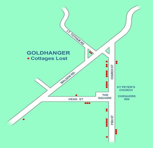
Cottages lost
In the early 1950s over
thirty cottages were demolished in the village. They were mainly tenanted or
tied properties in a very bad state of repair and were condemned by Maldon
Council as unfit for habitation. Ironically, some belonged at the time to the families
of past Rectors which had came into their possession as part of acquiring the
Benefice. Many of the owners did not live in, or even, near the village. New
council houses were built on the Maldon Road to provide accommodation for those
living in the condemned properties that were demolished.
As early as 1938 newspaper
articles were reporting that the council recognised that 23 cottages in the
village were in a poor state of repair and needed to be demolished, but a
temporary reprieve was granted in response to opposition from the tenants and the
second world war deferred action for a further 15 years. It made worldwide
news…
select articles to enlarge and zoom in
Although the cottages were
picturesque, they were described by the tenants who had lived in them as
"damp, cold with very low ceilings and little or no sanitation". By
modern standard these cottages were poorly constructed with softwood timbers
and lath & plaster walls. Most did not have gutters and down-pipes. Some
were built of a soft porous red brick and had no damp courses of cavities. The
1820 Tithe map lists 48 cottages in the village as "tenements", and
the number of owner/occupied as just 9, and most of these were the shops.
Posrcard views of thirty of
the demolished cottages appeared in this PDF document...
select articles to enlarge and zoom in
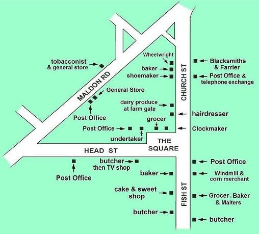
Shops lost
Before the arrival of the
automobile and the omnibus, in the days when a pony and trap and horse drawn wagon
were the means of getting to Maldon on market day, the village was largely self
sufficient with many shops. Many different shops have been identified from old
trade directories, although they weren’t all in business at the same time.
Select to enlarge
Shops from the past…


General store in the
Square cycle shop Head St. pork
butcher Fish St.
butcher
Over the years the post
office has been located in at least six different places, but there was
probably no more than one at any given time. Several general stores have been
identified and they may well have been two of these operating at a time, one
doubling up as the post office. There was also known to be three butchers
shops, but only two at the same time, one specialising in pork. Here is a
summary list (as of 2018)…
Street
|
Address
|
Approx. Dates
|
Past & Present Business
|
Church St
|
1 |
early 1700s |
Black
Bull ale house |
|
|
1 |
late 1700s |
Blacksmiths
& butchers |
|
|
1 |
1920s to 2004 |
Petrol
& service Station |
|
west side |
3 |
1920s - 1980s |
General Store, newspapers,
hairdressers |
|
|
5 |
1500s?- 1990s |
Hall
Farm -sold fresh dairy produce at gate |
|
|
31 |
1880s |
Bakers |
|
|
31 |
1800s |
Shoemakers |
|
|
31 |
early 1900s |
Fish
& Chip shop (north end lean-to) |
|
|
33 |
1800 - 1870 |
Wheelwrights
(in the thatched barn) |
|
|
33 |
1848 - 1970 |
Public
house & bakers |
|
|
33 |
1848 to present |
The
Cricketers Inn |
|
|
47 |
1980 to present |
Agricultural
Museum |
|
east side |
Church Fm |
1900-1950 |
Fruit
growers, Jam makers |
|
|
School |
1850 - 1977 |
Church
of England School |
|
|
School |
1977 - 1998 |
London
borough study centre |
|
|
School |
1998 to present |
Wheatlands
/ Goldhanger Community Nursery |
|
|
4 |
1890s -1960s |
Blacksmiths
& Farrier |
|
|
4 |
1910 - 1920s |
Post
Office & telephone exchange |
|
|
4 |
1940s - 1950s |
Doctors
Surgery |
|
|
4 |
1960s - 1980s |
Agricultural
engineers |
|
|
14A, Coach Hs |
1960s |
Pan Signs, graphic design & sign writers |
|
The Square |
|
1575 to present |
The
Chequers Inn |
|
Fish St |
1 |
1890s - 1900 |
General
Store & Post Office |
|
east side |
1 |
1970s - 1980s |
Doctors
Surgery |
|
|
3 |
1700s - 1930s |
Mill
owners house & Malters |
|
|
9-11 |
1700s - 1870 |
Windmill |
|
|
9-11 |
1870 - 1930s |
Steam
driven mill |
|
|
15 |
1860s - 1899 |
Bird
in Hand, Ale house |
|
|
15 |
1860s - 1899 |
Malters |
|
|
15 |
1880s - 1900s |
Grocer
& Baker |
|
|
29 |
1900s - 1950s |
Butchers |
|
|
Bounds Fm |
500BC - 1840 |
Salt
Makers & Traders |
|
|
Bounds Fm |
1924 - 1946 |
Dog
& Chicken breeder |
|
|
Bounds Fm |
1920s - present |
Fruit
growers |
|
west side |
2 |
1900 - 1972 |
Bakers |
|
|
2 |
1700 - 1800s |
The
Dolphin Ale house |
|
|
10 |
1700 - 1800s |
The
Dolphin ale house? |
|
|
14 |
1800s |
Cake
& sweet shop |
|
|
30 |
1930s - 1940s |
Butchers |
|
|
30 |
1940s - 1970s |
Taxi
service |
|
Head St |
1 |
1830s - 1870s |
Blacksmiths,
Farrier & Wheelwrights |
|
south side |
3 |
1930s |
Pork
Butchers |
|
|
3 |
1940s |
TV
& radio shop |
|
|
15 |
1920s |
General
Store & Post Office |
|
north side |
2 |
1760s |
Clockmaker
& whitesmith |
|
(in The Square) |
2 |
1900s - 1970s |
General
Store & Post Office |
|
“ |
6 |
1800s - 1930s |
Wheelwrights,
bicycle shop |
|
“ |
6 |
1900s - 1920s |
Petrol
station |
|
“ |
6 |
1920s - 1980s |
Undertakers,
carpenters, builders |
|
“ |
6 |
2013 - 2016 |
Salty
Dogs, tearooms & gallery |
|
|
10 |
1840s - 1940s? |
Police
house |
|
|
8 |
1840s - 1940s? |
School
headteacher’s accommodation |
|
|
8 |
1990s - present |
Homeopath’s
surgery |
|
|
12 |
1800s |
Blacksmiths
& Farrier |
|
|
12 |
1850s |
Carpenters
& saw pit |
|
|
12 |
1910 - 1990s |
The
Parish Rooms |
|
Lt Totham Rd |
|
1970s to present |
Farm co-operative - North
Maldon Growers |
|
|
Follyfaunts Fm |
1300s - 1920s |
Farm |
|
|
Follyfaunts |
1960s to 2007 |
Verine Products, Fireplace
wholesalers |
|
|
Falcons Hall |
1300s - 1950s |
Farm |
|
|
Fruitfields Fm |
1920s To present |
Apple
& pear growers |
|
Maldon Rd |
40 |
1930s - 2000 |
General
Store & Post Office |
|
|
34 |
2001 - 2005 |
Post
Office |
|
|
45 |
1900 - 1920 |
General
store & tobacconist |
|
|
Blacksmiths
On the Tithe map of 1841 the
blacksmiths shop is shown on the south side of Head St. adjacent to The Square.
The 1880 Ordinance Survey map shows a “Smiths” adjacent to The Square on the
north side. William Bentall, inventor of the Goldhanger plough and founder of
Bentalls Agricultural Engineers, had his original models of the plough built at
the Goldhanger blacksmiths before creating his own foundry and workshops in
1795.
An early photograph shows
the blacksmiths and a post office opposite the Cricketers
Inn in Church St. and we know Shire horses from Bounds Farm were led up
through the village to the blacksmiths shop for re-shoeing.
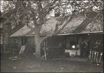
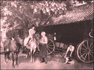
Three generations of the
Emeny family were blacksmiths and farriers in the first half on the 20th
century. George Emeny developed the business into general agricultural
engineering between the 1950s & 60s. In an article published in the Essex
Chronicle in 1962 Harold Emeny recalled that the business closed down in the
1932 recession. Later he said there was a time when there was so much business
that horsemen frequently passed the time in the Cricketers
Inn opposite waiting for their horses to be re-shoed, and by the early
1960s the trade was “down to one or two shoes a day”.
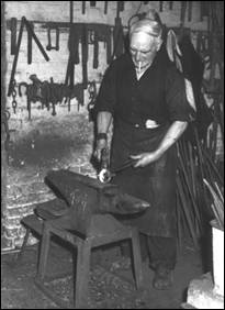
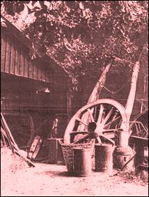
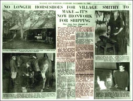
In 1962 a full page article
appeared in the local press about how the Blacksmiths and forge had changed
over the years...
select articles to enlarge and zoom in
The Windmill and Steam-mill
The mill and maltings stood
on the east side of Fish Street a few yards south of The Chequers Inn. For much
of its life it was a steam driven and then diesel driven mill and finally ceased
to operate in the 1920s. Although in the past there was some doubt amongst
locals as to whether it ever was a windmill, records now available confirm that
it was indeed originally operated by wind power. The wooden tower that appears
on several early postcards clearly looks as if it was once the base of a
windmill.
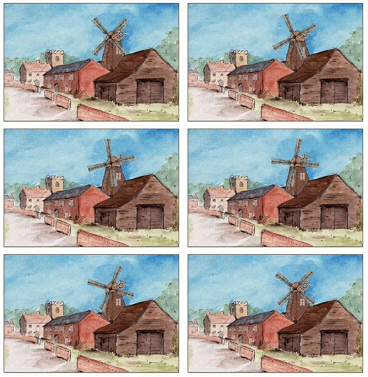
artist’s
impression of the windmill
However, steam was
introduced comparatively early in 1837, so no photograph of the tower with
sails is likely to exist. Hoever, it is identified and described in volume-4 of
Essex Windmills, Millers & Millwrights written by Kenneth Farries and published in
1985. Here is an extract...
|
Goldhanger Windmill erected over a malting; precise form not known.
Stood on the east side of Fish
Street a few yards south of The Chequers public house. TL 905087. In 1781 a windmill and watermill stated to be at
Goldhanger were to be let, together with 12 acres of pasture, the whole
advantageously situated for the London trade, application to be made to
Thomas Piggot Esq., of Maldon. The
exact location was not given, nor does it appear on maps, unless the reference be loosely to the pair
of wind and tide mills, of which the former stood in the attenuated stretch
of Little Totham parish which barely secured a frontage on the Blackwater. With regard to the 19th-century windmill, situated as
above described, a letter from the indefatigable Roland W. Smith is quoted
both as a tribute to his spade work towards the ends of this publication and
as an example of the transient nature of the folk memory: 20th
November 1971. I have been making enquiries lately about Goldhanger Mill
without success. The steam mill, run by an oil engine in its last years, is
still there, now converted into houses.
They present a very ordinary appearance. I don't think anyone would guess their origin. I was told about them by Mr Fred Neville,
who lives next door. His father was
carter for the mill in its last years - it was a stone grinding mill until
the end. A local all his life, Mr
Neville had never heard of a windmill there.
At the suggestion of Mr Frost of Tolleshunt Major, I wrote to a Mr W.
Wenden, now 87 years of age ... Mr Wenden had himself worked at Goldhanger
mill. I received from him the briefest of replies, saying he knew nothing
about the windmill. With the help of
the telephone directory I got in touch with a Mr P. Belsham of Chelmsford, a
member of the family who had once been millers at Goldhanger. He was aware of the family's past, and had
done some research in trade directories, etc., but he, also, knew nothing
about a windmill at Goldhanger. The windmill was, however, real enough. It was erected by the Belshams who from
1826 to 1926 at the least were recorded in directories, operating until c
1870 as rnaltsters and millers, and later as millers only. The windmill was first noted in the Essex
and Suffolk insurance registers (Maldon Agency) as at Belsham's premises in
December 1823, being valued at £200, and a month or so later the agent felt
obliged to record the droll observation: 'The Malting on which Mr Jacob
Belsham's Wind Mill is built is worked as a Malting. Steam was introduced comparatively early,
in 1837, and in 1850 Edward Quy
insured another steam-driven flour mill in the parish. The windmill probably continued in use until about 1875,
for it qualified for inclusion on the first 6 in O.S. map as 'Goldhanger Windmill (Corn)', but in an insurance
record of that year relating to Messrs O. D. & L. Belsham, there is a
mention of four pairs of stones driven by steam, but no reference to
wind. The firm was still to be found
in Kelly's directory of 1926 as
Oliver Daniel and Lewis Belsham, Millers (Steam). |
Here is a section of the
1880s OS map which is marked with: “Goldhanger Windmill (Corn)”
The wooden tower that
appears on several early postcards clearly looks as if it was once the base of a
windmill. However, steam was introduced comparatively early in 1837, so no
photograph of the tower with sails is likely to exist.
Marine maps of the
Blackwater Estuary in 1800s give the “Goldhanger Mill chimney with the Church
tower adjacent” as a navigation landmark and early postcards label what is now
called Fish St as Mill Lane. In 1850 Edward Quy insured a steam-driven flour
mill in the parish. Cyril Southgate recorded in his
memoirs “My father as a young single man had
arrived in Goldhanger about 1910-1911, he was a millwright by trade, and stone
dresser, and was employed by the then owners of Goldhanger mill.
The business was listed in
1926 Kelly's directory as “Oliver Daniel and Lewis Belsham, Millers (Steam)”, and
the tower and chimney are clearly visible in the background of a photograph of
the 1937 Coronation Children’s parade
taken in The Square is in… Early group photos and
is also shown here... It was a stone grinding mill until the end.
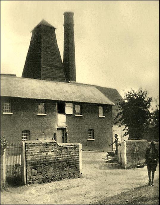
The mill warehouse has been
converted into two cottages.
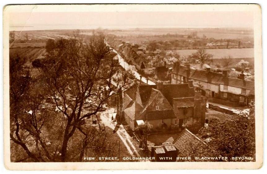
1908 postcard view of the mill from the Church
tower
1925 postcard view of the mill from the Church tower
Fish Street scenes of the mill from early postcards
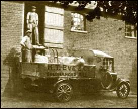
The brick warehouse building shown in these
photographs remains as a pair of cottages
Here are photos of the Mill House itself together
with two early paintings...
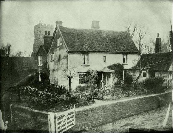
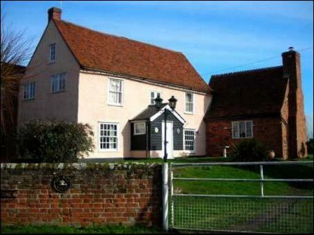
the 1920s
recently
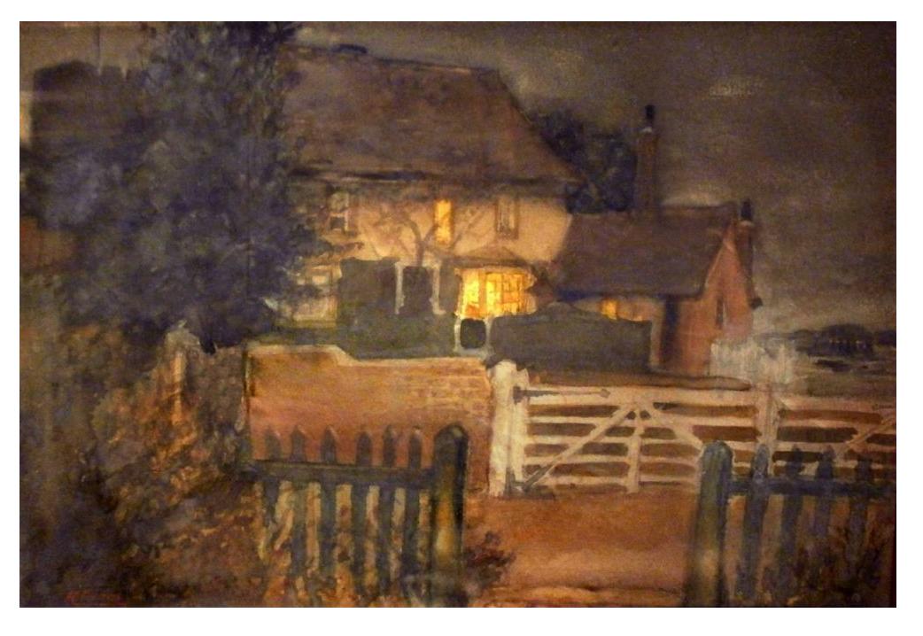
We also have an early photo that shows there was
another door into Fish St from the rear wing of the building. This seems to be
an established method of accommodating two generations of local farming and
business families. When the senior members of the family were not able to run the business or no longer wished to, the families would swap
accommodation, supporting and enabling the younger members of the family to run
the business. Other examples in Goldhanger are The
Limes and Highams.
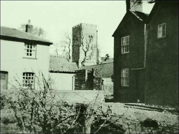
Alehouses
In the past there were
several alehouses in the village as well as the Chequers and the Cricketers
Inns. They were probably not licensed. The locations included:
The Bird in Hand at 15 Fish
St
The Dolphin at 10 Fish St
2 Fish St (more recently the
bakery)
The Black Bull at 1 Church
St (the site of the garage of No.2 Head St.
and is referred to on old Deeds of this property).
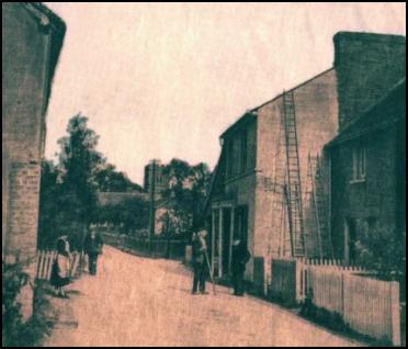
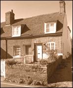
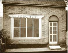
Bird in Hand The Dolphin 2 Fish St
Several reasons for having so
many alehouses in a village the size of Goldhanger have been given:
o
In the 18th century there was a period when a licence was not required
to brew and sell low alcohol beer so as to discourage people from drinking
smuggled spirits. This was the period when Hogarth recorded scenes of
alcoholism in London Streets. So the alehouses were not necessarily breaking
the law at the time.
o
The Methodist community also encouraged their wealthier supported to
open alehouses for the same reason. This probably accounts for why the Bird in
Hand was one of the ale houses, as the Alexander family who owned it were
heavily involved in the Wesleyan Chapel in head St.
o
Because the low alcohol ale made in small batches on the premises, it
didn’t keep for very long, and it was offered for only a short period from each
alehouse on a rotor basis. A sprig of broom was hung outside the alehouse to
indicate that ale was available. So it was unlikely the businesses would all be
selling ale at the same time.
o
Maldon fishermen were said to spend time at Goldhanger waiting for the
tide and were willing and captive customers.
o
There was ready supply of smuggled spirits passing up Fish St. from the
Creek before the coastguards arrived in the village in 1820.
There are many reports of
past incidents and criminal activity associated with the local alehouses in the
Early court and newspaper reports. The last newspaper
reference to the Bird-in-Hand was in October 1900, which referred to the
“surrender of the licence”. The roadside cottages in Fish St and Church St had
shutters on the ground floor windows, said to be there to protect the residents
from the drunken fishermen returning from the alehouses to their boats. The
shutters can be seen on these early postcards. . .
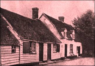
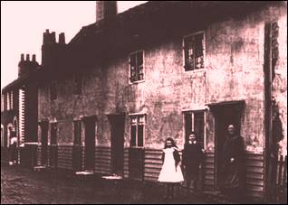
Cottages with shutters on the road in Church
St.
Cricket in the park
The cricket field was was located behind the Rectory, now
called Goldhanger House and beside the Maldon
Road. It was always known as “The Park”. Tea was usually provided in the garden
of the Cricketers Inn. The first recorded landlord
of the Cricketers was in 1848, so presumably the cricket pitch dates from at
least that time.
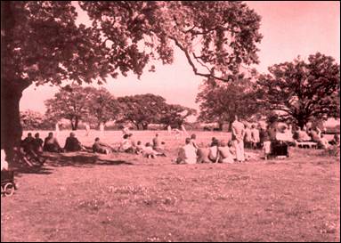
The June 1919 Parish magazine reported:
20 men attended a meeting to
form a Goldhanger & District Cricket Club covering the parishes of
Goldhanger, Little Totham, Beckingham and Osea Island. Subscription 5/- and
upwards for playing members. Mr. Pinhey was appointed Captain and the Curate,
Rev B.H. Durrant-Field Vice-Captain.
Practice nights will be on Tuesday and Thursday, and matches to be
played away until after hay time.
Before the Second World War cattle were grazed in
the park and iron hurdles with wheels were used to fence off the cricket square
from the animals, and for many years a concrete strip was used as the pitch,
over which coconut matting was stretched and pegged into place. A hard cork
ball without a seam was used.
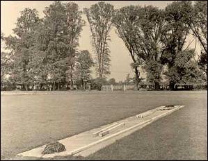
The concrete cricket strip
Other activities also took place in the field during
this period, such as WI organised sports days. During the second
world war the park and the pitch were used by a searchlight battery
stationed in the village.
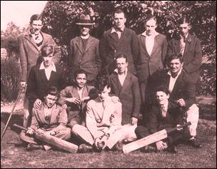
The cricket team in 1930
After WW-2 declining support
made it increasingly difficult to pay the ground rent and in 1952 when the
farmer disposed of his milking herd the lease for the cricket square was given
up and all of the park was converted to arable land.
Tithe barn and Glebe farm
The village tithe barn was located in Church Street
next the Church. It is shown on the 1820s Tithe map and more
recent ones, but must have been a much older than the 1800s. In the first half
of the 20th century the barn was part of the Glebe otherwise known as Church Farm belonging to the Page
family. The barn was a low timber framed building, with gabled entrances
just large enough for horse draw carts to load and unload in the dry.
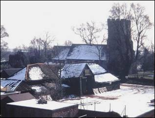
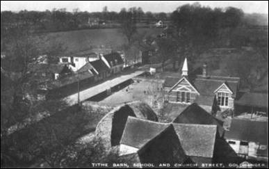

The barn was demolished as
recently as the1970s just after the photo on the left above was taken and when
it was in a bad state of repair. The early postcard photo (upper right) taken
from the Church tower clearly shows the shape of the barn. It was unusually
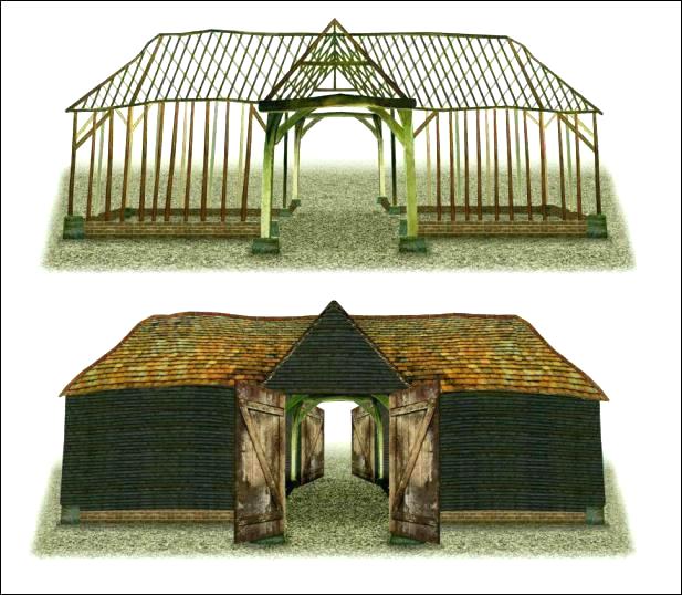
symmetrical with four gable ends. As these four photos are the only record of
the appearance of the barn, an “architectural drawing” has been produced to
show what the barn might have looked like in its hay-day...
One reason for the entrances
being placed opposite each other in this way was to create draught for
“winnowing” the chaff in the days before any form of mechanised drying existed.
See also… other barns lost
Judging from early
photographs and postcards taken in the first half of the 20th
century Church Farm or Old Rectory Farm, appears
to have been a prosperous and successful farming enterprise…
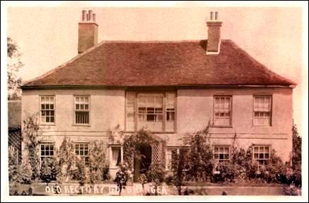
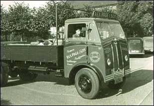
Between the 1920s to the 50s Charles Page and the Page family maintained extensive fruit orchards on the land to the east side of the village and for a time produced jam in the farm buildings on their land which, together with their D’arcy Spice apples, were sold all over the country. Rex Page, Charles's son, is sitting in this truck...
Common Market policy resulted in the orchards being taken out in the early 1970s and the fields were became arable land and merged with Highams Farm. By 1974 the tithe barn was in a poor state of repair and it was demolished and two detached houses were built on the site: Churchside and Jasmine.
Barns Lost
As well as the Tithe barn
several other ancient timber framed barns have been lost in the village for to
a variety of reasons…

Falcons Hall had a large timber framed barn which was demolished
in the 1940s as it was in a poor state and unsafe. It was replaced just after
WW-2 with a redundant semi-circular corrugated iron structure.
Wheelwrights barn next to the Cricketers Inn in Church St. was
burn down in the 1970s. It just appears on three of the early postcards of Church Street next to the
Cricketers. A private house was built on the site.
Hall Farm barn was sold, dismantled and move to Tiptree heath in
the 1960s, where it remains as a private house.
The Tithe Barn was demolished as recently as the1970s. Photos are above. Two private houses
were built on the site. The beams and roof tiles were sold on.
Scotts & Motts the barn seems to have fallen down in the 1980s but
some remains are still there. A photograph of an aircraft crash on the Maldon
Road during WW-2 (shown below) clearly shows several buildings in the
background that were Scott & Motts farm.
Bounds Farm barn caught fire due to an electrical fault,
probably in the 1990s, and has been replaces with a modern structure.
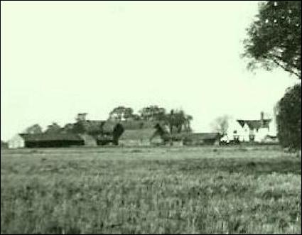

Falcons Hall barns Tithe Barn


Hall Farm
Barn before being dismantled Bounds
Farm Barn before the fire .

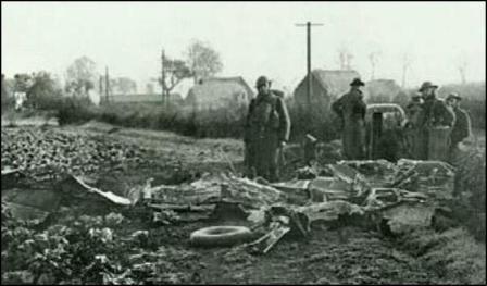
The
Tithe Barn during demolition Scotts &
Motts Farm and barns in the background.
Ancient barns
remain at... Cobbs, Follyfaunts, Vaulty Manor and Highams
farms
top home more... Goldhanger Lost


