|
Archaeology
Summary for Goldhanger The
locations below are shown on the… Interative map |
||||
|
HER - Essex Historic Environment Records,
see links to... Listed Buildings and Monuments Local - indicates knowledge from local sources (documents
in local archives) the web - indicates information from the internet(extracts
in local archives) |
||||
|
__________________________________________________________________________ Origin Location Description
Images __________________________________________________________________________ |
|
|||
|
HER |
playing field |
|
|
|
|
HER |
Bounds Farm |
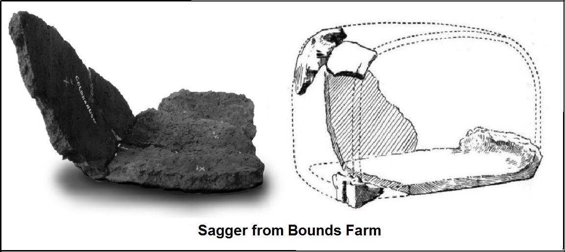
Roman midden, saltern, broken Sagger, etc. see… Salt
extraction in the Blackwater |
|
|
|
HER HER |
Bounds Farm Sailing Club |
Roman
pottery, Samian ware, large jars with rolled rims. Crop-marks showing at
Bounds Farm Redhill excavated in 1908.
One of the many local Redhills. |
|
|
|
|
|
|||
|
__________________________________________________________________________ |
|
|||
|
HER |
Joyces Creek |
Prehistoric settlement, Redhill
excavated, flints |
|
|
|
HER |
“ |
Hand axe, Neolithic worked flints & pottery |
|
|
|
HER |
“ |
Mesolithic dated worked flints with serrated blades |
|
|
|
HER |
“ |
Two line of posts, date unknown |
|
|
|
HER |
“ |
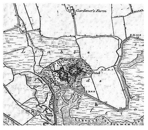
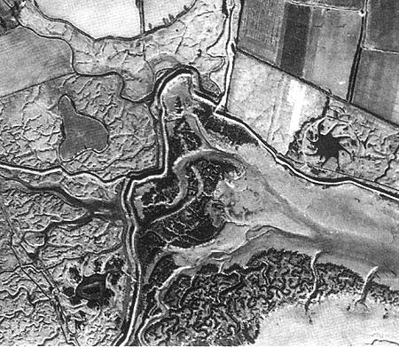
Decoy Ponds one with eight “pipes” |
|
|
|
Locql |
“ |
Site
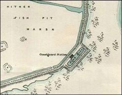
of Fish Pits and the 1953 Seawall breach
that caused local flooding |
|
|
|
|
|
|
||
|
__________________________________________________________________________ |
|
|||
|
HER |
The Stumble |
Neolithic settlement,
midden, cooking pot, steam baths & Neolithic plant material, 4000 -2300
BC |
|
|
|
the web |
“ |
The most comprehensive group of Earlier
Neolithic plant remains of any domestic site in England” |
|
|
|
HER |
“ |
Early Bronz age settlement, post holes 2350 - 700 BC |
|
|
|
HER |
“ |
Iron age settlement - hurdle bridge, fish traps,
stock enclosure, etc |
|
|
|
HER |
“ |
Pottery vessel, Roman occupation, 43 - 409 AD |
|
|
|
HER |
“ |
A discus like polished flint
knife found on the eroding shoreline in the area of the Stumble. Theses
knives are rare and appear to be a British develoment, associated with Beaker
pots and EBA burials. |
|
|
|
HER |
“ |
Post-medieval wooden structures |
|
|
|
Local |
" |
Hand
millstone, 20 inch diameter found at this location |
|
|
|
Local |
" |
Site of WW-II V2 rocket crash |
|
|
|
Local |
" |
A bronze
spearhead in perfect condition, found by a dingy sailor in the estuary near
the Stumble. |
|
|
|
__________________________________________________________________________ |
|
|||
|
HER |
The Creek |
Lines of wooden posts,
date unknown |
|
|
|
the web |
" |
Wooden structures on the Goldhanger foreshore
radiocarbon dated to 13th century. Probably a jetty. |
|
|
|
HER |
" |
Wreck of Thames barge Snowdrop is still
visible. |
|
|
|
Local |
" |
The barge Snowdrop had a long local
career. |
|
|
|
Local |
" |
Parts of a wreck were explored by Crawshay Frost
in the 1950s, which he thought was the keel of a
Roman galley. Parts are said to be given to Colchester Castle museum |
|
|
|
Local |
" |
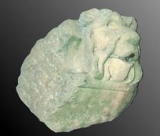
Pieces of ornamental masonry from the oldLondon Bridge
were used to build parts of the seawall. Some were not used and saved by
locals. |
|
|
|
the web |
" |
Remains of a Roman Pier” found in Goldhanger Creek in 1947 |
|
|
|
the web |
“ |
“Prof. S.J.Rippon (1997:
130-3) has suggested Goldhanger Creek as an AngloSaxon trading place on the
Essex coast”. |
|
|
|
__________________________________________________________________________ |
|
|||
|
HER |
Collins Creek |
Early medieval fish traps or weirs, consisting of
thousands of posts, 640-670 AD |
|
|
|
__________________________________________________________________________ |
|
|||
|
HER |
Highams Farm |
A
medieval moat |
|
|
|
__________________________________________________________________________ |
|
|||
|
HER |
Church field |
Cropmarks
of linear features |
|
|
|
Local |
Church field |
Aerial
photos of clear cropmarks were said to be the former Goldhanger Hall. However an excavation in 2011
did not supported this. |
|
|
|
|
|
|
|
|
|
__________________________________________________________________________ |
|
|||
|
Local |
Garden near the Church |
A
Neolithic stone
implement found in a garden that was formerly a farmyard. It could be
either a axe head or a hand tool for skinning animals. |
|
|
|
__________________________________________________________________________ |
|
|||
|
HER |
south of Gardners Farm |
Redhills, salterns and barrows investigated in the
early 1900s |
|
|
|
HER |
“ |
Near the seawall: A first brass of Trajan and a
first brass of Faustina Jnr were among six coins found at Goldhanger and
donated to Colchester Museum (2909.14) by Mr F W Reader in 1914. Pastcape monument no. 383370 |
|
|
|
Local |
“ |
Decoy Ponds “destroyed
by modern reservoir” |
|
|
|
__________________________________________________________________________ |
|
|||
|
Local |
Barrow Marshes |
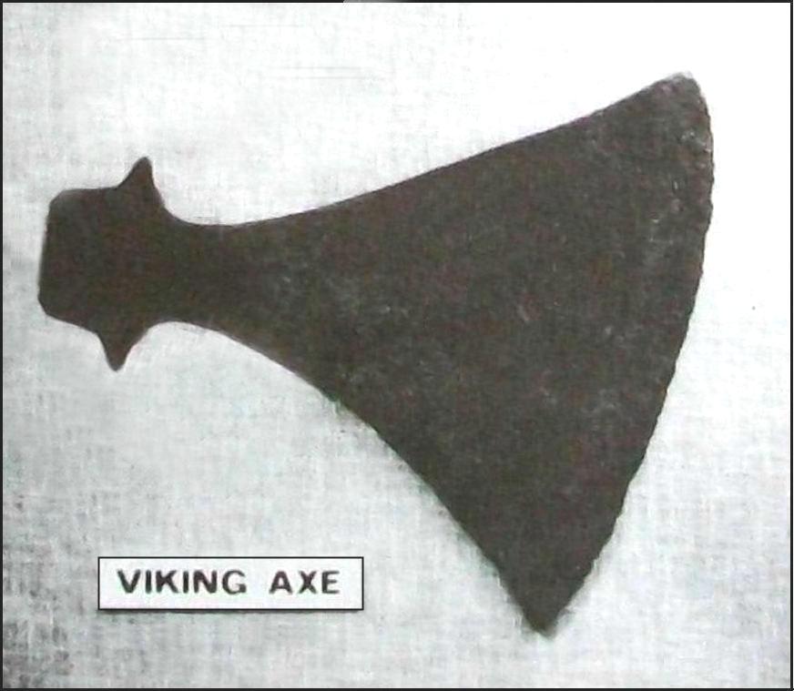
there are very few signs remaining of the Ancient Tumuli at the Barrow Marshes,
however a Viking Axe was found there... |
|
|
|
__________________________________________________________________________ |
|
|||
|
HER |
Osea Island east end |
Polished neolithic
implement |
|
|
|
__________________________________________________________________________ |
|
|||
|
Local |
Osea Island |
There are many metal and concrete remnants of HMS Osea including the remains for the CMB
launch ramps. |
|
|
|
__________________________________________________________________________ |
|
|||
|
HER |
Estuary off Bounds |
Neolithic
worked flints & pottery |
|
|
|
Local |
“ |
Site of two Fish Pits
shown on 1820 Tithe map. Roman coins found in
the Estuary. Dagger and spurs
found in the Estuary. |
|
|
|
Local |
“ |
Blocks
of stone that proliferate in the Estuary and Creek are said to have been
ballast in barges not needed for return journeys. |
|
|
|
__________________________________________________________________________ |
|
|||
|
Local |
Estuary off Bounds |
Two
trackways or causeways from Bounds hatch heading towards Osea Island, clearly
visible at low tide. A track or causeway here may have been part of an
ancient/Roman north-south route from Colchester to Osea Island. See... Local highways and byways and
section 6 - North and south routes from The Square |
|
|
|
__________________________________________________________________________ |
|
|||
|
HER |
south of Cobbs Farm |
Site of Bentall’s 19th
century iron foundry |
|
|
|
__________________________________________________________________________ |
|
|||
|
Local |
field east of village |
Copper ingot hoard
found in the year 2000 |
|
|
|
__________________________________________________________________________ |
|
|||
|
HER |
north of Charity Farm |
Cropmarks of rectilinear feature |
|
|
|
__________________________________________________________________________ |
|
|||
|
HER |
north of Folly Faunts |
Cropmark of rectilinear features and pits |
|
|
|
__________________________________________________________________________ |
|
|||
|
Local |
Estuary, off Lauristons |
Redhills & decoy ponds shown on 1947aerial photo |
|
|
|
Local |
“ |
Site of WW-2 Douglas Boston bomber crash, Nov 1942 |
|
|
|
__________________________________________________________________________ |
|
|||
|
Local |
field in village triangle |
Stone-age knife handle found, whereabouts unknown |
|
|
|
__________________________________________________________________________ |
|
|||
|
HER |
Estuary, off Rolls Farm |
Neolithic
and Bronze Age site and a substantial red hill |
|
|
|
__________________________________________________________________________ |
|
|||
|
See also the Maldon Archaeological and Historical
Group website and the Maldon area study report … Maeldune -
Introduction - Maldon both in External links |
|
|||
|
|
|
|||
__________
