|
Contents |
|
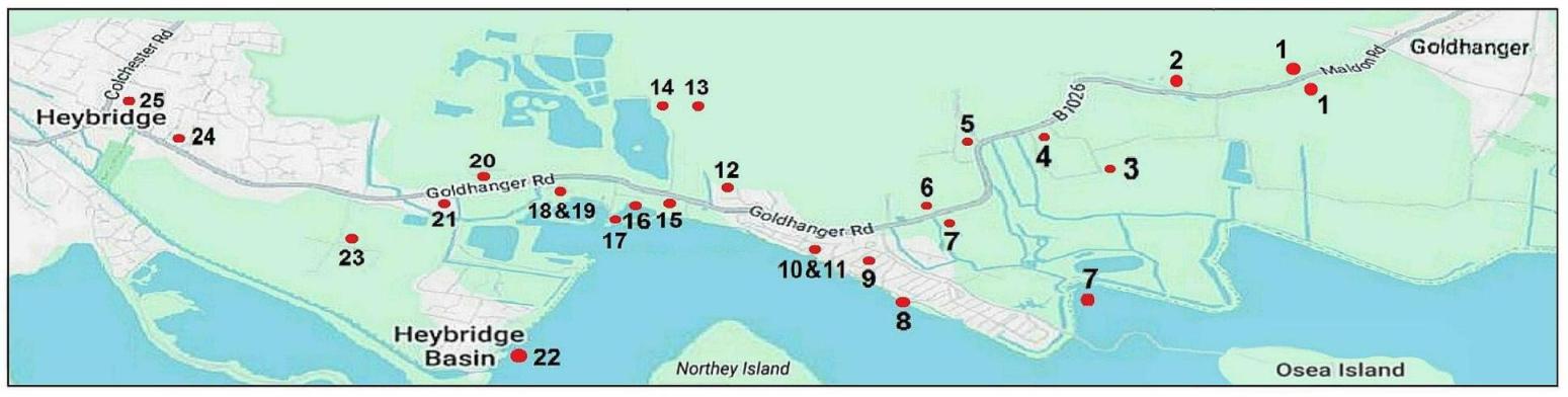
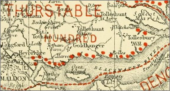
the B1026
road to Heybridge has 25 historic features
with connections to Goldhanger
Saltcote Hall Saltworks Saltcote Maltings Tidemill Tidemill House Millhouse Mill Beach Barrow Marsh Farmhouse
Introduction
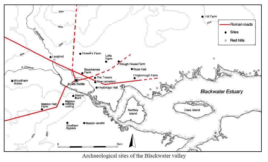
Before the seawall
was completed in the early 1800s this section of the north bank of the
Blackwater Estuary, known as the Barrow
Marshes, was part of a long stretch of salt marsh from Wash Brook,
Goldhanger to Heybridge and there is evidence that the track has Roman origins.
Heybridge
Basin didn’t exist until the canal was constructed in the 1790s. This map
from the Elms Farm archaeological dig report undertaken near the Causway in
Maldon shows known Roman roads in the area, and one of those is the Goldhanger
Road from Heybridge to Goldhanger...
On the 1777 Chapman & Andre map the track
from Goldhanger to Heybridge and Maldon (now the B1026) is shown as dotted
lines crossing the marshes, indicating it was not always passable at high
tides...
Over the centuries this area of land had been
divided in several ways between Gt. and Lt. Totham and Goldhanger parishes to
give the inland villages access to the navigable waters and to the salt, and the Tothams each had their own north-south route to reach this part of the estuary.
Before the Reformation,
this strip of marsh land was owned by Beeleigh Abbey, and during the 18th and
19th centuries most, if not all of it, was owned by the Coe, Coe-Coape and Coape-Arnold families. The main
residence of the Coe and Coe-Coape family was Vaulty
Manor, which is still within Goldhanger parish. Many of their Deeds and
other documents relating to their ownership of the Barrow Marsh features give a
Goldhanger address, which in the past has led to some
complications and confusion and not all of the historical extracts given on
this webpage are consistent with each other.
The name Barrow
Marsh is derived from the presence of various mounds that were investigated
in the past to see what they contained and establish their origin. It was
mainly that early archaeological work resulted in their disappearance.
The word Barrow
has been spelt many ways over the centuries:
Barrowe Hills, Burrowe Hills and Barrowe
Marsh, Burrowe Marsh – in ERO Deeds
Barrow Hills, Borough Hills - in Maldon & the River Blackwater, by E
A Fitch in 1898
Barrow Hills – in the Tithe Awards of 1820
& 1838
Burrow Marsh - Whites directory of 1848
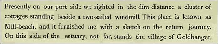
The Windmill at Millbeach
Below is an extract from a paper written by Miller Christy and W H Dalton in 1925, published
in the Transactions of the Essex
Archaeological Society...
A
windmill with the suggestive name " Barrow-hill Mill" stood formerly
close to the water-side, and adjoining the present Mill Beach restaurant, which
is in the narrow tongue of Great Totham. It was probably so called because it
was placed actually on one of the Barrow hills. Mr. G. W. Johnson says (History
of Gt. Totham, p47 1831) that it "was erected about the year 1703"
(very likely in place of an earlier mill destroyed in the Great Storm) and
that, having been destroyed by a hurricane on the 30th June, 1830, it was
rebuilt in the following year.
This last mill
has now, in its turn, completely disappeared. Possibly the mound on which it
stood is that standing on the bank of a large pool of water and on which a
detached dining-hall has recently been built; or this mound may be, in whole or
in part, that of which Mr. Fitch says (Maldon and the Blackwater, p31 1896)
that it was "the result of Mr. Green's spending £200 to have his mill pond
cleared out about fifty years ago." Its base is, we judge, three or four
feet above mean sea level.
|
|
|
|
|
a 1892 sketch
from Essex Highways,
Byways & Waterways by C.R.B.
Barrett |
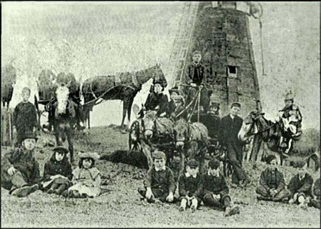
a photo from the
1890s |
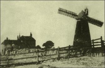
a photo from the
early 1900s |
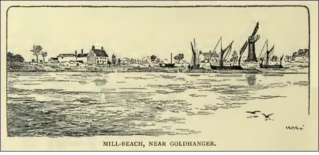
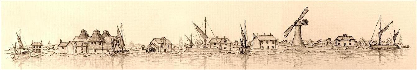
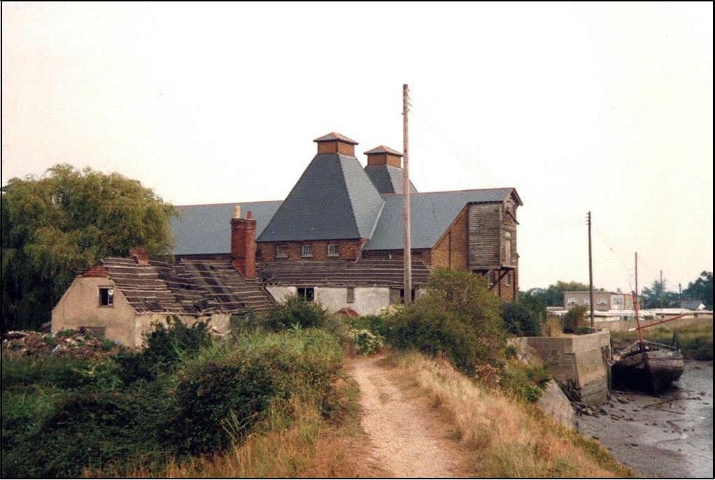
The sketch on the left above made by C.R.B.
Barrett in 1892 would appear to show the saltworks on the left side, the
tide-mill house and windmill on the right side. The sketch seems to have been
made before the Maltings and Mill Beach Hotel were built. In Barrett’s book the
only words relevant to the sketch are these...
The Mill Beach Hotel and public House
The very early photograph on the right above
shows two buildings in the background. The closest appears to be where the Mill
Beach public house was located until around the year 2000 and was most likely
the mill house for the windmill originally. The further building is most
probably the mill house for the tidemill, which still located at the eastern
end of the tidemill pond. This can be confirmed by a close inspection of the
1873 map and the recent aerial view shown below. The Christy and Dalton extract
above indicates that the “Mill Beach restaurant/dining-hall” was created around
1925.
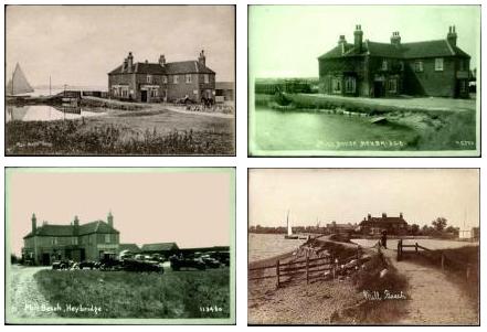
Many postcards were produced over a twenty
year period that indicate in it’s day the Mill Beach Hotel was a high-class
establishment that attracted affluent clientele with the means of transport to
get there. Here are four typical postcards from that period...
(select
image to enlarge and zoom in)
and view a video of
30 postcard scenes...
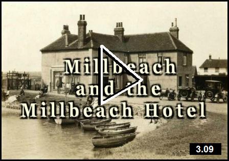
The Mill Beach pub was
finally demolished around 2018.
The Tidemill
There are several early references to a tide
mill or watermill located at Goldhanger...
In Goldhanger - an Estuary Village Maura Benham wrote:
"The Jarpenville family settled at
Little Totham in the 12th century . . . part of the estate was handed over to
Philip and Matilda in 1271 during the lifetime of Matilda's father, Roger de
Jarpenville, and included was a water-mill at Goldhanger
with suits and all other things appertaining to that mill".
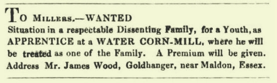
The Evangelical
Magazine and Missionary Chronicle of 1842 had an advertisement for an
apprentice...
It seems very unlikely that any of the
streams close to the village could have supported a watermill and there is no
evidence that there was ever a tide mill across Goldhanger Creek (although that
would have been a possiblilty). However we now know that a tide mill was
located at the end of Wharf Rd. on the Goldhanger Rd. close to Heybridge and
this area was once part of Goldhanger Parish.
Beryl Claydon’s book: Heybridge in the Nineteenth and
Twentieth Centuries is a valuable source of information about the
tidemill, Saltcote Mill and the area generally. Here are three extracts from
pages 184-188:
“The tide mill, located in the section
of the river known as Mill Reach, is recorded in documents as far back as 1819.
As the tide rose, water was allowed to flow into three enclosed ponds. When the
tide began to drop, sluices would divert the flow past the mill building and
drove a large water wheel. The mill was converted to steam, but then demolished
in 1892”.
"There were three pounds into which
water flowed on rising tides. Sluices diverted water as the tide went out to
drive the water wheel".
“Sluice gates were wound up and down by
turning a handle. As the gates were raised, a frame of enclosed mesh that captured
eels and flounders was placed in front of the sluice gate. The eels were placed
in a bucket with eel shears and covered with sacking to prevent their escape”.
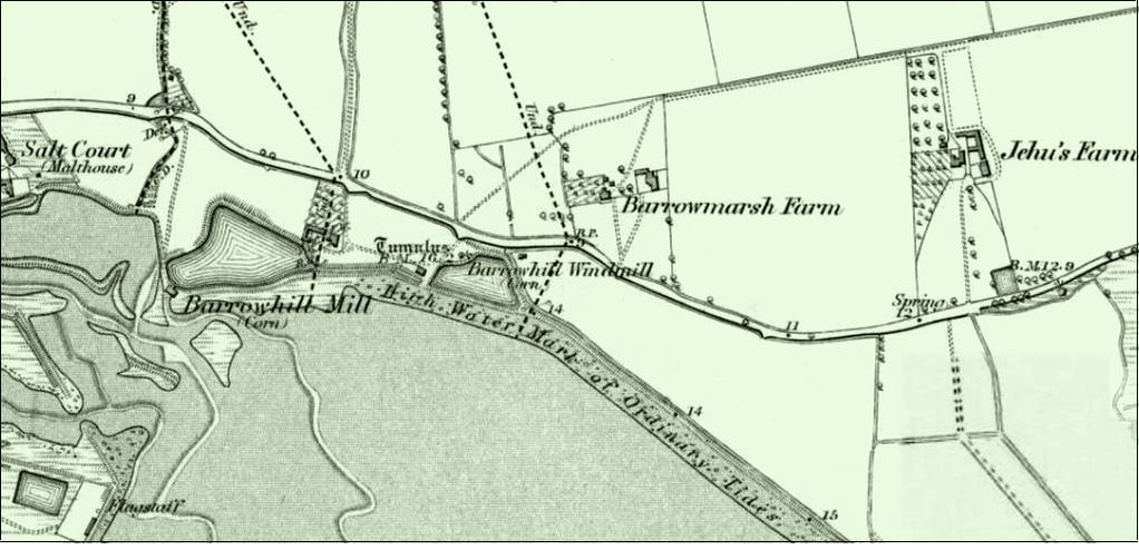
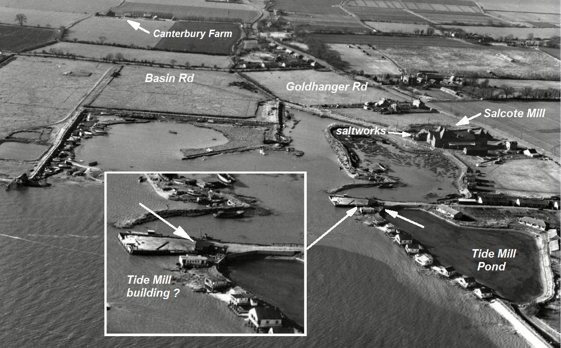
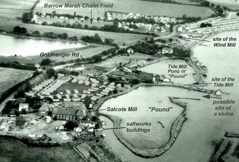
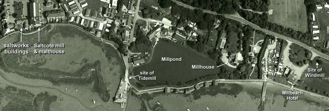
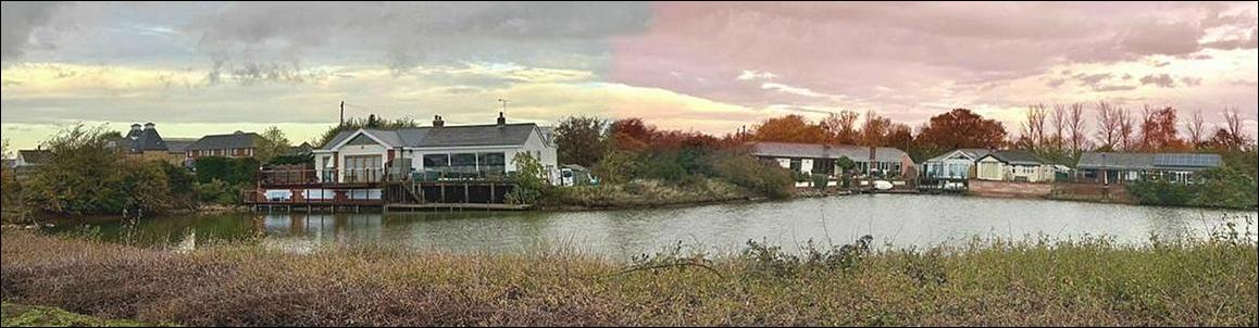
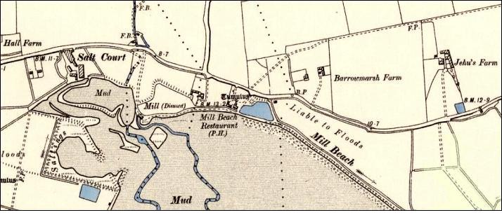
The 1873 map below identifies both the Barrow
Hill windmill and the Barrow Hill tidemill/watermill. Unfortunately no close-up
photograph or sketch of the tidemill has been found, but it was very likely to
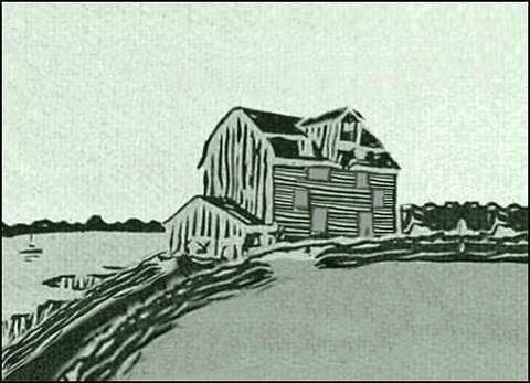
have been a simple wooden weather boarded structure and similar to others in
the region, particularly the tidemill at Thorrington near Brightlingsea...
|
|
|
||||
|
1873 map |
how
the tidemill may have looked |
|
|||
|
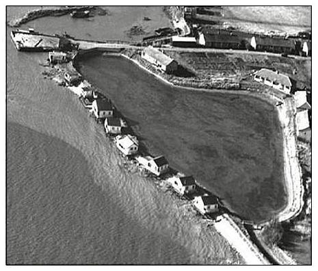
an aerial photo
from the 1940s does appear to show the Tide Mill but
a 1950s aerial photo indicates that it had been demolished by then.. |
|
||||
|
1940s
aerial photo |
1950s aerial
photo |
|
|||
|
|
|
||||
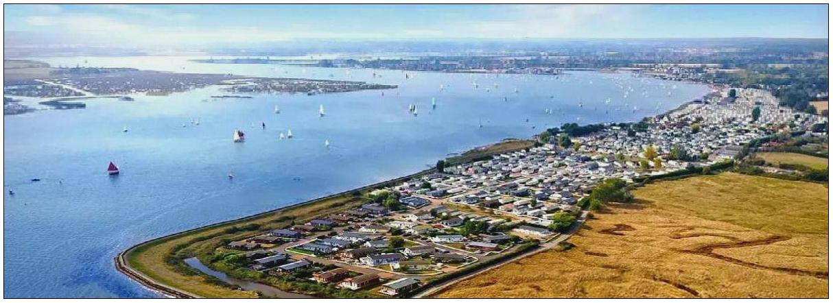
|
aerial view of
the location today |
|
||||
Deeds dated 1845-1851
(ERO D/DU 627/4 - with extracts at the end of
this page)
identifies both of the mills owned by the Coape family of Vaulty Manor,
Goldhanger: “...windmill
and watermill called Barrow or Burrow Hill Mills” and includes
amazingly an inventory of the water mill contents.
The following extract
from the 1907 Essex Review, refers to
a corn-riot at “Burrow-hills” in 1629...
here is an extract from a Maldon Nub
News article in March 2022, by Nick Spenceley
at... https://maldon.nub.news/n/historic-maldon-district-the-formidable-women-of-maldon
‘Captain’ Ann
Carter was hanged in 1629 for her part in the Maldon grain riots of that year.
An economic depression had hit the Essex cloth trade, leading to widespread
hardship and discontent. The decline in cloth exports meant that food which
might have been purchased locally was exported at higher prices, and the loss
of employment in the cloth trade reduced people’s purchasing power at the same
time. Two major riots occurred in or near Maldon in 1629, both involving Ann
Carter, the wife of a butcher, born and married in the town.
In the first riot,
100 women and children stormed a Flemish ship at “Burrow Hills” (probably Barrow Hill in Goldhanger) and
filled their caps with grain. The authorities did not aggressively pursue the culprits,
only targeting a handful already known for their outspoken behaviour. One of
these was Ann. In an age where women were seen as not being capable of
independent thought and actions, the law often left them alone, but Ann Carter
had already made herself stand out. She had crossed swords with a magistrate in
1622, calling him a “bloud sucker”. She had also in 1624 defended her husband
with a cudgel against an attempted arrest.
But it’s the second
riot in 1629 where Ann really came into her own. Between 200 and 300 men and
women boarded a ship loaded with grain at Mill Beach,
taking some of the cargo and distributing it to local hungry families. Ann
coordinated it, calling herself ‘Captain’ in letters to neighbouring
communities and using one John Gardner, a baker, as her secretary. The crew of
the ship was assaulted according to one source, though another says they were
sympathetic and actively co-operated.
Co-ordinated action
on this scale could not be ignored by the authorities, and a special commission
was set up to catch and prosecute the offenders.Only eight people were tried,
as courts preferred to make an example of a few rather than carry out mass
punishments. Of these, five were hanged, including Ann Carter. She was the only
woman so punished, and the story goes that she refused to hide behind her sex
and made it clear that she was an active participant - the ‘Captain’ - rather
than a misled follower.

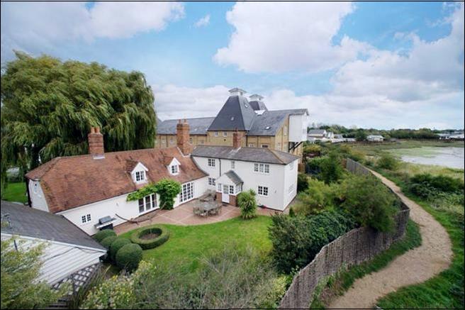
Although no photos or drawing of the tidemill
itself have been found, there are photographs available of the tidemill house
which is still at the side of the mill pond and old postcards of that are
available.
These pictures show:
The tidemill house in the 1930s and 40s then
operating as a guest house; the tidemill house beside the millpond and close to
the estuary; two views from the beach in the 1920s; and as it appears in recent
years now surrounded by trees and hardly visible from public paths.
(select
image to enlarge and zoom in)
HMS Osea huts around the Tidemill pond
At the end of the Great War a significant
number of huts from HMS Osea were moved from
Osea Island to the Millbeach area. Four were placed around the north side of
the Tidemill pond and three were placed just a short distance away along Wharf
Road, and they are all still there...
The aerial photo from the 1940s below shows
the huts around the pond and the three along Wharf Road...
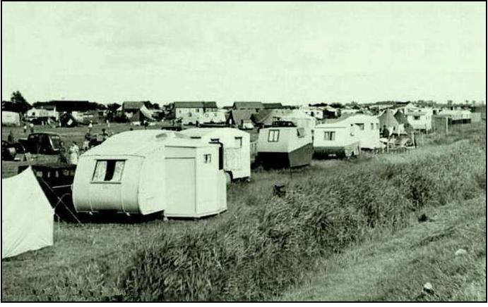
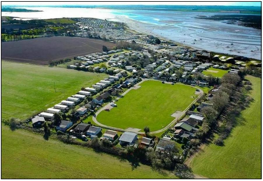
The Caravan and Holiday Parks
Today the most significant feature of the
road journey from Goldhanger to Heybridge is the predominance of static holiday
caravans both sides of the road. There are four separate parks and businesses: Osea Road, Mill Beach and Happy Days
on the south of the road and adjacent to the seawall, and Barrow Marsh to the north of the road.
an ariel view the caravan parks today
In fact all of these sites have existed for
around 100 years, but they have evolved considerably during that time and are
still evolving. Their origins were most likely to have been associated with a
past growing trade at the Mill Beach pub, together with
increasing ownership of private cars and a realisation that the location
provided excellent south and west facing views across the Blackwater Estuary;
plus dingy sailing in the calm waters and swimming in the salty
seawater from sandy beaches, from where in reality it is a man-made beach
created over a salt-marsh when the seawall was built. All this from what is
increasingly recognised as a local micro-climate.
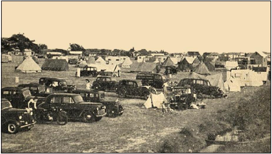
Early postcard views, photos and
reminiscences of former holiday makers indicate that in the early days these
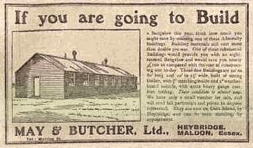
sites weren’t occupied just by caravans, there were many tents (most supplied by May & Butcher, Ltd, of Heybridge Basin), simple wooden
chalets, old buses, old railway carriages and
even a retired trolley bus located there...
This mix of accommodation types was steadily
replaces with the more standard types of mobile caravans that were towed to the
sites by holiday makers with their own cars, but were increasingly left on site
for long periods...
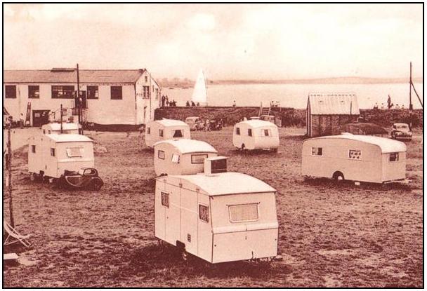
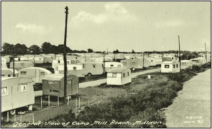
In contrast it is
obvious that most of the accommodation today is provided by large “mobile
homes” that remain on site but are static. However, the exception to this is
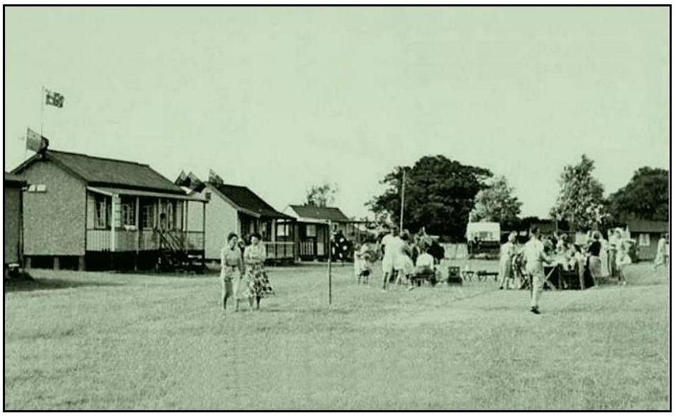
the collection of early chalets on the Barrow Marsh Field.
From the reminiscences of former Millbeach
holiday makers and property owners on the sites it appears that there is a
large degree of similarity between the early days of the Mill Beach sites and
the development of Plotlands that
emerged in many other coastal regions around the UK just after WW-1. This well
documented movement was based on city dwellers using the railways to reach the
coast for low cost holidays at a time when farmers and landowners were selling
or renting land at low prices during the recession of the 1920s (the nearest station to Millbeach was about a mile away).
These huts and chalets gave low cost holiday accommodation
for three generations of a family at one time, and over a much longer timescale
provided accommodation for many more generations of the same family.
The extent and volume of documentation
associated with plotlands is in part due to the significant social history
aspects of these developments. Here are some of the many references to the
history of Plotlands and particularly to the Essex Plotlands...
https://en.wikipedia.org/wiki/Dunton_Plotlands
http://www.essexrecordofficeblog.co.uk/tag/The
passing of plotlands/
https://www.basildonheritage.org.uk/.../The Plotland Era.pdf
https://orca.cardiff.ac.uk/.../Lost Plotlands.pdf
https://www.essexwt.org.uk/nature-reserves/langdon/haven
https://hutters.uk/2015/05/24/the-haven-and-dunton-plotlands/
https://www.spatialagency.net/database/the.plotlanders
http://www.roselake.co.uk/index.htm
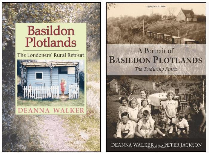
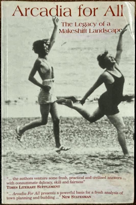
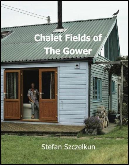
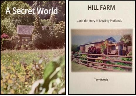
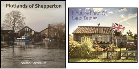
some examples of books describing plotlands

and here is a YouTube
video made by the BBC and Jonathan Meades in 1990
about the Bewdley Farm plotlands and
plotlands generally
many of the comments could well be
equally applicable to the Millbeach area
the video is 30mins long - Bewdley
Farm starts 5mins in
|
a national map with 270 sites |
a
local map |
a map from “Arcardia for All” |
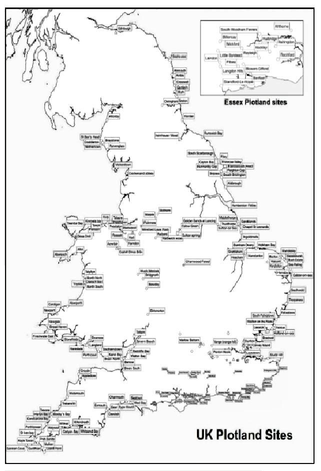
The exact number of sites originally in Essex
is not known as difference sources have different maps and lists. For example
we know that Frederick Ramuz, a property developer and mayor of Southend in the
early 1900s, and his son George, bought up many acres of heavy unproductive
“3-horse” farm land in Essex, then via “The Land Company” sold or rented out
thousands of plotlands. Some of that land was also around the Blackwater
Estuary which was vulnerable to flooding, and included sites at Maldon and
Heybridge.
One of those sites was at the end of Hall
Road, Heybridge, the site was sadly cleared and replaced with new housing as
recently as the year 2000. The remaining chalets were demolished, this was one
of them...
However, some of the
original plotlands still remain around the UK and have been protected...
Conservation Areas:
Dungeness in Kent
Hubsterston
“Fitties” near Cleethorpes (Fitties is an acient word for saltmarsh)
Peacehaven
and Telscombe on the Sussex coast
Holtsfield on the Gower Peninsula
Bewdley in Worcestershire and The Hill Farm Trust
Protected areas:
Dunton near Basildon is protected by Essex Wildlife
Trust
Landon
Ridge/Hills and “The Havens” near
Basildon which is an SSI designated area
Thundersley
Oaks Nature Conservation Area, a small
area of plotland owned by the Essex Wildlife Trust
Ferry
Rd, Southwold within an Area of Outstanding Natural Beauty (AONB)
Owensfield,
Hareslade
and Sandy Lane on the Gower within an Area of Outstanding
Natural Beauty
There may well be other similarly special
sites that have not been identified. However, during WW-2 many of the South
Coast plotland sites were commandeered and cleared by the army in response to
the threat of invasion from across the Channel, and some plotlands on the Essex
and Suffolk coast in low lying areas close to the coast were severely affected
by 1953 floods and have not survived.
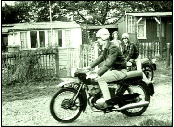
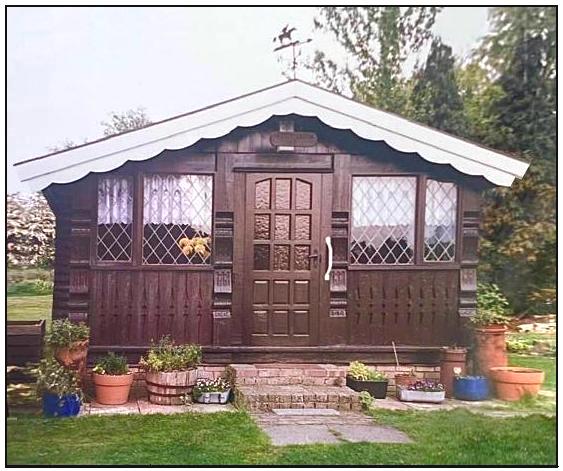
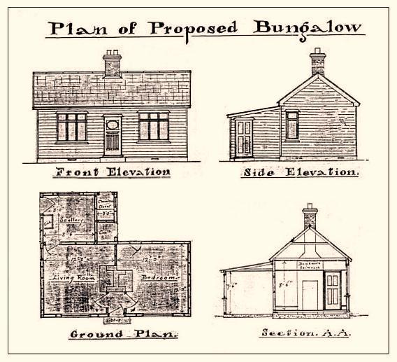
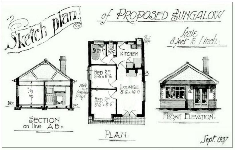
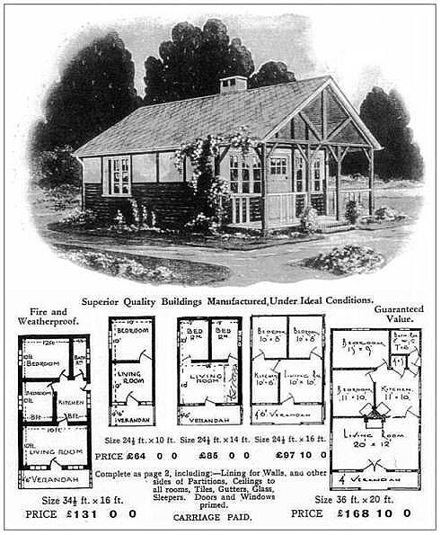
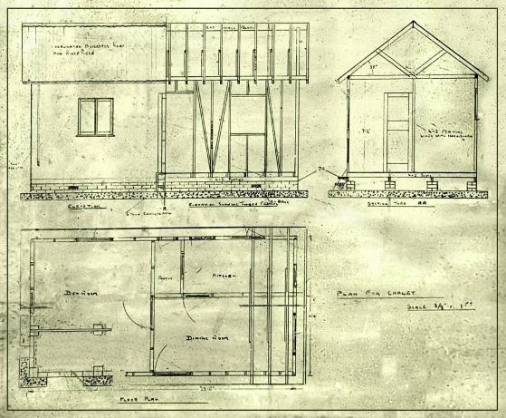
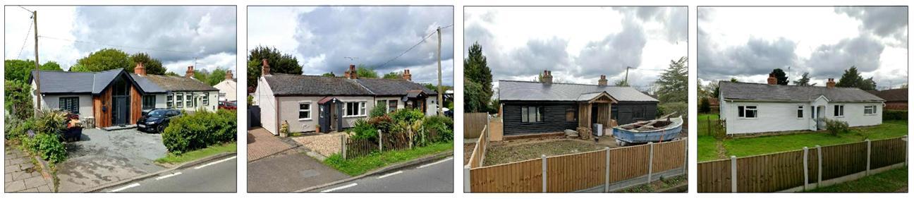
Many of the Chalets on these Plotland sites
and some at Millbeach sites were “self-builds”, often based on standard plans
and kits of parts that were available to purchase at the time and it is known
that many early visitors to the Millbeach sites stayed in tents while they were
building their own chalets.
Here are samples of the drawings that were
then available that have a remarkable similarity to some of the Millbeach
Chalets that appear in the old photos and some that are still in the Barrow
Marsh Field...
|
|
|
|
|
|
|
Barrow Marsh Farm
Part of Barrow Marsh Farm is still within
Goldhanger Parish. The farmhouse was destroyed during WW-2, and today most of
the land is used a caravan site for holiday makers, due to its proximity to the
south facing bank of the Blackwater Estuary. In several Deeds in
the Essex Records Office (ERO) the farm is called “Vans, Vanns and Vaus
farm”. This map from 1895 shows Barrowmarsh
farmhouse and the broad dotted lines of the parish boundaries between
Goldhanger, Lt. Totham and Gt. Totham...
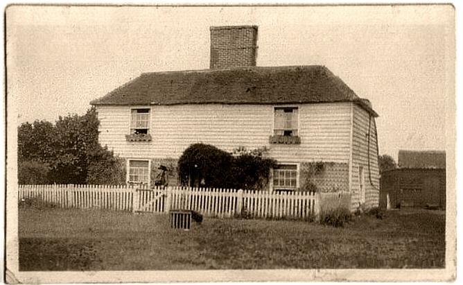
a postcard view of Barrow
Marsh Farm
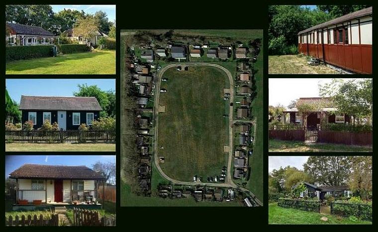
In
the late 1930s the “chalet field” was developed by the Barrow Marsh farm
landowner who allowed early visitors to stay in tents while they built their own
chalets. Today the chalet field is an historic and attractive, but hidden,
feature of “Barrow Marsh Caravan and Chalet Park” with 36 privately owned
chalets arranged around a grass quadrangle...
|
|
|
here is an extract from page 280 of Beryl Claydon's book Heybridge in the Nineteenth and Twentieth
Centuries...
In
the late 1930s the Chalet Field became available to campers with their bell
tents on the field north of Goldhanger Road. The visitors stayed in their tents
while they built chalets on the chalet field. one tenant placed three railway
carriages close to the entrance to chalet field and used it as a holiday base.
In
1940, when the war was going badly, all use and development was stopped at
Barrow Marsh and Mill Beach. Peter Wakelin was cycling home from Maldon Grammar
School in July 1944 when an ARP warden stopped him and told him that a doodle
bug had destroyed Barrow Marsh Farm House and stack but that his parents were
fine. John Wakelin, his wife and two sons moved into one of the railway
carriages in chalet field for six months until a small bungalow near the road,
known as Magrath, became empty.
After
1945 more Londoners asked to build their own chalets on Barrow Marsh, others
brought caravans for the other non-arable fields. In the early 1950s, Mr. and
Mrs. Wakelin ran a shop selling mainly local fruit and vegetables and free
range eggs. Their customers came from Mill Beach as well as Barrow Marsh and
there were long queues in the summer months. Peter Wakelin remembers that
Arthur and Hilda Butcher ran a café opposite the caravan site on the other side
of the road selling teas, soft drinks and ice creams with a shell fish stall
nearby where the windmill used to be.
The
site and caravans suffered badly during the 1953
floods. A breach in the sea wall led to the front field and the low field being
under water. Mr. Wakelin toured the site in a boat viewing the caravans
floating in the water. Fortunately, everything was in order for the summer.
and
here are some extracts from... MAELDUNE - The Battle Site, by The Maldon Archaeological
Group
The
one thing we do know about the site of the historic Battle of Maldon is that we
are unlikely to discover it using straightforward archaeological excavation
techniques...That a battle took place is a matter of historical fact, recorded
in various contemporary works ... Many scholars and antiquarians have pondered
the whereabouts of the site in recent history, notably Dr E D Laborde (1925), E
A Fitch (1894) and P Morant (1768)...
....The
battle seems to have taken place alongside the river, at a crossing place
accessible only at low tide...But where on the river were the Vikings?...
...In
'The History and Antiquities of The County of Essex' Morant noted that in 1768
there were in Totham parish, by the shore, many tumuli or mounds of earth,
called Borough Hills, which seemed to be the graves of Danes or Saxons slain in
assaulting and defending the area ...
...
Similarly in 'Maldon and the River Blackwater' (1898), Fitch noted that some of
these tumuli were in Heybridge parish but the most noticeable were in that part
of Great Totham "that runs down to Blackwater Bay" ... Both authors
refer to the shore-line at Mill Beach...
...Recent
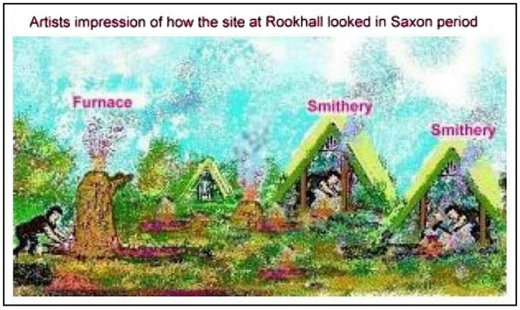
archaeological work at Chigborough Farm, Slough House Farm and Rook Hall have
uncovered evidence of an extensive Saxon metal working or smelting industry.
This would have provided a good dry encampment and site for foot soldiers to
fight on....
possible battle site
and a Viking axe was found at the same site.
The fields immediately adjacent to the Chalet
Fields have also been the subject of Roman excavations.
See... Chigborough Farm
below
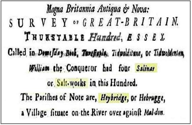
The Saltworks and Saltcote Mill/Maltings
The saltworks has very ancient origins and
has been described as both the Heybridge saltworks and Maldon saltworks, and
has also been recorded with a Goldhanger address. The orgins of saltworks at
Heybridge and Goldhanger go back to the Bronze age and the formation of
Redhills. “Salthouses” at Heybridge and Goldhanger were listed in the Domesday
Book, along with eighteen other locations around the Blackwater Estuary...
There is much more about the local saltworks
at...
Salt
Extraction on the north bank of the Blackwater
In the early 1800s when the saltworks moved
to the river bank in Maldon a new mill and maltings building was build at the
site adjacent to the old saltworks building, although this is not consistent
with the 1892 sketch show in Windmill section above.
The demise of the salt extraction at this location could well have been in part
the result of a new seawall was built along Barrow Marsh and around the
saltworks in 1807 (see letter below).
Around 1840, the former salt store was
converted into the distinctive red-brick maltings with large kiln flues and
ventilation towers by Hayward Rush and later developed by George and Frederick
May. The mill was ideally located for the delivery of barley and the shipping
of malt, most of which went to Watney’s Brewery. The materials were moved in
and out on their ‘Saltcote Belle’ barge, built in Maldon in 1895 which was
ideally suited to navigate the shallow creek up to the Saltcote Wharf, where an
overhead hoist was used for loading and unloading. This 1873 map shows the
“Salt Court (Malthouse)” located close to the tidemill and adjacent to the
seawall...

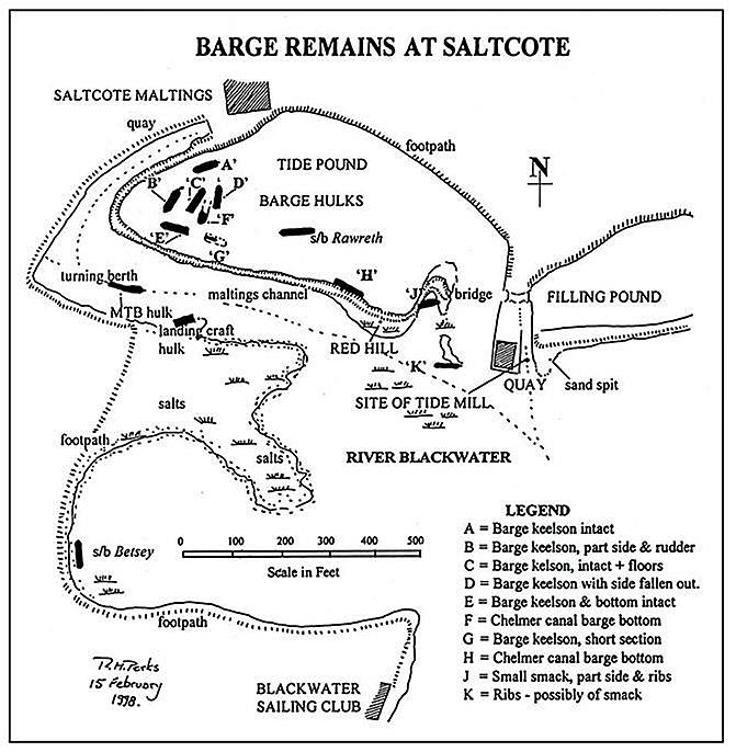
This 1990s map shows the location of various
wrecked barges in the vicinity of the Saltworks and Malthouse...
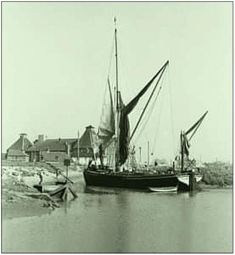
The early photo on the left below, shows a
barge manoeuvering along the narrow channel to reach the mill’s quay, or
“Saltcote Wharf” as it was know. The photo on the middle taken in the 1970s,
shows the two saltworks buildings in the foreground in a state of dereliction
with the malthouse in the background. The photo on the right, taken in 2016,
shows the two saltworks buildings in the foreground, having restored and
converted to private residences, with the malthouse in the background, which
was converted into residential flats and holiday accommodations in the 1980s...
|
|
|
|
|
|

There was previously
a manger’s house Maltings building site which was positioned close to the
Goldhanger Rd., it was demolished as part of the rebuilding work in the 1980s.
The May family also built Saltcote Hall opposite Basin Road which remains
today...

Manger’s
house
Saltcote Hall.....
G&F May - Mineral Water Manufactures
|
|
|
|
|
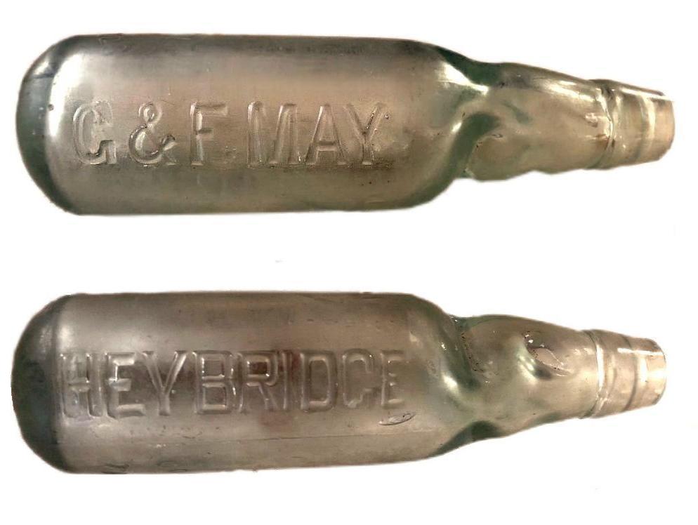
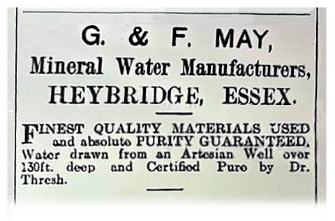

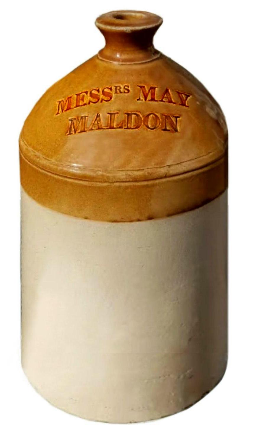
George
and Frederick May produced bottled sparkling and still mineral water in glass
“Codds” and stoneware jars from their premises at the Saltcote Maltings. They
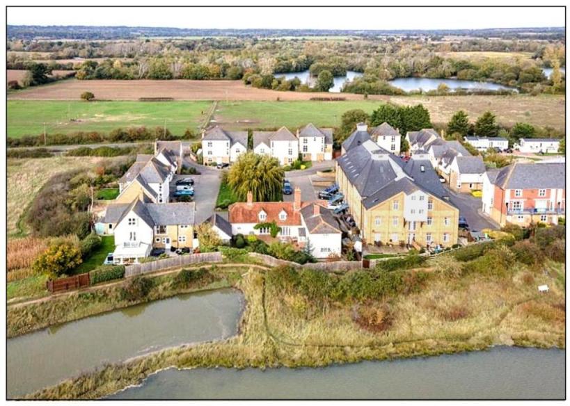
also made Ginger Beer. It is said that the water came from a deep well at
Chigborough Farm opposite the Maltings. The Chigborough lake nearest the
Maltings is still called “May Water” where presumably today there is a natural
spring within it. This recent photo shows “May Water” close to the Maltings...
Chigborough Farm
Surprisingly,
three references to Chigborough Farm with a Goldhanger address have been found,
although the two in ERO as also associated with Great and
Little Totham. However, a newspaper advert of 1855 for properties of the Coape
family refers only to it being at Goldhanger. This may a reflection of its
ancient connections with Beeleigh Abbey, or simply that the Coape family had a
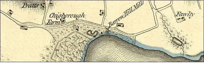
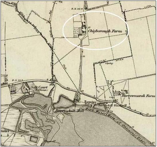
preference for a Goldhanger address. Here is an 1850s map showing Chigborough
Farm...
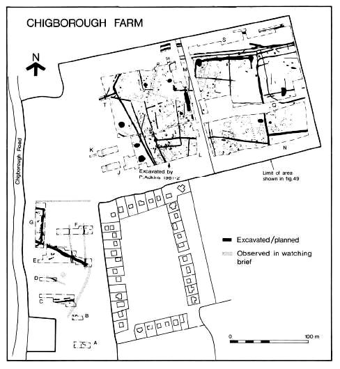
Chigborough Farm has
been the subject of several archaeological excavations over the year due to its
Roman associations and finds from that period. This is a 260 page online report
of one of those excavations...
https://eaareports.org.uk/assets/uploads/repository/EAA_Report_82.pdf
The report contains
this excavation map which shows the Barrow Marsh Chalet Field adjacent to the
dig areas...
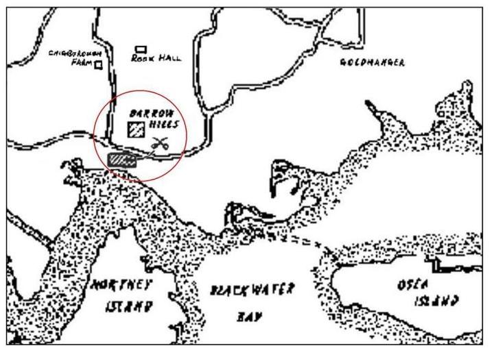
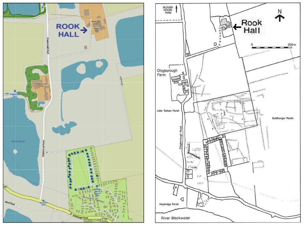
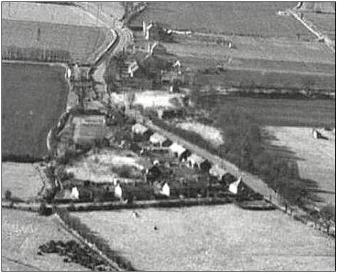
Rook Hall Farm
Rook Hall has never been in Goldhanger
Parish, unlike the adjacent Barrow Marsh and Chigborough Farms, rather it has
always been the second Manor
in Little Totham. Just one document in ERO from 1760
refers to Rook Hall at Goldhanger, but most in ERO give its location as Lt.
Totham. However, the proximity of its lands and the important archaeology digs
and finds from there easily justify its inclusion here. A recent map and one
from archaeological digs shows the relationship between the sites...
|
|
the Hall today |
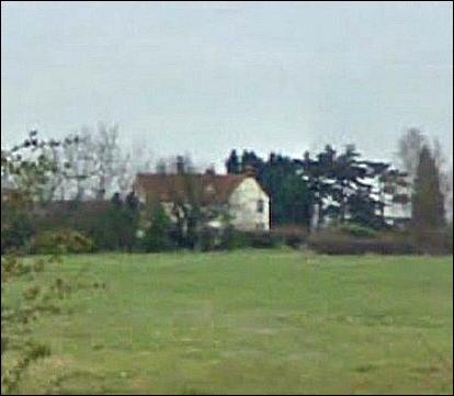
Today
the Hall itself is remote and hardly visible from the road, but it was once on
a significant track from Goldhanger to Maldon, a route that was well used for
centuries before the seawalls were completed and when the salt marshes were
covered. See.. Local highways and
byways from the past (route-1)
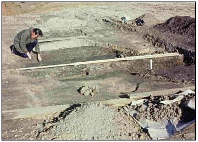
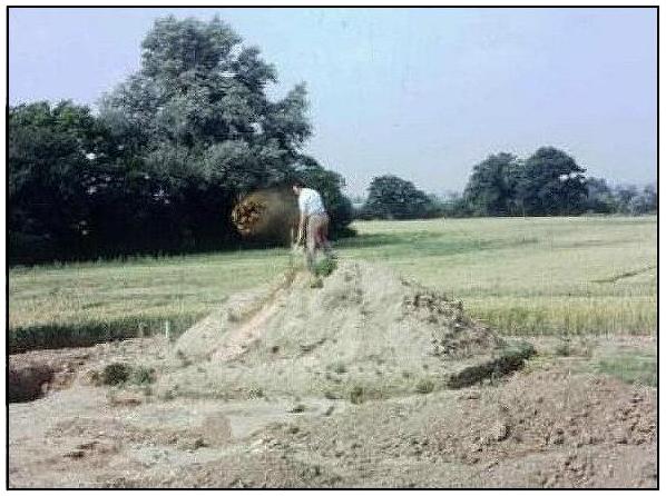
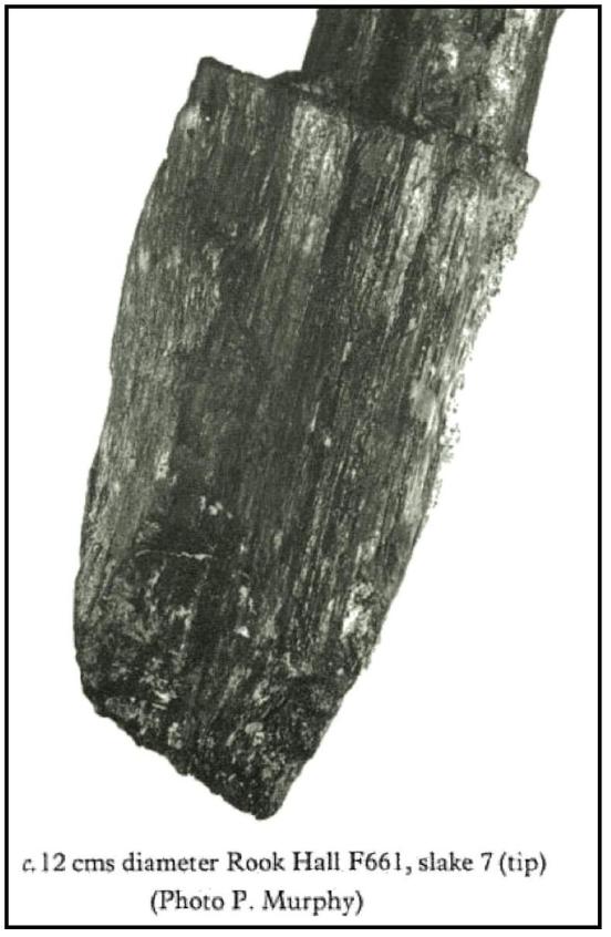
Much
of the work carried out at Rook Hall was undertaken by local amateur
archaeologist Pat Adkin. Here are some of the images from his reports...
|
|
|
|
|
|
|
|
|
|
|
|
and a large number of reports were written
about the Rook Hall archaeological digs, a summary of them is at...
Rook Hall excavation report extracts
HMS Osea huts near Basin Rd
The aerial photo from the 1940s shows eight
huts that were brought from HMS Osea at the
end of the Great War and positioned around the junction of Goldhanger Rd and
Basin Rd. We also have a poor quality copy of a May & Butcher advert for
the huts from 1923...
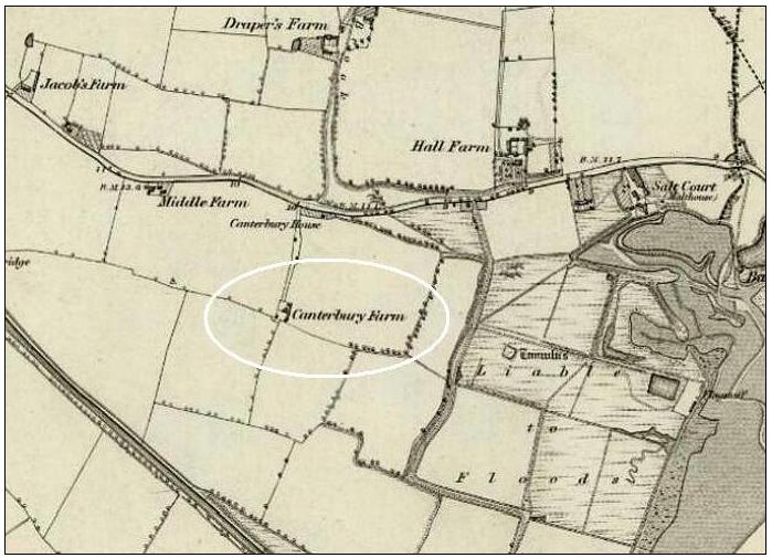
Canterbury Farm
Letters
& Papers of Henry VIII, dated 1553, refers to lands called “Caunterberyes in
Goldaunger”...
Also ERO D/DVz/359 (shown
further down this page) dated 1569 refers to “Canterberies at Goldhanger”.
These documents would suggest that the farm which is near Jacobs Farm on the
Goldhanger Road and close to Heybridge, was once within Goldhanger parish. It
is now called Canterbury Farm. The name appears to originate from an owner or
farmer called Thomas Caunterbury in the 1381, rather than any connection with
Kent or an archbishop.
Here is an extract from page-390 of Philip
Morant’s classic: History and Antiquities
of the County of Essex dated 1758 which has a reference to Canterberyes....

and
here is an extract from an 1850s map showing Canterbury House (circled in red)
and Canterbury Farm (circled in white) which is the most westerly location
identified with a Goldhanger address...
The Ancient Tumuli
A great deal has been written about the
mounds, burrows or tumuli around the Barrow Marsh area. Up to 25 were recorded
and investigated in the past to establish what they contained and to determine
their origin, and this early archaeological work was largely responsible for
their disappearance. Many early antiquarians believed they were burial mounds
resulting from the Battle of Maldon. However the two more recent reports cited
below dismiss that theory. There were Tumuli at the site of Saltcote Mill which
were investigated when the maltings was built in the 1800s and then destroyed
during the construction work.
an extract from...
The
Maldon Archaeological and Historical Group - MAELDUNE - The Battle Site, by Barbara Smith:
In
'The History and Antiquities of The County of Essex' Morant noted that in 1768
there were in Totham parish, by the shore, many tumuli or mounds of earth,
called Borough Hills, which seemed to be the graves of Danes or Saxons slain in
assaulting and defending the area. Similarly in 'Maldon and the River
Blackwater' (1898), Fitch noted that some of these tumuli were in Heybridge
parish but the most noticeable were in that part of Great Totham "that
runs down to Blackwater Bay".
Both
authors refer to the shore-line at Mill Beach. A mound was opened in 1773, but
no antiquities were found. Possibly the mounds were soil heaps resulting from
the digging of the mill pond for Heybridge Tide Mill built during the 18th
century.
E.A.
Fitch, Mayor of Maldon in the late 1800s, historian, antiquarian, author
and president of the Essex Field Club is quoted in their 1881 Transactions...
Mr.
Fitch mentioned the Barrow Hills, between Heybridge and Goldhanger. It was
there that the great battle of Maldon was fought, the bloodiest battle before
the Conquest. Some thirty or forty years ago a number of bones were found
there.
Mr Fitch describes these Tumuli in his 1890s
book Maldon and the River Blackwater.
His description is included on page 2-page of this
3-page extract.
Here is an extract from a paper written by Christy Miller and WH Dalton in 1925 and published
in the Transactions of the Essex
Archaeological Society...
Two
Large Groups of Marsh Mounds on the Essex Coast
IV - Description and known history of
the group near Maldon
This
group, which was entirely destroyed long since, was known as the ‘Barrow’, or
‘Borough’ hills. It is not now possible to give any but a vague description of
this group as it existed originally, owing to its complete disappearance.
Fortunately, however, the group attracted the notice of several of our early
local historians, and their remarks, though very meagre, give us some idea of
what it was like. We have, however, the testimony of antiquaries as to what
they sa w-in one case, over a century and a half ago, when some of the hills
were in course of demolition.
How
many hills there may have been originally, it is now impossible to say; but
most of the early Essex historians speak of "many”, and one speaks of
"near fifty". Frequent reference is made to the lands, pastures, and
marshes "known as Barrow-hills and Barrowmarsh," in Goldhanger, Great
Totham, and Little Totham. It remains to consider the various theories which
have been put forward to account for these curious groups of mounds and to draw
conclusions...
(a)
The
Burial-Mound Theory - Mr. G W Johnson adopts the view. He says of the hills
that "They undoubtedly mark the burying places of the Saxons and Danes”
who fell in some one of the numerous conflicts which took place in this
neighbourhood between those nations. I am "inclined to consider it to have
been that in which Brythnoth, Ealdorman of Northumberland and Governor of
Essex, fell in 991".
However
tempting the theory that these mounds are sepulchral memorials, one cannot get
away from the awkward fact that, of all those which have been opened, not a
single one has been found to contain anything even suggesting an interment
therein. Equally awkward is the fact that none of the mounds occupy the kind of
situation in which burial-mounds are generally placed-namely, on high ground;
but they all occupy, on the contrary, ground so low that it is below high-tide
level and, before the construction of the seawalls, must have been constantly
under water. One cannot imagine either sepulchral or memorial mounds being
erected in such a situation.
(b)
The Cattle-Refuge Theory - If they were cattle- shelters, they would not be
found closely grouped together in considerable numbers at two spots only and no
other such anywhere on our marshes.
(c)
The Red-Hill Theory - Red-hills occur almost invariably close to the inner edge
of the marshes, where the dry land begins to r ise. These other mounds occur,
not near the rising ground, but right out on the level marshes and close to the
salt water. Red- bills consist throughout of a fine burnt clay, having a
curious dull-red tinge which is quite unmistakable by those familiar with it.
Nevertheless, it seems possible that the mounds in question may be built upon
older red hills.
(d)
The Beacon-Mound Theory - This is a highly-improbable hypothesis, the position
of the mounds and th eir c lose grouping being both against it.
(e)
The Land-Mark or Sea-Mark Theory - It is hard to imagine that many could be
required together or what particular service any could be in such low positions
as those occupied by the groups in question.
(j)
The Gun-Placement Theory - thrown up at the time of the Dutch invasion of 1667.
It has been shown that some of the mounds existed before 1667.
It
seems then, that the various hypotheses which have been put forward all fail
completely.
What
is the approximate age of these mounds?
- We know that the Barrow Hills group was in existence at least as early
as 1574. There is no evidence that they are of great antiquity; for nothing
which can be regarded as prehistoric, or even as Roman or Saxon, has been found
in them.
Next,
what was the probable origin and use of the mounds? - It is admirably summed up in Mr. Francis
Reader's report to the Morant Club... There is little doubt that the 'tanks'
were the main object of the construction of the works; and that they may be
regarded as dumps of refuse, the surplus of what was not required for forming
banks around 'sun pools'.
If
the tanks were the principal feature of these works, what were they used for? -
Two kinds of tanks have been used commonly on the Essex marshes, of w ich we
still have existing examples - one for the preservation of fish, the other to
hold seawater to be evaporated by the sun, the brine thus produced being
subjected to further heating by fire, thus producing salt crystals.
We
cannot regard the mounds as "contingencies" or as "dumps of
refuse" merely. It seems to us that the piling of waste material into
mounds 15 or 20 feet high is far from being the most convenient way of
disposing of it, especially where there is ample space all round for disposing
of it, as there is on these marshes. It seems to us, therefore, that the mounds
must have served some definite purpose, as mounds, though we are unable to
indicate the nature of that purpose.
Summary of Essex Records Office held documents [with
the word Goldhanger highlighted by the author]
1569 D/DVz
359 Vaizey Family of Halstead and North Essex
Deed of Livery...
including manor of Fallyfantes ... grange of Langwyke, in previous possession
of Monastery of Coggeshall ... Canterberies in
Goldhanger, previously in possession of monastery of Beeleigh.
1646 D/DU
1675/1/2
Toft and 40a. of
‘upp Lande’ and 40a. of marsh called Barrowe Hills
otherwise Burrowe Hills and barrowe Marsh otherwise Burrowe Marsh in
Great Totham., Little Totham, and Goldhanger,
now occupied by William Sidey.
1760 D/DHt T354/2
Title: Deeds of
Goldhanger
Deed of Manor and
tenement called Rook Hall, Goldhanger
and Little Totham
1676 ERO
D/DU 1675/1/1-35 Deeds of Barrow Hill Farm, Goldhanger
Messuage called
`the salt coate house’ and loft called Barrow Hill otherwise Burrow Hills
Barrow Marsh otherwise Burrow Marsh, containing 80a., in Great Totham, Little
Totham, Heybridge and Goldhanger
1697 D/DU
1675/1/14 D/DU 1675/1/1-35 Deeds of Barrow Hill Farm, Goldhanger
Assignement of
remainder of mortgage term (demise for 1000 years)
(i) Francis
Freshfield mariner of Colchester and Richard Waller merchant of Colchester;
(ii) Charles Coe grocer of Maldon; (iii) William Coe linen draper of Maldon
1792 extract from Origins and failure of New South-End,
written by J. R. Smith and published by
ERO & Univ. of Essex in 1991
“...in 1792 the
Pattison family began operating a bathing machine and lodgings at Burrow Hills in Goldhanger”.
1795 REFI No.14618-
James Whiborn, miller.
Water
wheel standing and going gears mill stones and machinery in a water mill brick
& timber built & windmill.
Simmons
mill was timber framed weather boarded painted white on brick foundations
wheel
16ft dia by 8ft 6ins wide wooded float shaft 27ins square oak
4pr
stones 4ft dia. 2ponds 80 x 40 yds the other 30 x 20yds, water flowed in under
road through brick arch.
1811-1817 ERO
D/DU 627/14
Messuage, windmill,
watermill called Burrow Hill Mills, granaries and land (10 acres) in Great and
Little Totham.
1811
- Artical of Agreement: Mrs Pigott and Joseph Finch. £105 per annum.
1813
- Assignment of lease to William Aldham of Heybridge by Joesph Finch with
consent of Mrs Piggot.
1817
- Lease of Barrow Hill Mills by Mrs Hannah Pigott to Robert Green of Lt Totham
for 29 years at rent of £105.
1819 ERO
D/B 3/3/664/1 Court Papers
..to avoid payment
of tolls on goods imported by ship and that Thomas Plume ...keepeth and
maytayneth a Wharfe late made and erected...at Heigh Bridge...and the said
Wm.Syday hath also lately erected and made and keepeth a Wharfe at Barrow hills
[in Goldhanger]... at which Wharfe in every
of the said five years now last past he hath landed charged and discharged
bought and sold Iron two hundred quarters of Wheate, two hundred quarters of Rye,
two hundred quarters of Malte, two hundred quarters of Oates, two hundred
loades of Weed and other Goods and Wares.
1845-1851 ERO D/DU 627/4
Deeds of Coape Family In Goldhanger
Deeds of
Chigborough Farm (113 acres) in Goldhanger
and Great and Little Totham; Barrow or Barrow Marsh alias Vans Farm (91 acres) in Goldhanger and Little Totham; Cobbs and
Sewells Farm (101 acres), lands [21 acres] [field-names] and marshes (38 acres)
near Goldhanger Wash; Ovesey Island Farm (242 acres) in Great Totham; Vaultys
Farm (95 acres) in Little Totham and Goldhanger;
The Wash Farm alias Gardners Farm and Decoy Farm (190 acres) and saltings (80
acres) in Great and Little Totham; messuage, windmill and watermill called
Barrow or Burrow Hill Mills, granaries and lands (10 acres) in Great and Little
Totham and Heybridge; and messuage with salt office and yards called the Salt
Cote and land (1 acre) at back of Malting and adjoining Salt Cote March and
Salt Pond, and cottage in Little Totham, all in Heybridge and Little Totham.
Extracts from these Deeds of the Coape family of Goldhanger include amazingly this inventory of water mill contents:
|
Water Wheel
shaft, Iron and Brasses |
12 spanners, lot of hard chisels and
rat trap |
|
Pillow Blocks
and sleepers to diito water wheel |
Boat hook and 3 levers. |
|
Cog-wheel and
wallower Nut with Irons upright shaft |
Iron straight staff with box |
|
Bridstree and Brays Upright shaft
and case Iron Brasses |
3 blocks staffs 3 brooms hand brush
and strike |
|
Crow Tree
spurwheel |
1 Bushel Scuttle and sieve. |
|
Twos pur nuts
with irons |
cast Iron snatch block |
|
Stone Bridge
trees and Brays Gatesrolls and chains |
Scale beam scales and lever, 5x½cwt,
|
|
Crown wheel
and nut to diit with Iron |
one Lr bloom weight and 5 Brass
weight |
|
Lay long
shaft, Irons Brasses and Riggers Popet andBrays |
4 straps, 2 sack barrows and 4
shovels, |
|
Two pair 4 foot 4 inch French stones
Iron and Brasses |
6 Hatch boards |
|
Two sets of
vats Ladders Hoppers and shoes. Two spouts |
4 Notch blocks, 2 Stone wedges |
|
Two meal Trough Lighers Irons and
Spanners |
2 Iron chain and Iron cap to Gudgeon |
|
Two Saddles and two stones |
writing desk and 2 lamps |
|
Bolts and
Stones Bearers sack Tackle with Ropes |
Sack jacks Bags and cords. |
|
Flour machine
with Hopper Shoe and Rigger |
7 hammers, 4 crows and 50 mill bills
|
|
Flour mill
with Hopper shoe and riggers jumper complete |
5 threfts, jackplane |
|
Pollard Bins
as fixed, two wheat Screens and Spouts |
8 bolting cloths, lot of tools. |
1824 and 1839 D/DOp
B17 Letters and draft leases
Burrow
Marsh otherwise Vaus Farm in Goldhanger and Little Totham.
1850 D/DU
1675/1/20
Henry Coe Coape
esq. of Goldhanger and James
Weston gentleman of Fenchurch St. City of London to Rt. Hon. Lady Adelaide
Georgiana Fitz Clarence spinster of Addision Road Kensington Middlesex.
Messuage called Chigborough Farm (113a. Or.7p.) in Goldhanger,
Great Totham and Little Totham, occupied by Sarah, Elizabeth and Anna Carter;
freehold parts of messuage called the Barrow or Barrow
Marsh otherwise Vanns (94a. or 27p.) in Goldhanger and Little
Totham, occupied by Thomas Challis Carter.
1918 D/P 112/28/1 Sale catalogue
Sale catalogue of Barrow Hill Farm (90 acres) in Goldhanger
Newspaper articles, letters and Journals
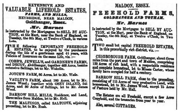
Advertisement in the Essex Herald of 1855 for
the sale of properties of the Coape family at Goldhanger and Barrow Marsh...
Below is part of a letter dated 1807,
published in the Transactions of Arts,
Manufactures, and Commerce Society, from a William Lawrence, after being
awarded a silver medal for his achievements in building a seawall across the
Barrow Marshes. The new wall enabled the saltworks to continue to operate, but
admits that several tumuli were destroyed. (in fact it only operated for
another 14 years)...

a
recommended read is in:
The
Colchester Archaeological Group - 1996 Annual Bulletin
pages 6-10
Losing
Savour: the Decline of Essex Salt - Heybridge
and Maldon within...
http://caguk.net/wp-content/uploads/2013/01/Bulletin-39.pdf
_________________________
surrounding area historic features on the
Goldhanger Rd Coe-Coape and Coape-Arnold families