|
The historic features along the Goldhanger Road the
long B1026 road to Heybridge has many historic buildings and features that
have connections to this village they are all identified on this map and
on the list below that has links to more information about them... |
|
|
|
1
Scotts
& Motts Farm and Charity
Farmhouse 2
Cobbs Farm
home of William Bentall and the Goldhanger Plough 3
Gardners
Farm an ancient farmhouse, now with a farm shop 4
WW-1
Flight Station at the roadside in a Gardeners Farm
field to tackle Zeppelins 5
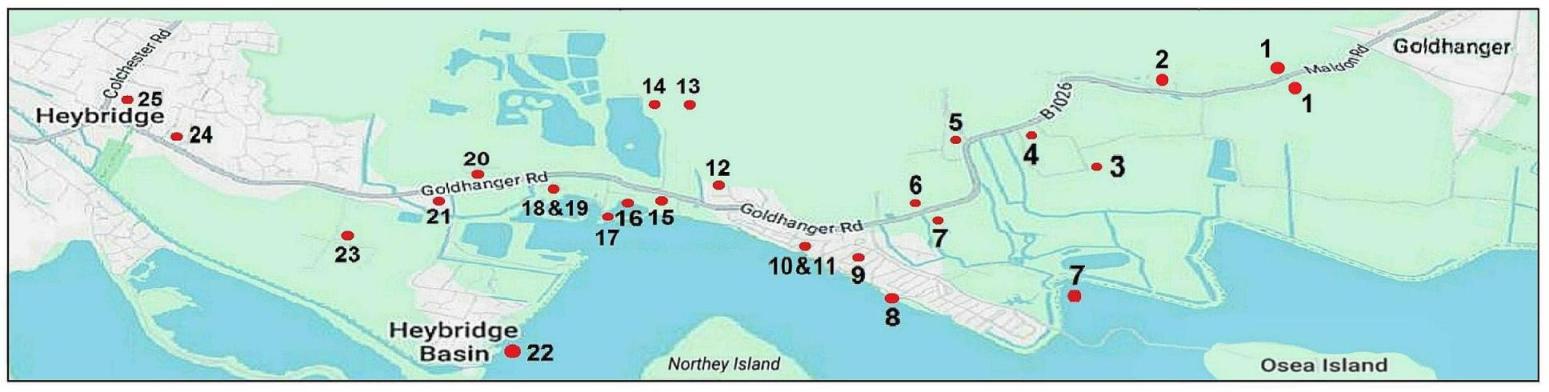
Wash Bridge flooding
during the 1953 floods and many other times since 6
Vaulty
Manor the home of Charles Brandon the
First Duke of Suffolk 7
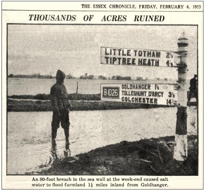
Osea Rd
Decoy Point seawall breach during the 1953 floods 8
Millbeach
Ancient Tumuli possibly burial mounds from the Battle of Maldon 9
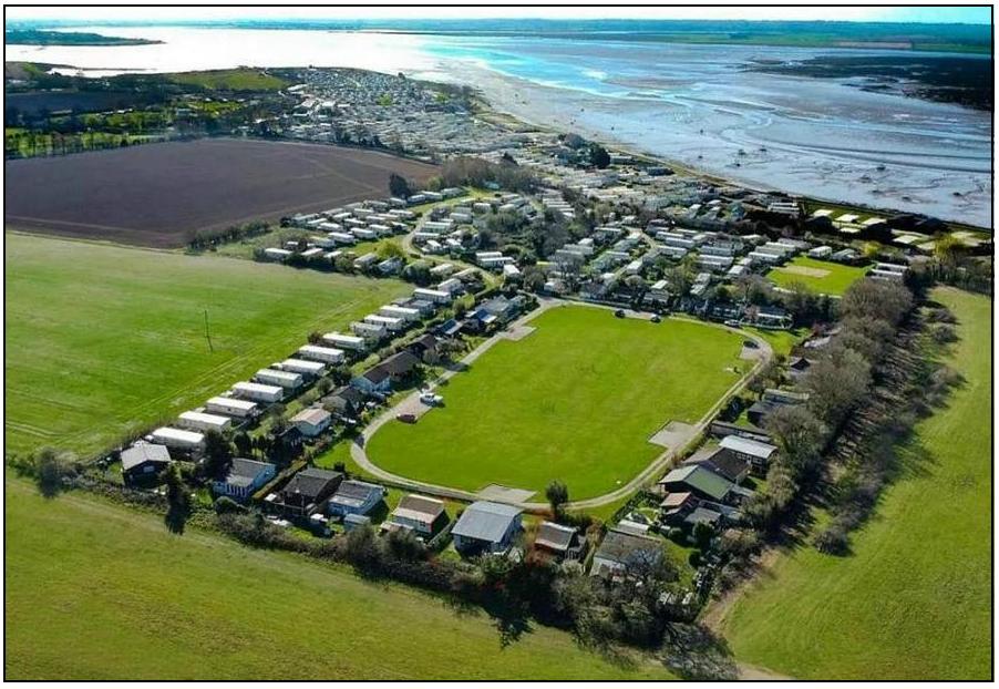
Millbeach
Caravan and Holiday Parks originally “plotlands” emerging
after WW-1 10 Millbeach Windmill erected
in 1703, probably demolished in 1925 11 Millbeach hotel and pub a
restaurant created in 1925 & demolished in 2018 12 Barrow Marsh Farm and The Chalet Field still
partly within Goldhanger
Parish 13 Rook Hall Farm Saxon site excavated
by a local amateur archaeologist 14 Chigborough Farm Roman site once
had a Goldhanger address 15 Viking axe head
found at
the junction of Goldhanger Road & Chigborough Lane 16 Former huts from HMS Osea
around the
Tidemill pond 17 Tidemill or Watermill at
Wharf Road 18 Saltworks and Saltcote Mill/Maltings 19 G&F May’s Mineral Waters produced
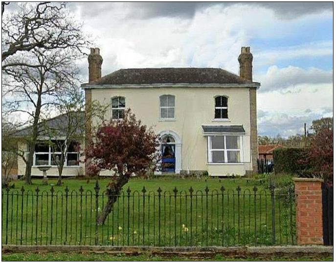
at Saltcote Mill 20 Saltcote Hall home
of the May family 21 Former huts from HMS Osea
at the
Basin Rd junction 22 Heybridge Basin a
link to the “Cannibal Island” Heybridge Basin’s history site 23 Canterbury Farm the
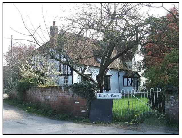
most westerly location once within Goldhanger Parish 24 Jacobs Farm the
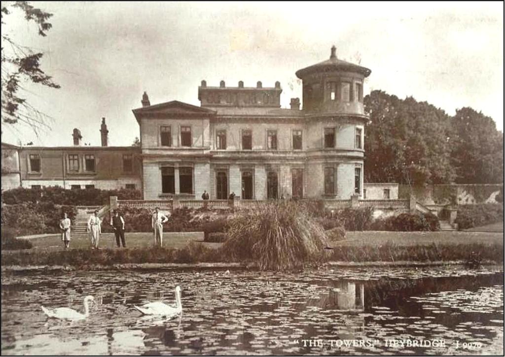
summer-time home of the artist Vasant 25 The Towers former
impressive home of the Bentall family at the Goldhanger Rd junction |