|
Goldhanger's Red Brick Walls |
|||
|
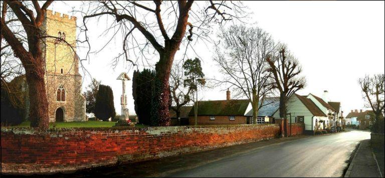
The
widespread red brick boundary walls in the centre of the village are not seen
at other locations locally or elsewhere and could well be unique to the
village. The Revd. C.B. Leigh, rector between 1846
and 1893 and a major land owner at the time, was said to have been
responsible for building the walls around the Church
and the school and is said to have encouraged other
property owners to build them to keep farm animals out of their front
gardens. This was at that time when there were two farms in the middle of the
village (Church Farm which the rector owned,
and Hall Farm). Both had animals that would have
been driven along the main streets each day to fields on the outskirts of the
village.
The conservation
area is given cohesion and a sense of identity by the common use of low red
brick boundary walls to properties... Historic red brick walls fronting both
old and new properties enclosing the street edges... The soft red brick,
generally laid in Flemish bond, is a common feature for the walling... and
make a significant impact on the area... The low red brick walls with a variety of forms of capping are very
prominent in the conservation area. These are particularly common around the
Square, along Church Street and the northern end of Fish Street... They date
from the 19th century. Soft brick,
particularly where used with lime mortar, adds warmth, colour and texture to
the streetscape. Some newer houses that have replaced older cottages have
retained the historic brick boundaries, which helps them to bed into the
historic environment... There has been some attempt, with varying degrees of
success, to emulate the historic walls on some modern properties. |
|||
|
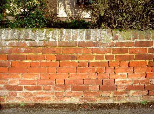
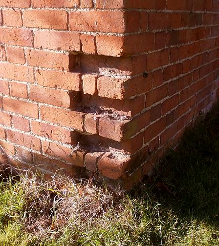
The walls are not of a uniform
construction, varying in height and style of capping, although they all
appear to be made with the same size Victorian bricks. The one exception to
this seems to be the Church brick gate posts There are no signs of any small Tudor
bricks, which would confirm the origin of the walls as being mid 1800s. The
walls around the churchyard have angled capping and would appear to be oldest
and are probably the least modified. Some very old walls in Head St. have
rounded capping, as do most of the recently built walls in Church St. A few
early walls and those built in the 1950s-60s have square capping. The use of soft red bricks with lime mortar
on exposed walls with no damp course has resulted in their deteriorate over
time due to dampness. The moisture encourages ivy, moss and lichen, and
although not unattractive in appearance results in the need regular
re-pointing and maintenance, which changes the appearance. |
|||
|
|
|||
|
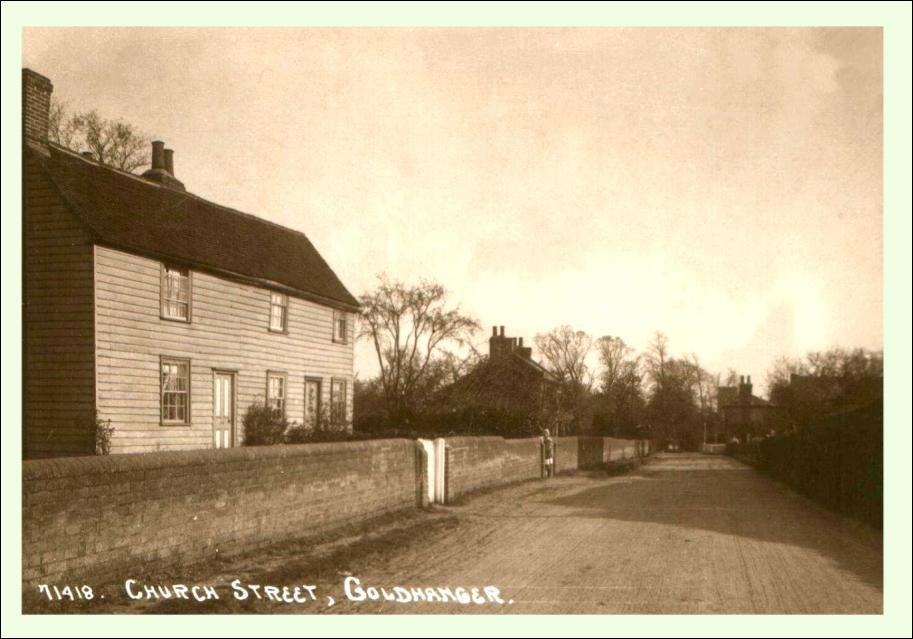
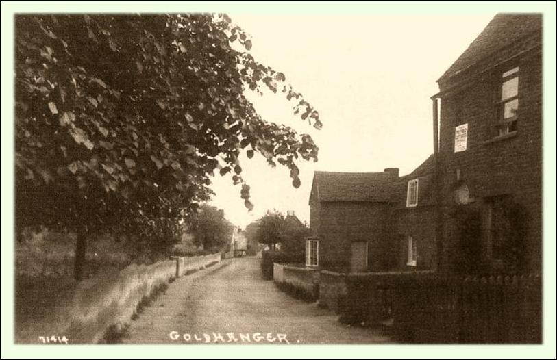
Postcard street scenes - revealing how
extensive and uniform the walls were a hundred years ago. . . |
|||
|
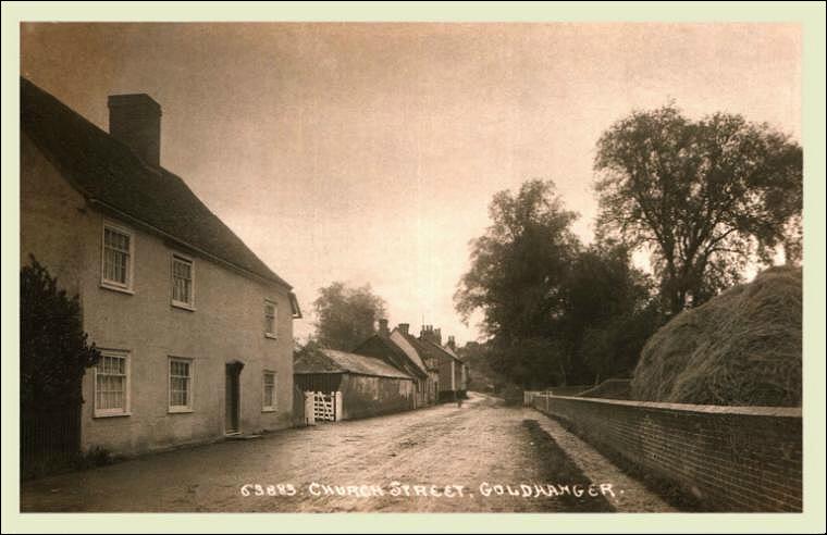
This postcard shows the wall at
Lavender Cottage at the north end of Church Street with the wall extending
down to the Blacksmiths that
was once opposite The Cricketers Inn.
Most of this stretch of wall is exists but with several sympathetic entrances
made for newer properties. |
|||
|
The wall opposite Hall Farm in Church Street once extended across
both the farmyard of Church Farm and the front
of the village school. The wall is still in place
with openings made for the two properties that have been built to replace the
Tithe Barn. The school
originally had walls on all sides of the playground as seen in an early view from the Church tower. |
|||
|
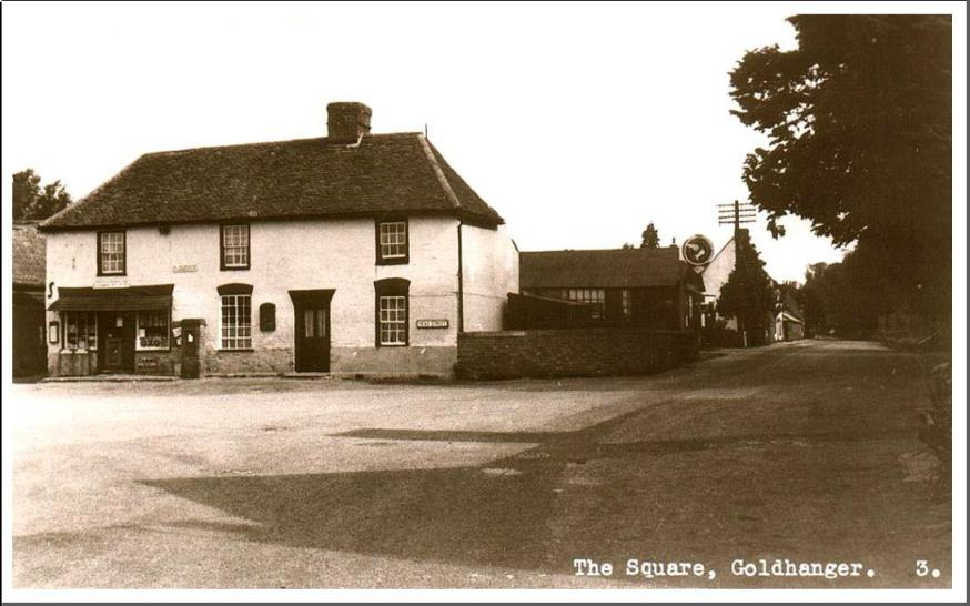
Apart from the buildings, The Square
is virtually surrounded by red brick walls. On the south side there is the
boundary wall of the Chequers
car-park and on the north side both 2 Head St & 6 Head St have boundary
walls.
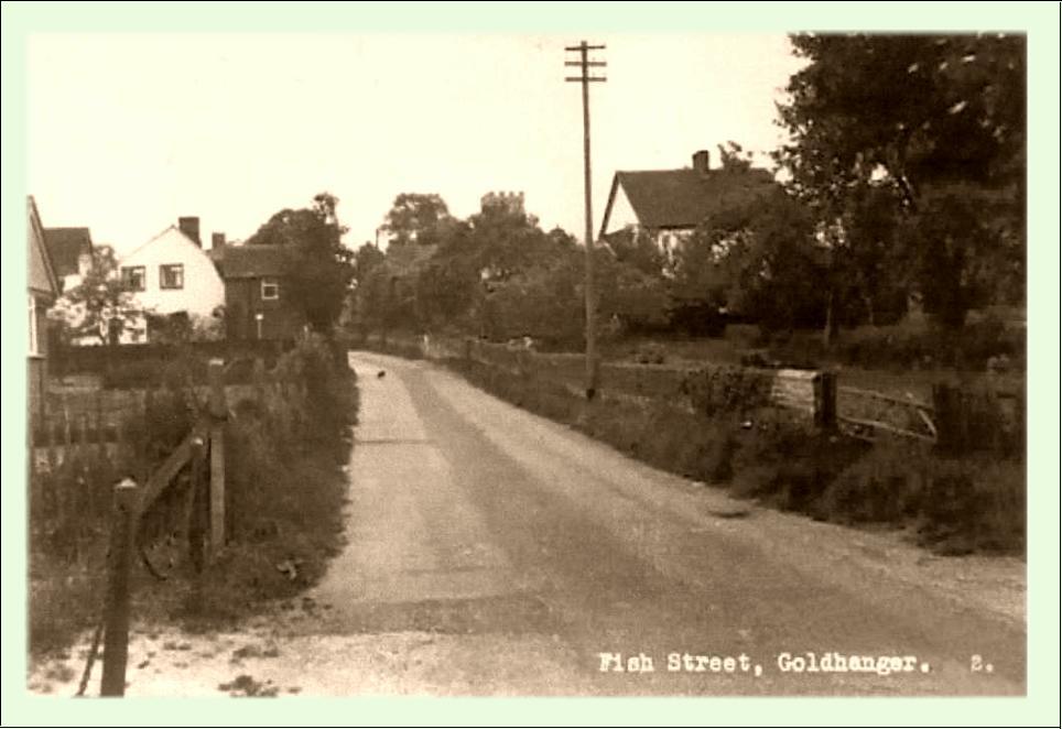
The close-up of an early postcard scene
looking up Fish St to (on the left) shows a collapsed wall on the corner of
No.2, and a close-up(on the right) taken from a postcard of No.6
indicates that the wall had recently been re-pointed at the time the photo
was taken in the early 1900s. |
|||
|
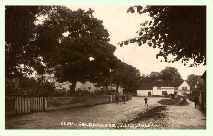
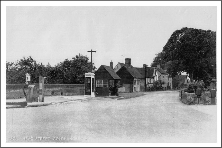
The eastern end of Head Street close
to The Square also had extensive walls on both sides of the road as shown in
this early postcard. The wall along The Chequers car park, which was probably an
allotment when this photo was taken, seems to be noticeably higher than on
the north side of the road, and today the wall behind the village pump still
has several higher sections. |
|||
|
This picture of the former Parish Rooms in Head St. shows curved
sections of wall built in the traditional way when the Parish Rooms were
built in 1906. The left-hand section has angled capping while the right-hand
side has rounded capping. It was probably done this way to match the adjacent
properties. Sadly these walls were lost when the Parish Rooms were demolished
in the 1980s. |
|||
|
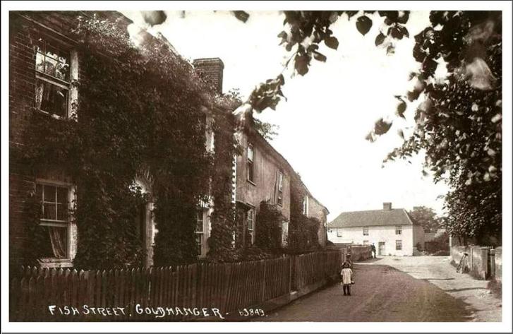
The top end Fish St. also had a
uniform wall on the east side from The
Mill that extended as far as the Bird-in-Hand as shown in this postcard photo
taken from outside the Mill House. As this part of Fish St distinctly slopes,
the wall has a laddered top in consequence of the bricks being laid on the
level. This stretch of wall is still largely intact but with several openings
made into the newer properties.
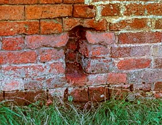
At the location of the Mill and what
is now 11a Fish St. there was previously a small unique “Foot Stile” set into
the base of the wall. This was to enable Mill workers coming up Fish St to
take a short cut into the mill. Sadly this feature was lost when 11a was
built in the early 2000s. |
|||
|
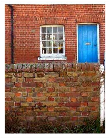
The wall in front of Beehive
Cottages (on the right in this photo) came in for particular praise in the
2007 Conservation Area Review with
these words: |
|||
|
These cottages represent a good
survival of vernacular cottages where many have been lost. The front boundary
wall is particularly good, comprising both yellow stock bricks (which are not
particularly common in boundary walls) and red bricks with half rounded brick
capping. The
wall has since been sympathetically restored since that time. |
|||
|
Looking up Fish St from the Bird-in-Hand the Allotments
boundary wall can clearly be seen in this 1950s postcard. This wall is now
(in 2016) desperately in need of restoration and is covered in ivy. It is of
interest that the 1950s photo shows the section nearest the gate in the
foreground had recently been restored, and today is leaning badly. |
|||
|
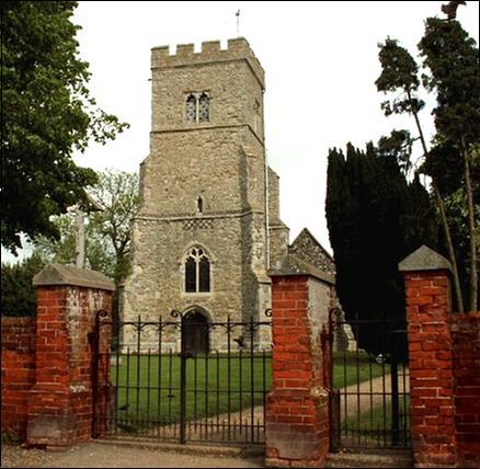
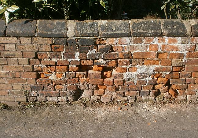
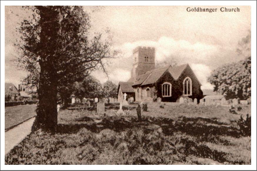
The red brick walls around the Churchyard The Revd. C.B. Leigh,
rector between 1846 and 1893, was responsible for renovating St Peters Church and at the same time building the
walls around the churchyard to keep the farm animals out that belonged to Church Farm next door and Hall
Farm across the street. This recent photo of the front wall shows that it
is still in a reasonable condition... |
|||
|
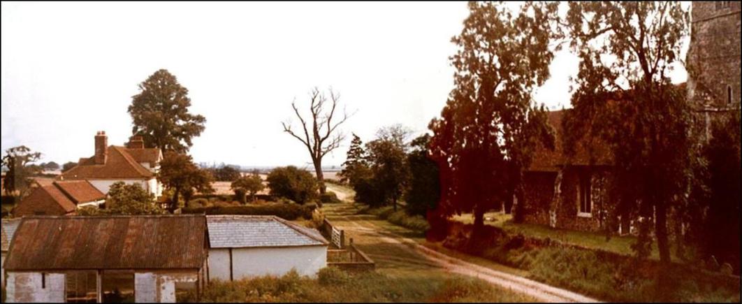
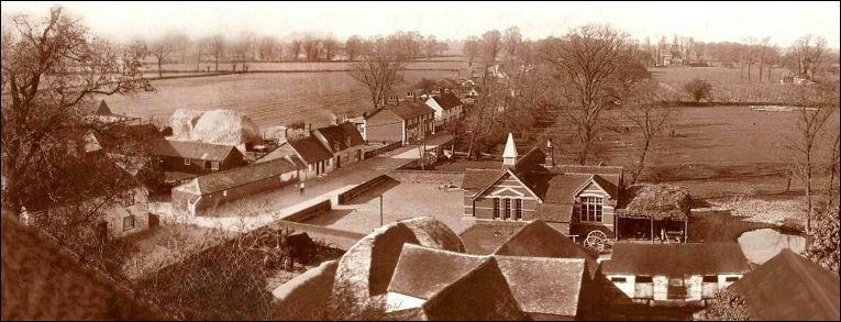
The full extent of the wall on the
north side can be seen in this unusual photograph from the early 1980s taken
from the site of the derelict Tithe
Barn at Church Farm, with the Old Rectory in the background. The last of the
Elm trees were still in place at the time and the wall was covered in ivy... |
|||
|
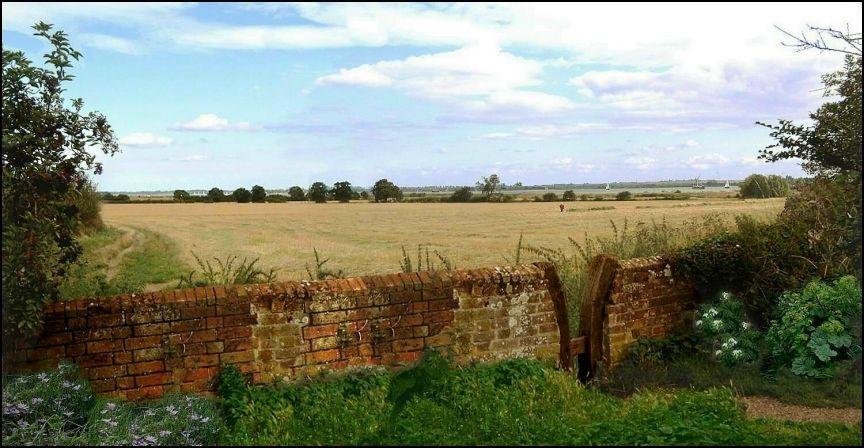
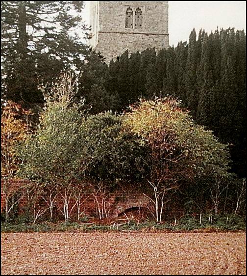
This scene at the eastern end of the
churchyard, photographed in 2012, shows the wall, the stile and one of the
best views across to the estuary. The photo is one of the... |
|||
|
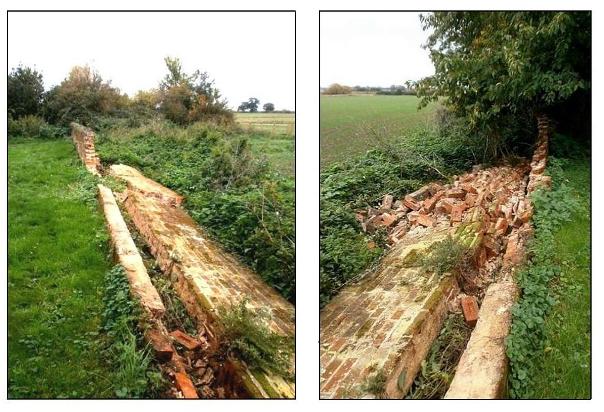
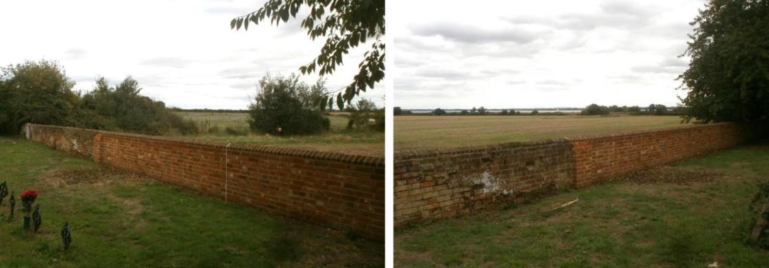
Sadly in the autumn of 2015 a large
section of the wall at the eastern end of the churchyard collapsed.
Fortunately the section show above with the stile survived. It is a very
exposed position and had been leaning for some time. There are plans to rebuild
it, but this incident should be taken as a sign of how vulnerable these walls
are if not adequately maintained, particularly where lime mortar had been
used in the construction. |
|||
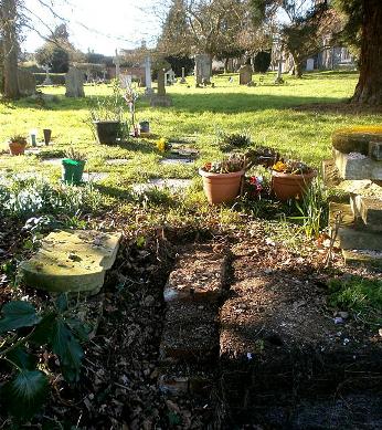
|
The
section of the east wall that collapsed contained an intriguing archway which
in recent years caused much speculation as to its origin. The archway is
clearly shown on this close-up taken from the cover of the Goldhanger Millennium Calendar. Some speculated that
it might have even been the remains of a smugglers
cave that once connected the churchyard to the Creek. However, its origin is
more mundane. It was simply an arch built over the roots of a very large elm
tree that stood in this location until Dutch Elm decease killed the tree. |
|||
|
Fortunately, in 2018 the fallen
section of the wall was re-built by the local builder using the original
capping bricks many of the old bricks using traditional methods. |
|||
|
The 2007 Conservation Area Review stated: The churchyard
is bounded on its west, north and part of the east side by a characteristic red
brick boundary wall ... this wall once completely enclosed the space, but
when the churchyard was extended in 1899 a new iron boundary fence was
erected. It is surprising to see this reference to a
brick wall on the south side of the churchyard, as little evidence of that
remains. However, there is some current and historical evidence for this so
the assertion seems correct... Maura Benham's book Goldhanger - an
Estuary Village refers to the 1899 graveyard extension on Page-66. An
archaeological dig in Church field to the east of the Church in 2011 revealed
only a dump of red bricks dating from the 18th or 19th century and were most
likely to be the remains of that wall. |
|||
|
here is where the wall probably joined onto the Chequers
buildings at the western end... ...here is where the wall joined onto the eastern boundary
wall. Two early postcards showing the front and rear of the Church both show
what appears to be a long straight wall on the south side of the churchyard,
as does an early postcard view from the
Creek. |
|||
|
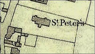
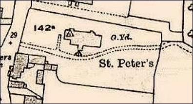
Furthermore, the
1906 and 1922 maps shows the south boundary of the churchyard in a different
positions... |
|||
|
1906 map extract > |
|
|
< 1922 map
extract |
|
An assessment of general condition of the walls The village red brick boundary walls
identified on the map provide
the boundaries for over 40 separate properties and if all joined end to end would
stretch for 3/4 of a mile. Considering that most are fragile of soft brick
with lime mortar, are exposed in all weathers, and in many locations exposed
to the consequences of modern traffic, are generally in a remarkably good
condition for their age. However, these walls need, and in the past have
received regular maintenance. Today it is obvious in a few places where this
has not been carried out. It is not a coincidence that sections of wall that
are in most need of attention today are near The Square where the heavy
trucks and buses emit the maximum amount of exhaust fumes as they accelerate
away from the junction.
Perversely, some of the old-world-charm of
the village is in part due to the sense of maturity and history created by
these partially decaying walls. If all the walls all were suddenly restored
to a pristine condition, or worse, replaced, much of this atmosphere would
lost. Perhaps we should ask if these walls
steadily disappearing... Although the churchyard south wall was demolished
about 100 years ago, and other small sections have disappeared to make access
to new properties, in the last quarter of a century several new stretches of
wall have been built, notably between 1 and 9 Church Street. So overall it
would seem a similar amount of wall still exists. The recently built walls in
Church Street have replicated the style of the walls at other locations and
those lost from outside the Parish
Rooms, which have both curved corners and rounded capping, giving a
particularly agreeable appearance in keeping with Goldhanger's past. |
|||
